County of Barrhead No. 11
| County of Barrhead No. 11 | |
|---|---|
| Municipal district | |
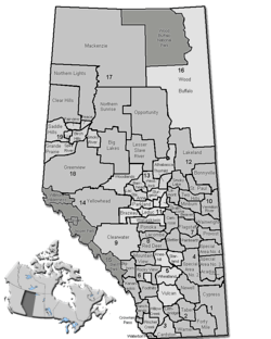 Location of Barrhead County No. 11 in Alberta | |
| Coordinates: 54°07′23″N 114°24′07″W / 54.12306°N 114.40194°WCoordinates: 54°07′23″N 114°24′07″W / 54.12306°N 114.40194°W | |
| Country |
|
| Province |
|
| Region | Central Alberta |
| Census division | No. 13 |
| Established | 1955 |
| Incorporated | 1959 (County) |
| Government[1] | |
| • Reeve | Douglas Drozd |
| • Governing body | County of Barrhead Council |
| • Office location | Barrhead |
| Area (2016)[2] | |
| • Land | 2,406.25 km2 (929.06 sq mi) |
| Population (2016)[2] | |
| • Total | 6,288 |
| • Density | 2.6/km2 (7/sq mi) |
| Time zone | UTC-7 (MST) |
| Website | Official website |
The County of Barrhead No. 11 is a municipal district in north central Alberta, Canada. It is located northwest of Edmonton and is in Census Division No. 13.
Demographics
In the 2016 Census of Population conducted by Statistics Canada, the County of Barrhead No. 11 recorded a population of 6,288 living in 2,298 of its 2,830 total private dwellings, a 3.1% change from its 2011 population of 6,096. With a land area of 2,406.25 km2 (929.06 sq mi), it had a population density of 2.6/km2 (6.8/sq mi) in 2016.[2]
In the 2011 Census, the County of Barrhead No. 11 had a population of 6,096 living in 2,206 of its 2,718 total dwellings, a 4.3% change from its 2006 population of 5,845. With a land area of 2,404.7 km2 (928.5 sq mi), it had a population density of 2.5/km2 (6.6/sq mi) in 2011.[3]
| Visible minority and Aboriginal population (Canada 2006 Census) | |||
|---|---|---|---|
| Population group | Population | % of total population | |
| White | 5,520 | 94.4% | |
| Visible minority group Source:[4] | South Asian | 0 | 0% |
| Chinese | 0 | 0% | |
| Black | 0 | 0% | |
| Filipino | 0 | 0% | |
| Latin American | 0 | 0% | |
| Arab | 0 | 0% | |
| Southeast Asian | 0 | 0% | |
| West Asian | 0 | 0% | |
| Korean | 0 | 0% | |
| Japanese | 0 | 0% | |
| Visible minority, n.i.e. | 0 | 0% | |
| Multiple visible minority | 0 | 0% | |
| Total visible minority population | 10 | 0.2% | |
| Aboriginal group Source:[5] | First Nations | 55 | 0.9% |
| Métis | 240 | 4.1% | |
| Inuit | 0 | 0% | |
| Aboriginal, n.i.e. | 15 | 0.3% | |
| Multiple Aboriginal identity | 0 | 0% | |
| Total Aboriginal population | 315 | 5.4% | |
| Total population | 5,845 | 100% | |
Communities and localities
|
The following urban municipalities are surrounded by the County of Barrhead No. 11:[6]
The following hamlets are located within the County of Barrhead No. 11:[6]
|
The following localities are located within the County of Barrhead No. 11:[7]
|
Attractions
- Parks: Thunder Lake Provincial Park, Holmes Crossing Recreation Area, Klondike Ferry Park
- Dolberg Lake Campground, Homesteaders Walking Trail
- Lakes: Clear Lake, Lac la Nonne / Elks Beach, Peanut Lake
- Sport Venues in Barrhead: Swimming Pool, Curling Rink, Rodeo Grounds, Tennis Courts
- Ice hockey: Barrhead Agrena
- Golf: Barrhead Golf Course, Paddle River Golf Course
- Bowling: Blue Heron Bowl
- Ski: Misty Ridge Ski Hill
See also
References
- ↑ "Municipal Officials Search". Alberta Municipal Affairs. September 22, 2017. Retrieved September 25, 2017.
- 1 2 3 "Population and dwelling counts, for Canada, provinces and territories, and census subdivisions (municipalities), 2016 and 2011 censuses – 100% data (Alberta)". Statistics Canada. February 8, 2017. Retrieved February 8, 2017.
- ↑ "Population and dwelling counts, for Canada, provinces and territories, and census subdivisions (municipalities), 2011 and 2006 censuses (Alberta)". Statistics Canada. February 8, 2012. Retrieved February 8, 2012.
- ↑ Community Profiles from the 2006 Census, Statistics Canada - Census Subdivision
- ↑ Aboriginal Population Profile from the 2006 Census, Statistics Canada - Census Subdivision
- 1 2 "Specialized and Rural Municipalities and Their Communities" (PDF). Alberta Municipal Affairs. 2012-03-01. Retrieved 2012-08-11.
- ↑ "Standard Geographical Classification (SGC) 2006, Economic Regions: 4813018 - Barrhead County No. 11, geographical codes and localities, 2006". Statistics Canada. 2010-03-05. Retrieved 2012-08-11.
External links
Places adjacent to County of Barrhead No. 11 | |
|---|---|