Daventry District
| Daventry District | |
|---|---|
| District | |
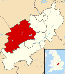 Shown within Northamptonshire | |
| Sovereign state | United Kingdom |
| Constituent country | England |
| Region | East Midlands |
| Administrative county | Northamptonshire |
| Admin. HQ | Daventry |
| Government | |
| • Type | Daventry District Council |
| • Leadership: | Alternative - Sec.31 |
| • Executive: | Conservative |
| • MP: | Chris Heaton-Harris |
| Area | |
| • Total | 255.8 sq mi (662.6 km2) |
| Area rank | 58th |
| Population (mid-2017 est.) | |
| • Total | 82,600 |
| • Rank | Ranked 289th |
| • Density | 320/sq mi (120/km2) |
| Time zone | UTC+0 (Greenwich Mean Time) |
| • Summer (DST) | UTC+1 (British Summer Time) |
| ONS code |
34UC (ONS) E07000151 (GSS) |
| Ethnicity | 98.0% White |
| Website | daventrydc.gov.uk |
Daventry is a local government district in Northamptonshire, England. Its council is based in the town of Daventry.
The district was created on 1 April 1974, under the Local Government Act 1972, by a merger of the historic municipal borough of Daventry with the Daventry Rural District and most of the Brixworth Rural District. The town of Daventry became an unparished area with Charter Trustees and remained so until 2003 when a civil parish was created, roughly corresponding with the boundaries of the former borough, so allowing Daventry to have its own town council.[1]
In March 2018, an independent report commissioned by the Secretary of State for Housing, Communities and Local Government, proposed structural changes to local government in Northamptonshire. These changes would see the existing county council and district councils abolished and two new unitary authorities created in their place. [2] One authority would consist of the existing districts of Daventry, Northampton and South Northamptonshire and the other authority would consist of Corby, East Northamptonshire, Kettering and Wellingborough districts.[3]
At the 2011 Census, the district had a population of 77,843, a little under a third of whom (25,026) lived in the town of Daventry.[4] Other significant settlements include Brixworth, Long Buckby and Weedon Bec. The rest of the district is predominantly rural.
Settlements
- Althorp, Arthingworth, Ashby St Ledgers
- Badby, Barby, Boughton, Braunston, Brington, Brixworth, Brockhall, Byfield
- Canons Ashby, Chapel Brampton, Charwelton, Church Brampton, Church Stowe, Clay Coton Clipston, Cold Ashby, Coton, Cottesbrooke, Creaton, Crick
- Daventry, Dodford, Draughton
- East Farndon, East Haddon, Elkington, Everdon
- Farthingstone, Fawsley, Flore
- Great Brington, Great Oxendon, Guilsborough
- Hanging Houghton, Hannington, Harlestone, Haselbech, Hellidon, Holcot, Holdenby, Hollowell
- Kelmarsh, Kilsby
- Lamport, Lilbourne, Little Brington, Long Buckby, Lower Catesby
- Maidwell, Marston Trussell, Moulton
- Naseby, Newnham, Norton
- Old, Overstone
- Pitsford, Preston Capes
- Ravensthorpe
- Scaldwell, Sibbertoft, Spratton, Stanford-on-Avon, Staverton, Sulby
- Teeton, Thornby
- Upper Catesby, Upper Stowe
- Walgrave, Watford, Weedon Bec, Welford, Welton, West Haddon, Whilton, Winwick, Woodford Halse
- Yelvertoft
Historical settlements
Energy policy
In May 2006, a report commissioned by British Gas[5] showed that housing in the district of Daventry produced the 7th highest average carbon emissions in the country at 7,276 kg of carbon dioxide per dwelling.
See also
References
- ↑ Daventry Town Council
- ↑ https://www.bbc.co.uk/news/uk-england-northamptonshire-40610349
- ↑ http://www.itv.com/news/anglia/2018-03-15/northamptonshire-county-council-should-be-split-up-finds-damning-report/
- ↑ "Key Figures for 2011 Census: Daventry". Office for National Statistics (Neighbourhood Statistics). Retrieved 28 August 2015.
- ↑ http://www.britishgasnews.co.uk/managed_content/files/pdf/greenCity.pdf Archived June 26, 2008, at the Wayback Machine. britishgasnews.co.uk
Northamptonshire Portal | |
| Boroughs or districts | |
| Major settlements | |
| Rivers | |
| Canals | |
| Topics | |
