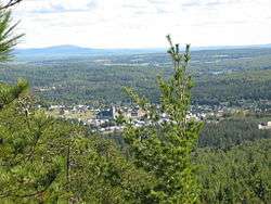
Saint-Joseph-de-Coleraine
| Saint-Joseph-de-Coleraine | |
|---|---|
| Municipality | |
 | |
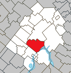 Location within Les Appalaches RCM | |
 St-Joseph-de-Coleraine Location in province of Quebec | |
| Coordinates: 45°58′N 71°22′W / 45.97°N 71.37°WCoordinates: 45°58′N 71°22′W / 45.97°N 71.37°W[1] | |
| Country |
|
| Province |
|
| Region | Chaudière-Appalaches |
| RCM | Les Appalaches |
| Constituted | November 11, 1891 |
| Government[2] | |
| • Mayor | Gilles Gosselin |
| • Federal riding | Mégantic—L'Érable |
| • Prov. riding | Lotbinière-Frontenac |
| Area[2][3] | |
| • Total | 134.50 km2 (51.93 sq mi) |
| • Land | 126.87 km2 (48.98 sq mi) |
| Population (2011)[3] | |
| • Total | 1,870 |
| • Density | 14.7/km2 (38/sq mi) |
| • Pop 2006-2011 |
|
| • Dwellings | 1,171 |
| Time zone | UTC−5 (EST) |
| • Summer (DST) | UTC−4 (EDT) |
| Postal code(s) | G0N 1B0 |
| Area code(s) | 418 and 581 |
| Highways |
|
| Website |
www |
Saint-Joseph-de-Coleraine is a municipality in the Municipalité régionale de comté des Appalaches in Quebec, Canada. It is part of the Chaudière-Appalaches region and the population is 2,018 as of 2009. It is named after Saint Joseph, father of Jesus, and the town of Coleraine in County Londonderry, Northern Ireland.
References
External links

- Commission de toponymie du Québec
- Ministère des Affaires municipales, des Régions et de l'Occupation du territoire
Places adjacent to Saint-Joseph-de-Coleraine | ||||||||||
|---|---|---|---|---|---|---|---|---|---|---|
| ||||||||||
| Cities & Towns | |
|---|---|
| Municipalities | |
| Parishes | |
| |
This article is issued from
Wikipedia.
The text is licensed under Creative Commons - Attribution - Sharealike.
Additional terms may apply for the media files.