Chiang Khong District
| Chiang Khong เชียงของ | |
|---|---|
| Amphoe | |
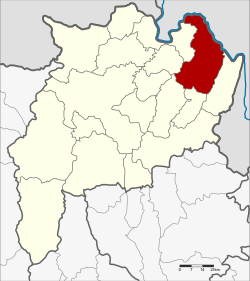 Amphoe location in Chiang Rai Province | |
| Coordinates: 20°15′36″N 100°24′24″E / 20.26000°N 100.40667°ECoordinates: 20°15′36″N 100°24′24″E / 20.26000°N 100.40667°E | |
| Country | Thailand |
| Province | Chiang Rai |
| Seat | Wiang |
| Tambon | 7 |
| Muban | 102 |
| Area | |
| • Total | 836.9 km2 (323.1 sq mi) |
| Population (2015) | |
| • Total | 64,197 |
| • Density | 76.1/km2 (197/sq mi) |
| Time zone | UTC+7 (ICT) |
| Postal code | 57140 |
| Geocode | 5703 |
Chiang Khong (Thai: เชียงของ, pronounced [t͡ɕʰīa̯ŋ kʰɔ̌ːŋ]) is a district (amphoe) in the northeastern part of Chiang Rai Province, northern Thailand.
Geography
The Phi Pan Nam mountains and their wide intermontane basins dominate the landscape of the district. The 1,328 m high Doi Luang Pae Mueang massif (ดอยหลวงแปเมือง) rises west of Chiang Khong town. The Mekong River flows at the northern end of the district, partially forming the boundary with Laos. Another important river is the Ing, a tributary of the Mekong.
Neighboring districts are (from the southeast clockwise) Wiang Kaen, Khun Tan, Phaya Meng Rai, Wiang Chiang Rung, Doi Luang, Chiang Saen of Chiang Rai Province. To the east is Bokeo Province of Laos.
Due to its location, the district forms a gateway to the neighboring country. Communication is mostly by boat, including the popular slow boat to Luang Prabang. Also bus travel on Asian Highway 3 from Ban Houayxay across the river to Boten at the Chinese-Laotian boundary is available. The Fourth Thai–Lao Friendship Bridge crossing the river opened mid-December 2013.
Administration
Central administration
The district Chiang Khong is subdivided into 7 subdistricts (Tambon), which are further subdivided into 102 administrative villages (Muban).
| No. | Name | Thai | Villages | Pop.[1] |
|---|---|---|---|---|
| 1. | Wiang | เวียง | 14 | 13,391 |
| 2. | Sathan | สถาน | 16 | 9,428 |
| 3. | Khrueng | ครึ่ง | 11 | 6,571 |
| 4. | Bun Rueang | บุญเรือง | 10 | 6,262 |
| 5. | Huai So | ห้วยซ้อ | 23 | 12,563 |
| 8. | Si Don Chai | ศรีดอนชัย | 18 | 8,927 |
| 10. | Rim Khong | ริมโขง | 10 | 7,055 |
Missing numbers belonged to the tambon which now form Wiang Kaen District.
Local administration
There are 7 subdistrict municipalities (Thesaban Tambon) in the district:
- Bun Rueang (Thai: เทศบาลตำบลบุญเรือง) consisting of the complete subdistrict Bun Rueang.
- Wiang Chiang Khong (Thai: เทศบาลตำบลเวียงเชียงของ) consisting of parts of the subdistrict Wiang.
- Wiang (Thai: เทศบาลตำบลเวียง) consisting of parts of the subdistrict Wiang.
- Khrueng (Thai: เทศบาลตำบลครึ่ง) consisting of the complete subdistrict Khrueng.
- Huai So (Thai: เทศบาลตำบลห้วยซ้อ) consisting of the complete subdistrict Huai So.
- Sathan (Thai: เทศบาลตำบลสถาน) consisting of the complete subdistrict Sathan.
- Si Don Chai (Thai: เทศบาลตำบลศรีดอนชัย) consisting of the complete subdistrict Si Don Chai.
There is one subdistrict administrative organization (SAO) in the district:
- Rim Khong (Thai: องค์การบริหารส่วนตำบลริมโขง) consisting of the complete subdistrict Rim Khong.
References
- ↑ "Population statistics 2015" (in Thai). Department of Provincial Administration. Retrieved 2016-06-09.
External links
| Wikimedia Commons has media related to Amphoe Chiang Khong. |

- amphoe.com
| |||||||||||