Mae Fa Luang District
| Mae Fa Luang แม่ฟ้าหลวง | |
|---|---|
| Amphoe | |
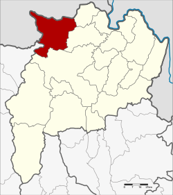 Amphoe location in Chiang Rai Province | |
| Coordinates: 20°16′2″N 99°48′5″E / 20.26722°N 99.80139°ECoordinates: 20°16′2″N 99°48′5″E / 20.26722°N 99.80139°E | |
| Country |
|
| Province | Chiang Rai |
| Seat | Mae Fa Luang |
| Tambon | 4 |
| Muban | 77 |
| Area | |
| • Total | 641.404 km2 (247.647 sq mi) |
| Population (2015) | |
| • Total | 76,301 |
| • Density | 119.4/km2 (309/sq mi) |
| Time zone | UTC+7 (ICT) |
| Postal code | 57110 |
| Geocode | 5715 |
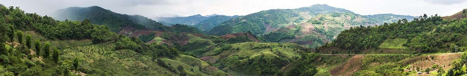
Mae Fa Luang (Thai: แม่ฟ้าหลวง, pronounced [mɛ̂ː fáː lǔa̯ŋ]) is a district (amphoe) in the northern part of Chiang Rai Province, northern Thailand.
History
The area of Mae Fa Luang was separated from Mae Chan district and created as a minor district (king amphoe) on 1 April 1992.[1] Originally it comprised the three tambon, Thoet Thai, Mae Salong Nai, and Mae Salong Nok. The fourth sub-district, Mae Fa Luang, was created in 1996. The minor district was officially upgraded to a full district on 5 December 1996.[2]
Etymology
The name Mae Fa Luang was given by Princess Mother Srinagarindra, who was commonly known as "Mae Fa Luang" (lit. Royal Mother from the sky) by the hill tribe people of the area.
Geography
Neighboring districts are (from the east clockwise) Mae Sai, Mae Chan, and Mueang Chiang Rai of Chiang Rai Province and Mae Ai of Chiang Mai Province. To the northwest is the Shan State of Myanmar.
Administration
Central administration
The district Mae Fa Luang is subdivided into 4 subdistricts (Tambon), which are further subdivided into 77 administrative villages (Muban).
| No. | Name | Thai | Villages | Pop.[3] |
|---|---|---|---|---|
| 1. | Thoet Thai | เทอดไทย | 18 | 22,472 |
| 2. | Mae Salong Nai | แม่สลองใน | 27 | 25,539 |
| 3. | Mae Salong Nok | แม่สลองนอก | 13 | 15,877 |
| 4. | Mae Fa Luang | แม่ฟ้าหลวง | 19 | 12,412 |
Local administration
There are 4 subdistrict administrative organizations (SAO) in the district:
- Thoet Thai (Thai: องค์การบริหารส่วนตำบลเทอดไทย) consisting of the complete subdistrict Thoet Thai.
- Mae Salong Nai (Thai: องค์การบริหารส่วนตำบลแม่สลองใน) consisting of the complete subdistrict Mae Salong Nai.
- Mae Salong Nok (Thai: องค์การบริหารส่วนตำบลแม่สลองนอก) consisting of the complete subdistrict Mae Salong Nok.
- Mae Fa Luang (Thai: องค์การบริหารส่วนตำบลแม่ฟ้าหลวง) consisting of the complete subdistrict Mae Fa Luang.
References
- ↑ ประกาศกระทรวงมหาดไทย เรื่อง แบ่งเขตท้องที่อำเภอแม่จัน จังหวัดเชียงราย ตั้งเป็นกิ่งอำเภอแม่ฟ้าหลวง (PDF). Royal Gazette (in Thai). 109 (53 ง special): 5. April 22, 1992.
- ↑ พระราชกฤษฎีกาตั้งอำเภอเหนือคลอง อำเภอนายายอาม อำเภอท่าตะเกียบ อำเภอขุนตาล อำเภอแม่ฟ้าหลวง อำเภอแม่ลาว อำเภอรัษฎา อำเภอพุทธมณฑล อำเภอวังน้ำเขียว อำเภอเจาะไอร้อง อำเภอชำนิ อำเภอโนนดินแดง อำเภอปางมะผ้า อำเภอสนธิ อำเภอหนองม่วง อำเภอเบญจลักษ์ อำเภอโพนนาแก้ว อำเภอบุ่งคล้า อำเภอดอนมดแดง และอำเภอลืออำนาจ พ.ศ. ๒๕๓๙ (PDF). Royal Gazette (in Thai). 113 (62 ก): 5–8. November 20, 1996.
- ↑ "Population statistics 2015" (in Thai). Department of Provincial Administration. Retrieved 2016-06-09.
External links

- amphoe.com
Chiang Rai | ||
|---|---|---|
| Main article |  | |
| Capital city | ||
| Districts (amphoe) | ||
| Related topics | ||