Doi Luang District
| Doi Luang ดอยหลวง | |
|---|---|
| Amphoe | |
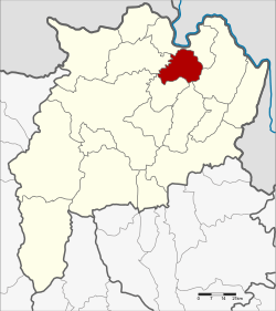 Amphoe location in Chiang Rai Province | |
| Coordinates: 20°7′6″N 100°6′0″E / 20.11833°N 100.10000°ECoordinates: 20°7′6″N 100°6′0″E / 20.11833°N 100.10000°E | |
| Country |
|
| Province | Chiang Rai |
| Seat | Pong Noi |
| Area | |
| • Total | 223.0 km2 (86.1 sq mi) |
| Population (2005) | |
| • Total | 19,356 |
| • Density | 86.8/km2 (225/sq mi) |
| Time zone | UTC+7 (ICT) |
| Postal code | 57110 |
| Geocode | 5718 |
Doi Luang (Thai: ดอยหลวง, pronounced [dɔ̄ːj lǔa̯ŋ]) is a district (amphoe) in the northern part of Chiang Rai Province, northern Thailand.
History
The area of Doi Luang was separated from Mae Chan District and established as a minor district (king amphoe) on 15 July 1996.[1]
On 15 May 2007, all 81 minor districts were upgraded to full districts.[2] With publication in the Royal Gazette on 24 August, the upgrade became official.[3]
Geography
Neighboring districts are (from the north clockwise) Chiang Saen, Chiang Khong, Wiang Chiang Rung, and Mae Chan.
Administration
The district is divided into three sub-districts (tambon), which are further subdivided into 31 villages (muban). There are no municipal (thesaban) areas, and three tambon administrative organizations (TAO).
| No. | Name | Thai name | Villages | Pop. | |
|---|---|---|---|---|---|
| 1. | Pong Noi | ปงน้อย | 10 | 5,928 | |
| 2. | Chok Chai | โชคชัย | 11 | 8,793 | |
| 3. | Nong Pa Ko | หนองป่าก่อ | 10 | 4,635 |
References
- ↑ ประกาศกระทรวงมหาดไทย เรื่อง แบ่งเขตท้องที่อำเภอแม่จัน จังหวัดเชียงราย ตั้งเป็นกิ่งอำเภอดอยหลวง (PDF). Royal Gazette (in Thai). 113 (Special 18 ง): 26. June 26, 1996.
- ↑ แถลงผลการประชุม ครม. ประจำวันที่ 15 พ.ค. 2550 (in Thai). Manager Online.
- ↑ พระราชกฤษฎีกาตั้งอำเภอฆ้องชัย...และอำเภอเหล่าเสือโก้ก พ.ศ. ๒๕๕๐ (PDF). Royal Gazette (in Thai). 124 (46 ก): 14–21. August 24, 2007.
External links

- amphoe.com
This article is issued from
Wikipedia.
The text is licensed under Creative Commons - Attribution - Sharealike.
Additional terms may apply for the media files.