Na Thawi District
| Na Thawi นาทวี | |
|---|---|
| Amphoe | |
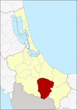 Amphoe location in Songkhla Province | |
| Coordinates: 6°44′30″N 100°41′30″E / 6.74167°N 100.69167°ECoordinates: 6°44′30″N 100°41′30″E / 6.74167°N 100.69167°E | |
| Country | Thailand |
| Province | Songkhla |
| Area | |
| • Total | 747.0 km2 (288.4 sq mi) |
| Population (2005) | |
| • Total | 58,675 |
| • Density | 78.5/km2 (203/sq mi) |
| Time zone | UTC+7 (ICT) |
| Postal code | 90160 |
| Geocode | 9004 |
Na Thawi (Thai: นาทวี, pronounced [nāː tʰā.wīː]; Pattani Malay: นาวี, pronounced [nāːwīː]) is a district (amphoe) in the southern part of Songkhla Province, southern Thailand.
History
The area of Na Thawi was separated from Chana District and made a minor district (king amphoe) in 1957.
Geography
Neighboring districts are (from the west clockwise) Sadao, Chana, Thepha, and Saba Yoi. To the south is the state of Kedah, Malaysia.
Administration
The district is divided into 10 sub-districts (tambon), which are further subdivided into 92 villages (muban). The township (thesaban tambon) Na Thawi covers parts of the tambon Na Thawi. There are a further 10 tambon administrative organizations (TAO).
| No. | Name | Thai name | Villages | Pop. | |
|---|---|---|---|---|---|
| 1. | Na Thawi | นาทวี | 17 | 14,760 | |
| 2. | Chang | ฉาง | 9 | 4,040 | |
| 3. | Na Mo Si | นาหมอศรี | 8 | 2,705 | |
| 4. | Khlong Sai | คลองทราย | 8 | 5,387 | |
| 5. | Plak Nu | ปลักหนู | 7 | 4,259 | |
| 6. | Tha Pradu | ท่าประดู่ | 9 | 4,400 | |
| 7. | Sathon | สะท้อน | 10 | 6,708 | |
| 8. | Thap Chang | ทับช้าง | 10 | 6,262 | |
| 9. | Prakop | ประกอบ | 7 | 5,264 | |
| 10. | Khlong Kwang | คลองกวาง | 7 | 4,890 |
External links
- amphoe.com (in Thai)
This article is issued from
Wikipedia.
The text is licensed under Creative Commons - Attribution - Sharealike.
Additional terms may apply for the media files.