Ranong
| Ranong ระนอง | |
|---|---|
| Town | |
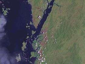 Satellite image around Ranong | |
 Ranong | |
| Coordinates: 9°57′43″N 98°38′20″E / 9.96194°N 98.63889°E | |
| Country | Thailand |
| Provinces | Ranong Province |
| District | Mueang Ranong District |
| Elevation | 9 m (30 ft) |
| Population (2005) | 16,163 |
| Time zone | UTC+7 (ICT) |
Ranong (Thai: ระนอง (Pronunciation)) is a town (thesaban mueang) in southern Thailand, former capital of the Ranong Province and the Mueang Ranong District. The town covers completely the area of the tambon Khao Niwet (เขานิเวศน์). As of 2005 it had a population of 16,163. Ranong lies 586 km south-southwest of Bangkok by road.
Geography
Ranong is on the estuary of the Pak Chan (or Kraburi) River, opposite Myanmar's Victoria Point. The Tenasserim Hills rise directly to the east of Ranong, and another small ridge runs along the edge of the estuary to the town's north.
Climate
Ranong has a tropical monsoon climate (Köppen climate classification Am). There is little variation in the temperature throughout the year, although the pre-monsoon months (February to April) are somewhat hotter in the day. However, Ranong's position to the west of the Tenasserim Hills means that the monsoon season's rains are greatly amplified, resulting in torrential rains from May until October, and significant rainfall in the transition months of April and November.
| Climate data for Ranong (1981–2010) | |||||||||||||
|---|---|---|---|---|---|---|---|---|---|---|---|---|---|
| Month | Jan | Feb | Mar | Apr | May | Jun | Jul | Aug | Sep | Oct | Nov | Dec | Year |
| Record high °C (°F) | 36.4 (97.5) |
38.3 (100.9) |
39.6 (103.3) |
39.1 (102.4) |
38.7 (101.7) |
35.3 (95.5) |
34.8 (94.6) |
34.0 (93.2) |
34.5 (94.1) |
35.2 (95.4) |
35.4 (95.7) |
35.0 (95) |
39.6 (103.3) |
| Average high °C (°F) | 32.8 (91) |
34.1 (93.4) |
35.0 (95) |
34.6 (94.3) |
32.4 (90.3) |
31.2 (88.2) |
30.8 (87.4) |
30.5 (86.9) |
30.5 (86.9) |
31.0 (87.8) |
31.4 (88.5) |
31.7 (89.1) |
32.2 (90) |
| Daily mean °C (°F) | 26.7 (80.1) |
27.5 (81.5) |
28.4 (83.1) |
28.8 (83.8) |
27.7 (81.9) |
27.3 (81.1) |
26.9 (80.4) |
26.8 (80.2) |
26.4 (79.5) |
26.4 (79.5) |
26.5 (79.7) |
26.3 (79.3) |
27.1 (80.8) |
| Average low °C (°F) | 21.9 (71.4) |
22.2 (72) |
23.4 (74.1) |
24.6 (76.3) |
24.7 (76.5) |
24.5 (76.1) |
24.3 (75.7) |
24.2 (75.6) |
23.9 (75) |
23.6 (74.5) |
23.3 (73.9) |
22.4 (72.3) |
23.6 (74.5) |
| Record low °C (°F) | 16.5 (61.7) |
16.1 (61) |
18.5 (65.3) |
19.8 (67.6) |
22.3 (72.1) |
21.8 (71.2) |
21.4 (70.5) |
21.6 (70.9) |
21.4 (70.5) |
20.2 (68.4) |
19.3 (66.7) |
16.5 (61.7) |
16.1 (61) |
| Average rainfall mm (inches) | 10.0 (0.394) |
16.0 (0.63) |
65.2 (2.567) |
152.6 (6.008) |
496.6 (19.551) |
649.4 (25.567) |
620.7 (24.437) |
789.1 (31.067) |
646.5 (25.453) |
424.5 (16.713) |
151.3 (5.957) |
45.5 (1.791) |
4,068.4 (160.173) |
| Average rainy days | 3.3 | 3.5 | 6.5 | 11.8 | 23.8 | 24.4 | 25.5 | 27.4 | 25.2 | 23.8 | 14.5 | 5.8 | 195.5 |
| Average relative humidity (%) | 72 | 70 | 71 | 76 | 83 | 84 | 85 | 86 | 86 | 85 | 80 | 75 | 79 |
| Mean monthly sunshine hours | 232.5 | 214.7 | 201.5 | 183.0 | 155.0 | 114.0 | 114.7 | 114.7 | 108.0 | 145.7 | 174.0 | 195.3 | 1,953.1 |
| Mean daily sunshine hours | 7.5 | 7.6 | 6.5 | 6.1 | 5.0 | 3.8 | 3.7 | 3.7 | 3.6 | 4.7 | 5.8 | 6.3 | 5.4 |
| Source #1: Thai Meteorological Department[1] | |||||||||||||
| Source #2: Office of Water Management and Hydrology, Royal Irrigation Department (sun and humidity)[2] | |||||||||||||
Transportation
Phet Kasem Road (Thailand Route 4) runs through the city. Ranong Airport is about 24 kilometres (15 mi) south of town.
The Port Authority of Thailand operates the Ranong Port, which is Thailand's principal Indian Ocean port. In 2008, the Ranong human-smuggling incident resulted in 54 deaths.[3]
References
- ↑ "Climatological Data for the Period 1981–2010". Thai Meteorological Department. p. 26–27. Retrieved 7 August 2016.
- ↑ "ปริมาณการใช้น้ำของพืชอ้างอิงโดยวิธีของ Penman Monteith (Reference Crop Evapotranspiration by Penman Monteith)" (PDF) (in Thai). Office of Water Management and Hydrology, Royal Irrigation Department. p. 105. Retrieved 7 August 2016.
- ↑ "54 Burmese dead in trafficking horror". Phuket Gazette. April 10, 2008. Archived from the original on January 12, 2013. Retrieved September 29, 2018.
External links
