Carbrooke
| Carbrooke | |
|---|---|
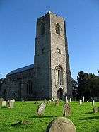 St Peter & St Paul, Carbrooke | |
 Carbrooke Carbrooke shown within Norfolk | |
| Area | 12.66 km2 (4.89 sq mi) |
| Population |
1,176 (2001 census[1]) 2,073 (2011)[2] |
| • Density | 93/km2 (240/sq mi) |
| OS grid reference | TF9494002230 |
| District | |
| Shire county | |
| Region | |
| Country | England |
| Sovereign state | United Kingdom |
| Post town | Thetford |
| Postcode district | IP25 |
| Dialling code | 01953 |
| Police | Norfolk |
| Fire | Norfolk |
| Ambulance | East of England |
| EU Parliament | East of England |
| UK Parliament | |
Carbrooke is a village and civil parish in the Breckland district of mid-Norfolk, East Anglia, England in the United Kingdom. It is 3 miles (4.8 km) from the centre of Watton, 8 miles (13 km) from Dereham and 17 miles (27 km) from its postal town of Thetford. It has an area of 12.66 km2 (4.89 sq mi) with an estimated population of 1,310 in 2007.[3] The measured population at the Census 2011 was 2,076.
It has a village hall, with plans for a new one, hosting among other things The Village Social Group.
The local church is St Peter & St Paul[4] in the Benefice of Watton.[5]
The local school is St Peter & St Paul VC Primary School.
References
- ↑ Census population and household counts for unparished urban areas and all parishes. Office for National Statistics & Norfolk County Council (2001). Retrieved 20 June 2009.
- ↑ "Civil Parish population 2011". Neighbourhood Statistics. Office for National Statistics. Retrieved 1 August 2016.
- ↑ Breckland Yearbook Archived 2008-11-21 at the Wayback Machine.
- ↑ St Peter & St Paul Church, Carbrooke
- ↑ Benefice of Watton
External links
![]()
This article is issued from
Wikipedia.
The text is licensed under Creative Commons - Attribution - Sharealike.
Additional terms may apply for the media files.