Capella, Queensland
| Capella Queensland | |||||||||||||||
|---|---|---|---|---|---|---|---|---|---|---|---|---|---|---|---|
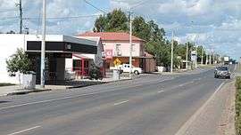 The Gregory Highway is the main street in Capella, 2016 | |||||||||||||||
 Capella | |||||||||||||||
| Coordinates | 23°04′S 148°01′E / 23.067°S 148.017°ECoordinates: 23°04′S 148°01′E / 23.067°S 148.017°E | ||||||||||||||
| Population | 1,010 (2016 census)[1] | ||||||||||||||
| Postcode(s) | 4723 | ||||||||||||||
| Location |
| ||||||||||||||
| LGA(s) | Central Highlands Region | ||||||||||||||
| State electorate(s) | Gregory | ||||||||||||||
| Federal Division(s) | Flynn | ||||||||||||||
| |||||||||||||||
Capella is a small town and locality in the Central Highlands Region, Queensland, Australia.[2][3] In the 2016 census, Capella had a population of 1,010 people.[1]
Geography
Capella is midway between Emerald and Clermont on the Gregory Highway. The highway passes through Capella from south to north as Capella's main street (also known as Peak Downs Street). Capella is served by the Capella railway station (23°05′00″S 148°01′17″E / 23.08333°S 148.02139°E)[4] on a railway line from Emerald to Blair Athol; it is a branch line of the Central Western railway line. The branch line also runs from north to south and is immediately adjacent and to the west of the highway.[5]
Capella Creek flows from east to west across the northern part of the locality to the immediate north of the town. Capella Creek is a tributary of the Nogoa River, which in turn is a tributary of the Fitzroy River which enters the Coral Sea.[5]
History
Capella was founded on traditional Wangan land in the 1860s by graziers influenced by the good reports of Ludwig Leichhardt. The town takes its name from Capella Creek, which was in turn named after the star Capella. The Creek was probably named by surveyor Charles Frederick Gregory[2] who, following the discovery of copper at Copperfield, about 60 kilometres to the north, surveyed three township sites in the Peak Downs area in 1862; Crinum Creek (Lilyvale), Capella, and Hoods Lagoon (Clermont).
The town remained a small roadside stopping place halfway between Emerald, to the south, and Clermont, to the north, until a railway line was built connecting the two larger towns in 1882. The same year saw the establishment of a Post Office, which opened on 5 December.[6]
Capella Provisional School opened the following year, 1883, and became Capella State School in 1900.[7]
Land resumed from large pastoral runs was made available to small farm selectors in 1883 and small cropping and dairying became early industries; a Butter Factory was built in 1900 under the "Meat and Diary Encouragement Act."[8]
By the late 1890s it was reported that "great improvements have been made at this place of late": in 1898 new offices for the Peak Downs Divisional Board (the fore-runner of the Peak Downs Shire Council were opened, a number of new shops had been built, and the Old Exchange Hotel and the Peak Downs Hotel were renovated and re-opened.[9]
The early 20th century was a time of stable growth and development in the town, although the population only increased from about 250 in 1900 to 300 in 1930.[10] The 1920s saw a great deal of building. Mrs M.J. Walsh opened a café in October 1925 and a bakery opened shortly after. A new Roman Catholic church, St Joseph's, seating 200 people, was dedicated in April 1926[11]. The same year also saw a new hall, picture theatre and Country Women's Association clubrooms built. A branch of the Queensland National Bank opened in 1930[12] and a new Catholic presbytery was built. The town became the council seat of the Shire of Peak Downs in 1927 and a new Shire Hall was built in 1936. The mid 1930s also saw the town's main streets kerbed and channelled and a "bitumen emulsion paved footpath" laid in the main street, Peak Down's Street.[13]
A town electricity supply was introduced in December, 1954[14] although other services had to wait for another decade or more, being introduced between 1962 (a town water supply) and 1982 (mains sewerage).
In the 1950s the Queensland British Food Corporation introduced large-scale grain production into the district on land formerly used for grazing. A run of poor seasons led to the project's failure, but introduced new crops such as sunflower and sorghum.
The Capella Hotel, on the corner of Peak Downs and Crinum Streets, was built in 1955. This was the site of the former Commercial Hotel, built in 1929, which was destroyed in a fire in February 1943.[15] The destruction of the Commercial left the town with only one other hotel and the Peak Downs Shire Council, realising the need to provide additional accommodation for visitors to the town, undertook to build the Hotel as a function of local government. Several local authorities in Queensland built and ran their own licensed premises in the 1950s, including Rockhampton, Townsville and Winton. The new Capella Hotel was designed by Mr E.A. Hegvold and built by J.J. Booker and Sons, at a cost of ₤33,000. The Hotel was officially opened on 7th May, 1955.[16]
The Peak Downs district was part of the Brigalow Development Scheme in the 1960s with large-scale clearing of the brigalow scrub by mechanical means.[17] The large new farming blocks opened up by the clearing of the Brigalow lent itself to the broadland growing of grain and cereal crops, particularly sunflower and sorghum. Bulk storage facilities for these new crops was built in 1964 and the population of the district increased with new farming families. Capella saw the opening of a range of new activities and facilities, including a district agricultural show (1961), Girl Guides (1966), a swimming pool (1969), and a pre-school centre (1978).
Coal was discovered at Tieri, about 36 kilometres east of Capella, in 1982 and a large open-cut mine was developed. The mine boosted the economy of the area and the 1980s saw a number of new developments and buildings in Capella, including the Capella Cultural Centre and a pioneer village. The Capella School opened a secondary department in 1984, which separated to become the Capella State High School on 23rd January 1989.[18] In 2003 the security of Capella's water supply was assured by a pipeline to Tieri.
At the 2006 census, the town had a population of 796.[19]
In 2008 the Shire of Peak Downs was amalgamated into the Central Highlands Regional Shire, with its seat in Emerald.[20]
In the 2011 census, Capella had a population of 926 people.[21]
Economy

Today, it is a service town catering to the large coal-mining interests in the area as well as pastoralists and farmers.
Facilities

The Peak Downs Shire cemetery is located in Walsh Street, Capella (23°04′50″S 148°00′32″E / 23.0806°S 148.0090°E). The cemetery has a memorial listing those who were buried in the first Capella Cemetery (1865-1899) located east of Capella.[22] The Central Highlands Regional Council operates Capella Library which is located on Peak Downs Street.[23]
Sport
Sport is a very big part of the town, especially Rugby League and Union. The Capella Cattledogs rugby union team made it to the grand final in 2007 against the Clermont Bushpigs.
Heritage listings
Capella has a number of heritage-listed sites, including:
- Lilyvale Road, Crinum: Lilyvale Stand Monument[24]
References
- 1 2 Australian Bureau of Statistics (27 June 2017). "Capella (SSC)". 2016 Census QuickStats. Retrieved 15 August 2018.

- 1 2 "Capella - town in Central Highlands Region (entry 6139)". Queensland Place Names. Queensland Government. Retrieved 28 September 2017.
- ↑ "Capella - locality in the Central Highlands Region (entry 46924)". Queensland Place Names. Queensland Government. Retrieved 28 September 2017.
- ↑ "Capella - railway station in Central Highlands Region (entry 6141)". Queensland Place Names. Queensland Government. Retrieved 28 September 2017.
- 1 2 "Queensland Globe". State of Queensland. Retrieved 29 April 2017.
- ↑ Premier Postal History. "Post Office List". Premier Postal Auctions. Retrieved 29 April 2017.
- ↑ Queensland Family History Society (2010), Queensland schools past and present (Version 1.01 ed.), Queensland Family History Society, ISBN 978-1-921171-26-0
- ↑ "CAPELLA BUTTER FACTORY". Morning Bulletin. LXII, (11, 094). Queensland, Australia. 3 June 1901. p. 5. Retrieved 15 August 2018 – via National Library of Australia.
- ↑ "CAPELLA". The Capricornian. 24, (23). Queensland, Australia. 4 June 1898. p. 21. Retrieved 15 August 2018 – via National Library of Australia.
- ↑ "Capella". Queensland Places. Centre for the Government of Queensland, University of Queensland. Retrieved 15 August 2018.
- ↑ "EMERALD". The Brisbane Courier (21, 291). Queensland, Australia. 22 April 1926. p. 11. Retrieved 15 August 2018 – via National Library of Australia.
- ↑ "Q. N. BANK". The Evening News (2502). Queensland, Australia. 14 September 1929. p. 9. Retrieved 15 August 2018 – via National Library of Australia.
- ↑ "CAPELLA". The Telegraph. Queensland, Australia. 3 April 1935. p. 3 (LATE CITY). Retrieved 15 August 2018 – via National Library of Australia.
- ↑ "CAPELLA'S NEW POWER STATION OFFICIALLY OPENED". The Central Queensland Herald. 21, (1298). Queensland, Australia. 23 December 1954. p. 12. Retrieved 15 August 2018 – via National Library of Australia.
- ↑ "FIRE AT CAPELLA". The Central Queensland Herald. 14, (728). Queensland, Australia. 25 February 1943. p. 15. Retrieved 15 August 2018 – via National Library of Australia.
- ↑ "CAPELLA'S NEW HOTEL". The Central Queensland Herald. 22, (1916). Queensland, Australia. 5 May 1955. p. 10. Retrieved 15 August 2018 – via National Library of Australia.
- ↑ McAlpine, Clive; Seabrook, Leonie. "The Brigalow". Queensland Historical Atlas. Retrieved 15 August 2018.
- ↑ Queensland Family History Society (2010), Queensland schools past and present (Version 1.01 ed.), Queensland Family History Society, ISBN 978-1-921171-26-0
- ↑ Australian Bureau of Statistics (25 October 2007). "Capella (L) (Urban Centre/Locality)". 2006 Census QuickStats. Retrieved 27 January 2008.
- ↑ Pugh, Theophilus Parsons (1927). Pugh's Almanac for 1927. Retrieved 13 June 2014.
- ↑ Australian Bureau of Statistics (31 October 2012). "Capella (SSC)". 2011 Census QuickStats. Retrieved 29 April 2017.
- ↑ Horton, David (August 2016). "Peak Downs (Capella)". South-East Queensland cemeteries headstone photo collection. Retrieved 29 April 2017.
- ↑ "Capella Library". Public Libraries Connect. Retrieved 9 January 2018.
- ↑ "Lilyvale Stand Monument (entry 602167)". Queensland Heritage Register. Queensland Heritage Council. Retrieved 7 July 2013.
External links
| Wikimedia Commons has media related to Capella, Queensland. |