Rolleston, Queensland
| Rolleston Queensland | |||||||||||||||
|---|---|---|---|---|---|---|---|---|---|---|---|---|---|---|---|
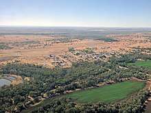
 The main street of Rolleston | |||||||||||||||
 Rolleston | |||||||||||||||
| Coordinates | 24°28′S 148°36′E / 24.467°S 148.600°ECoordinates: 24°28′S 148°36′E / 24.467°S 148.600°E | ||||||||||||||
| Population | 309 (2016 census)[1] | ||||||||||||||
| Postcode(s) | 4702 | ||||||||||||||
| Location |
| ||||||||||||||
| LGA(s) | Central Highlands Region | ||||||||||||||
| State electorate(s) | Gregory | ||||||||||||||
| Federal Division(s) | Flynn | ||||||||||||||
| |||||||||||||||
| |||||||||||||||
Rolleston is a small town and locality in the Central Highlands Region, Queensland, Australia.[2][3] In the 2011 census, Rolleston had a population of 129 people.[1]
History
Rolleston was built on Kanolu land. The town is named after Christopher Rolleston, a pastoralist who was involved in leasing a number of pastoral runs in the area in the 1860s.[2][3]
At the 2006 census, Rolleston and the surrounding area had a population of 123.[4]
Geography
It is located on the Comet River, 335 kilometres (208 mi) west of Gladstone and 694 kilometres (431 mi) northwest of Brisbane. Springsure, the nearest town lies 71 kilometres (44 mi) to the north-west. Rolleston lies on the junction of the Carnarvon, Gregory and Dawson highways.
Bushrangers
Queensland's last legendary bushrangers, the notorious Patrick and James Kenniff.
Mining
There is a large coal mine 13 kilometres (8.1 mi) west called the Rolleston coal mine. Mining began in October 2005 and is expected to last more than 20 years.[5]
Facilities
The Central Highlands Regional Council operates a public library on Planet Street.[6]
Education
Rolleston State School opened on 9 October 1871.[7]
See also
References
- 1 2 Australian Bureau of Statistics (31 October 2012). "Rolleston (SSC)". 2011 Census QuickStats. Retrieved 10 March 2017.

- 1 2 "Rolleson - town (entry 28948)". Queensland Place Names. Queensland Government. Retrieved 10 March 2017.
- 1 2 "Rolleson - locality (entry 46975)". Queensland Place Names. Queensland Government. Retrieved 10 March 2017.
- ↑ Australian Bureau of Statistics (31 October 2012). "Rolleston (State Suburb)". 2011 Census QuickStats. Retrieved 11 April 2016.
- ↑ Department of Infrastructure and Planning. "Rolleston Coal Project". Government of Queensland. Archived from the original on 29 June 2009. Retrieved 2009-06-30.
- ↑ "Rolleston Library". Public Libraries Connect. State Library of Queensland. 31 March 2017. Retrieved 29 January 2018.
- ↑ "Opening and closing dates of schools in Queensland". Education Queensland. 1 August 2013. Retrieved 3 February 2018.
External links
| Wikimedia Commons has media related to Rolleston, Queensland. |