Calico Mountains Wilderness
| Calico Mountains | |
| Wilderness | |
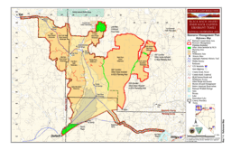 BLM map of the Black Rock-High Rock NCA and 10 wilderness areas including Calico Mountains Wilderness | |
| Country | United States |
|---|---|
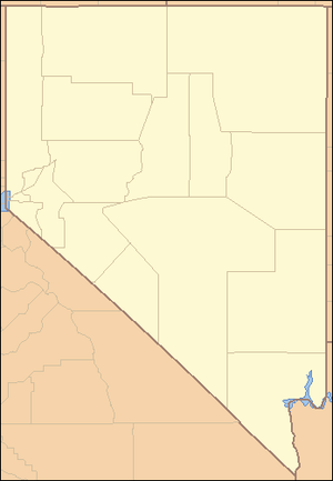
| State | Nevada |
| Region | Black Rock Desert |
| Location | Humboldt / Pershing counties, Nevada |
| - elevation | 2,085 m (6,841 ft) |
| - coordinates | 41°1′17.634″N 119°13′33.660″W / 41.02156500°N 119.22601667°WCoordinates: 41°1′17.634″N 119°13′33.660″W / 41.02156500°N 119.22601667°W |
| Founded | 2000 |
| Date | December 21 |
| Management | Bureau of Land Management |
| For public | Open to the public. BLM wilderness rules apply – mechanized travel prohibited. |
| Timezone | Pacific (UTC-8) |
| - summer (DST) | PDT (UTC-7) |
| Topo map | USGS Donnelly Creek |
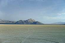
Calico Mountains Wilderness is a U S Wilderness Area in Nevada under the Bureau of Land Management. It is located in the Calico Hills.[1][2]
Rockhounding, hunting, and dayhiking are in the wilderness. Photography of geologic formations and spring wildflowers is a pastime of local visitors. Box, Fly, and Cherry Creek Canyons provide a setting for day-hiking, backpacking, photography, wildlife and wild horse viewing opportunities. Hunting for mule deer, antelope, and game birds is popular in the area.
See also
References
- 1 2 3 "Calico Mountains Wilderness". Geographic Names Information System. United States Geological Survey. Retrieved 2009-05-04.
- ↑ "BLM Black Rock Desert-High Rock Canyon Emigrant Trails National Conservation Area". Bureau of Land Management. Archived from the original on 2007-07-03. Retrieved 2007-12-30.
External links
This article is issued from
Wikipedia.
The text is licensed under Creative Commons - Attribution - Sharealike.
Additional terms may apply for the media files.