Brenan Park
| Brenan Park | |
|---|---|
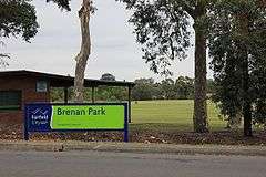 Brenan Park entrance sign | |
|
Location of Brenan Park | |
| Type | Urban park, sports ground, nature reserve |
| Location | Smithfield |
| Coordinates | 33°51′29″S 150°55′48″E / 33.8581°S 150.9300°ECoordinates: 33°51′29″S 150°55′48″E / 33.8581°S 150.9300°E |
| Area | 20 hectares (49.42 acres) |
| Opened | 1981 |
| Operated by | Fairfield City Council |
| Status | Open all year |
Brenan Park is an urban park situated in the western suburbs of Sydney, New South Wales, Australia.[1] Primarily categorised as a sports field, the reserve contains an open grassland, bushland and recreational areas within the vicinity of native plants, such as eucalyptus trees. It is named after John Ryan Brenan, who founded the suburb of Smithfield in 1836. Artificially terraced, Brenan Park was established in the early 1980s and it is one of the largest reserves in the City of Fairfield.[2]
History

The shape of Brenan Park appears on the first survey design, in 1838, of the market town sketched for John Ryan Brenan.[3] Brenan Park was planned to be a housing subdivision and a market area in 1938, with its triangular shape fashioned to take advantage of the topography and views of the surrounding district. The housing subdivision was never constructed. The site was used as a sewage disposal depot and landfill until 1980, where it was proclaimed as unhealthy building land in 1981. Subsequently, it was re-landscaped and eventually developed into a reserve.[4]
Geography
The reserve is located in the suburb of Smithfield, and is bordered by Cumberland Highway, Brenan and Bourke Streets, which provide good passive surveillance opportunities from close residences and contiguous roads. The park's surrounds are mainly single-story houses.[5] Brenan Park is in an elevated and weather-exposed location, with the highest areas being 44 metres above sea level and those near the Cumberland highway at 32 metres. The elevated regions in the park are situated alongside Bourke Street, where they would provide a panoramic view of the Greater Western Sydney area and even Sydney CBD.[6]
Ecology
Indigenous trees and shrubs are abundant in the park, with dominant vegetation species being Melaleuca quinquenervia (near the tennis courts), Eucalyptus moluccana (near the car park in Brenan Street), Casuarina glauca, Callistemon viminalis, Paperbark, Acacia, Lomandra and Eucalyptus bosistoana, most of which whom have large canopies that provide shade for visitors.[7]
The boundary along the top part of Bourke Street and near Cumberland Highway is thickly planted with an avenue of trees and shrubs, which provide a sense of entry to the park. The park is predominantly made up of sod and it lies on residual soils that are 1000mm deep. Its trees represent a link to the Cumberland Plain Woodland that covered most of Fairfield LGA before European settlement. There is a shrubby, dry sclerophyll bushland area to the south of the park, near Cumberland Highway.[8]
A sight in the park, on the corner of Brenan Street and Cumberland Highway, provides birdwatching, as dozens of bird species flock to the area to feed. Pigeons, Australian ravens, Australian magpies, galahs and crested pigeons are common sightings in the park, and can be seen in flocks feeding off ground food, most especially pigeons and ravens. Bird feeding is not encouraged in the park.[9]
Features
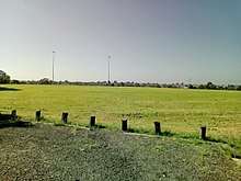
The park features six tennis courts, nine soccer fields (six which are full-sized), three cricket pitches, baseball and softball diamonds, three children's playgrounds, picnic areas (with barbeque), an outdoor gym and a 2 km long walking track (shared with cycling) that circuits the park. The park has a tremendous open space, which can be used for kiting and other activities when they are not being used for sport.[10] The park is floodlit and can be used at nights. Amenity blocks include a community hall, toilet facilities, kiosks and change rooms. The sports fields and the community hall are hired to a number of community groups, schools and clubs.[11]
Clubs
The sports fields are hired by these sporting groups:
- Smithfield RSL Cricket Club
- Smithfield RSL Soccer Club
- Fairfield Patrician Brothers Soccer Club
- Smithfield RSL Baseball Club
See also
References
- ↑ King Michael & Associates (1997) Recreation Needs Assessment Study prepared for Fairfield City Council
- ↑ Fairfield City Council (February 1999) Know your suburb – Smithfield Fairfield City Council
- ↑ George V (1991) Fairfield – A History of the District – second edition Fairfield City Council
- ↑ Clouston (1999) Fairfield Open Space Strategy prepared for Fairfield City Council
- ↑ Fairfield City Council (1999) Strategic Plan for Fairfield City 1999-2010 Fairfield City Council
- ↑ Fairfield City Council (1994) Local Environment Plan Fairfield City Council
- ↑ Woodward Clyde Environmental Consultants (1992 and 1997) Environmental reports in Brenan Park Property Files for Fairfield City Council
- ↑ Fairfield City Council (1999) Management Plan for Fairfield City 1999-2003 Fairfield City Council
- ↑ Fairley A and Moore P (1995) Native Plants of Sydney District – an identification guide Kangaroo Press, Sydney
- ↑ King M & Associates (1997) Recreation Needs Assessment Study prepared for Fairfield City Council
- ↑ Fairfield City Council (December 1999) Vision for Fairfield Fairfield City Council