Mid North Coast
| Mid North Coast New South Wales | |||||||||||||||
|---|---|---|---|---|---|---|---|---|---|---|---|---|---|---|---|
 | |||||||||||||||
| Population | 308,372 (30 June 2016)[1] | ||||||||||||||
| LGA(s) | |||||||||||||||
| State electorate(s) | |||||||||||||||
| Federal Division(s) | |||||||||||||||
| |||||||||||||||
The Mid North Coast is a country region in the north-east of the state of New South Wales, Australia. The region covers the mid to north coast of the state, beginning at Seal Rocks, 275 km (171 mi) north of Sydney, and extending as far north as Woolgoolga, 562 km (349 mi) north of Sydney, a distance of roughly 400 km (250 mi).
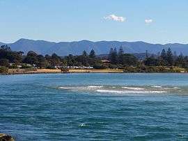
From south to north, the region's main towns include the twin towns of Forster and Tuncurry, Taree, Port Macquarie, Kempsey, South West Rocks, Nambucca Heads, Bellingen and Coffs Harbour. Of these Taree, Armidale, Port Macquarie and Coffs Harbour are the major commercial centres, all with large shopping centres, public facilities and attractions. Kempsey and Forster-Tuncurry are considered semi-major commercial centres. Smaller towns that are popular tourist spots are North Haven, South West Rocks, Urunga and Pacific Palms.
The region has a subtropical climate and is known for its beaches. Major industries are farming, logging and tourism.
Demography and area
The following local government areas are contained within the region:
| Mid North Coast rank | Local Government Area | Population 30 June 2016[2] | 10 year growth rate | Population density (people/km2) |
|---|---|---|---|---|
| 1 | Mid Coast Council | 91,958 | 8.7 | 9.1 |
| 2 | Port Macquarie-Hastings Council | 79,905 | 14.2 | 21.7 |
| 3 | Coffs Harbour City Council | 74,641 | 12.0 | 63.6 |
| 4 | Kempsey Shire Council | 29,454 | 5.1 | 8.7 |
| 5 | Nambucca Shire Council | 19,521 | 6.7 | 13.1 |
| 6 | Bellingen Shire Council | 12,893 | 1.4 | 8.1 |
| Mid North Coast | 308,372 | 10.0 | 14.4 | |
Coffs Coast
The Coffs Coast extends from the village of Broom's Head in the north and as far south as the small seaside town of Scotts Head. It includes the Sandon, Bellinger, Coffs and Nambucca River catchments/drainage basins. The Coffs Coast services a regional catchment of over 200,000 people, with about 68,000 living in the City of Coffs Harbour, 13,000 in the Bellingen Shire, and 19,000 in the Nambucca Shire.
The area has younger population, with the average age being 33 years of age.
The area is becoming known for Internet Start ups - with companies like Google, Altassian and Design Crowd recently opening up small offices in the area.
Public transport
Bus
Three bus services run throughout the region; Sawtell Coaches, Busways, and Ryans Bus Service. Sawtell Coaches run various services throughout Coffs Harbour city and to the suburbs of Boambee and Sawtell. Busways run services throughout Coffs Harbour city down south as far as Scotts Head and west into Bellingen. Ryans Bus services run throughout Coffs Harbour City and run North to Woolgoolga on a regular basis. Busways also operate services in the Port Macquarie region.
Rail
There are several railway stations on the Coffs Coast serviced by 3 trains; the Grafton, the Casino and the Brisbane XPT trains. Each run north and south once a day. Stations include Coffs Harbour, Sawtell, Urunga, Nambucca Heads, Macksville. Further south are Kempsey, Wauchope (for Port Macquarie), Kendall and Taree. There is no station for Foster-Tuncurry.
Rail is the fastest and cheapest way to get to either Sydney, Newcastle, the Gold Coast and Brisbane.
See also
References
- ↑ Statistics, c=AU; o=Commonwealth of Australia; ou=Australian Bureau of. "Main Features - Main Features". www.abs.gov.au. Archived from the original on 10 October 2017. Retrieved 3 May 2018.
- ↑ "3218.0 – Regional Population Growth, Australia, 2016". Australian Bureau of Statistics. Archived from the original on 29 July 2017.