Waterloo, New South Wales
| Waterloo Sydney, New South Wales | |||||||||||||||
|---|---|---|---|---|---|---|---|---|---|---|---|---|---|---|---|
 Botany Road, Waterloo | |||||||||||||||
 Waterloo | |||||||||||||||
| Coordinates | 33°54′01″S 151°12′28″E / 33.90028°S 151.20778°ECoordinates: 33°54′01″S 151°12′28″E / 33.90028°S 151.20778°E | ||||||||||||||
| Population | 14,616 (2016 census)[1] | ||||||||||||||
| • Density | 13,300/km2 (34,400/sq mi) | ||||||||||||||
| Established | 1815 | ||||||||||||||
| Postcode(s) | 2017 | ||||||||||||||
| Area | 1.1 km2 (0.4 sq mi)[2] | ||||||||||||||
| Time zone | AEST (UTC+10) | ||||||||||||||
| • Summer (DST) | AEDT (UTC+11) | ||||||||||||||
| Location | 4 km (2 mi) S of Sydney CBD | ||||||||||||||
| LGA(s) | City of Sydney | ||||||||||||||
| State electorate(s) | |||||||||||||||
| Federal Division(s) | Sydney | ||||||||||||||
| |||||||||||||||
Waterloo is an inner-city suburb of Sydney, New South Wales, Australia. Waterloo is located 4 kilometre (2.5 mi) south of the Sydney central business district and is part of the local government area of the City of Sydney.
History
Waterloo took its name from the Battle of Waterloo in 1815, when Allied and Prussian forces under the Duke of Wellington and Blücher defeated the French forces under Napoleon Bonaparte.
In the 1820s Waterloo began supporting industrial operations including the Fisher and Duncan Paper Mill and the Waterloo Flour Mills owned by William Hutchinson and Daniel Cooper. William Hutchinson, superintendent of convicts and public works, had been granted 1,400 acres (5.7 km2) of land in 1823. He sold Waterloo Farm to Daniel Cooper (1785-1853) and Solomon Levey (1794-1833). Cooper later bought out Levey's share and on his death the Waterloo Estate passed onto his son, also named Daniel Cooper, who was the first speaker of the New South Wales Legislative Assembly.[3]
Location
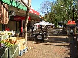
Waterloo is historically a working class region. Since early 2000s, the region has undergone some degree of gentrification with a rising business district focusing on technology-oriented firms and the development of more green space such as parks. By 2006, median individual income in Waterloo was slightly higher than the Australian average.[4] The suburb maintains numerous public housing apartments.
Waterloo is also a popular suburb to live for Sydney's large Gay and Lesbian population due to its closeness to nearby suburbs of Surry Hills and Darlinghurst.
The Waterloo Urban Conservation Area is a residential area of predominantly 19th century terrace and cottage housing. New development and redevelopment in this area is encouraged to be sympathetic to the existing heritage style.
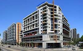
Green Square is a district in the south and east of the suburb including the suburbs of Waterloo and Zetland that is being redeveloped. It involves an urban renewal program which has seen many industrial buildings redeveloped or replaced by new residential and commercial developments. The area adjacent to South Dowling Street contains many high rise apartment buildings with retail space at ground level.
Transport
Waterloo is serviced by State Transit routes to the Sydney CBD. Green Square station, on the Airport line of the Sydney Trains network, is located in the south-west corner of the suburb. Redfern railway station is located close to the north-west corner of the suburb.
The very-fast Sydney Metro line will include a station and major interchange at the west side of Waterloo and is due to open in 2024.
Churches
Waterloo hosts the city campus of Hillsong Church (affiliated with the Assemblies of God). Other churches include Grace City Anglican Church, Shrine and Parish of Our Lady of Mount Carmel Catholic Church, Waterloo Congregational Church, South Sydney Uniting Church and Waterloo Salvation Army.
Demographics
At the 2016 census, Waterloo had a population of 14,616.
- Aboriginal and Torres Strait Islander people made up 3.0% of the population.
- 35.3% of people were born in Australia. The most common countries of birth were China 13.7%, England 4.2%, New Zealand 2.6%, South Korea 2.0% and United States of America 1.6%.
- 47.5% of people only spoke English at home. Other languages spoken at home included Mandarin 12.7%, Russian 3.3%, Cantonese 3.2%, Spanish 2.0% and Korean 2.0%.
- The largest religions were Catholicism (16.8% of the population), Anglicanism (5.5%) and Buddhism (4.5%). Furthermore, 41.6% of the population marked no religion, well above the national average.
- 89.7% of residences were units, well above the rest of Australia (where only 13.1% of residences were units). Furthermore, 70.8% of dwellings were rented, compared to 30.9% in Australia as a whole.[1]
Recreation
The Waterloo Skate Park, is a modern skate park and the first of its kind to copy the urban streetscape layout of popular skate spots like Martin Place and Cathedral Square in Sydney. The park is located next to Waterloo Oval and the South Sydney Youth Services building on Elizabeth Street.
Notable people
- Elaine Nile, politician
Gallery
 Uniting Church, Regent street
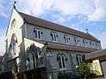 Mount Carmel Church
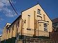 Mount Carmel School
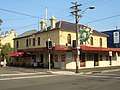 Cauliflower Hotel
Botany Road Waterloo War Memorial
Elizabeth Street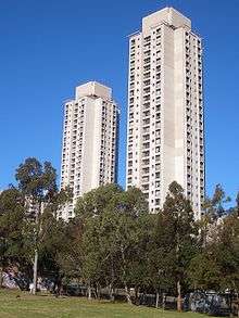 Waterloo
public housing towers
References
- 1 2 Australian Bureau of Statistics (27 June 2017). "Waterloo (State Suburb)". 2016 Census QuickStats. Retrieved 2 July 2017.

- ↑ Australian Bureau of Statistics (31 October 2012). "2011 Community Profiles: Waterloo (State Suburb)". 2011 Census of Population and Housing. Retrieved 23 June 2015.
- ↑ The Book of Sydney Suburbs, Compiled by Frances Pollon, Angus & Robertson Publishers, 1990, Published in Australia ISBN 0-207-14495-8, page 266
- ↑ Australian Bureau of Statistics (25 October 2007). "Waterloo (State Suburb)". 2006 Census QuickStats. Retrieved 28 February 2008.
External links
| Wikimedia Commons has media related to Waterloo, New South Wales. |