Blönduós
| Blönduósbær | |
|---|---|
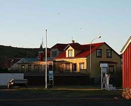
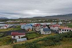 Houses in Blönduós | |
 Coat of arms of Blönduósbær | |
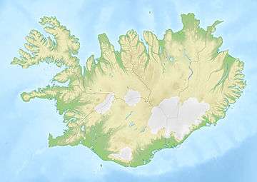
 Location of Blönduósbær | |
 Blönduósbær | |
| Region | Northwestern Region |
| Constituency | Northwest Constituency |
| Established | 1876 |
| Area | 183 km2 (71 sq mi) |
| Population | 895 |
| Density | 4.73/km2 (12.3/sq mi) |
| Municipal number | 5604 |
| Postal code(s) | 540, 541 |
| Website |
blonduos |
Blönduós is a town and municipality in the north of Iceland with a population of 895 in 2018.[1] Like many towns and villages around Iceland, Blönduós didn't emerge as a village until the late 19th century.
One of Blönduós' main characteristics is that the town is split into two parts by the glacial river Blanda, for which it is named (Blöndu is an oblique case of Blanda). The old part of town (Icelandic: "gamli bærinn"), including many original houses from the late 19th and early 20th century, is located on the south side of the river. Many of the local companies, the elementary school, supermarket, community center and sports facilities including a modern outdoor heated pool are located on the north side. On a hill above town is a church with striking architecture that is intended to resemble a volcanic crater.
Most of the industry and livelihood in Blönduós evolve around service for agriculture and tourism.[2] In recent years, the town has become known for its connection with textiles. A wool washery, Iceland's only textile museum Heimilisiðnaðarsafnið and the Icelandic Textile Center, featuring a residency program for international textile artists and scholars, are all located in Blönduós.
Geography and climate
Blönduós is situated on Route 1 at the mouth of the glacial river Blanda. Hrútey, a small island and natural reserve encircled by the river, is accessible via a pedestrian bridge just off the ring road. Blönduós has a tundra climate (ET).
| Climate data for Blönduós (1971–2000) | |||||||||||||
|---|---|---|---|---|---|---|---|---|---|---|---|---|---|
| Month | Jan | Feb | Mar | Apr | May | Jun | Jul | Aug | Sep | Oct | Nov | Dec | Year |
| Record high °C (°F) | 11.4 (52.5) |
12.1 (53.8) |
13.7 (56.7) |
17.2 (63) |
19.8 (67.6) |
23.0 (73.4) |
23.2 (73.8) |
20.5 (68.9) |
20.3 (68.5) |
18.5 (65.3) |
15.1 (59.2) |
12.6 (54.7) |
23.2 (73.8) |
| Average high °C (°F) | 0.6 (33.1) |
1.1 (34) |
1.7 (35.1) |
4.3 (39.7) |
8.1 (46.6) |
11.2 (52.2) |
13.0 (55.4) |
12.7 (54.9) |
9.5 (49.1) |
5.5 (41.9) |
2.3 (36.1) |
0.9 (33.6) |
5.9 (42.6) |
| Daily mean °C (°F) | −2.3 (27.9) |
−2.1 (28.2) |
−1.4 (29.5) |
1.0 (33.8) |
4.8 (40.6) |
7.7 (45.9) |
9.5 (49.1) |
9.3 (48.7) |
6.0 (42.8) |
2.6 (36.7) |
−0.4 (31.3) |
−2.0 (28.4) |
2.7 (36.9) |
| Average low °C (°F) | −5.8 (21.6) |
−5.0 (23) |
−4.3 (24.3) |
−2.0 (28.4) |
1.8 (35.2) |
4.8 (40.6) |
7.0 (44.6) |
6.5 (43.7) |
3.4 (38.1) |
0.1 (32.2) |
−3.3 (26.1) |
−5.4 (22.3) |
−0.2 (31.7) |
| Record low °C (°F) | −20.9 (−5.6) |
−21.8 (−7.2) |
−24.3 (−11.7) |
−19.6 (−3.3) |
−10.5 (13.1) |
−3.6 (25.5) |
−0.6 (30.9) |
−4.4 (24.1) |
−7.2 (19) |
−12.1 (10.2) |
−17.0 (1.4) |
−21.0 (−5.8) |
−24.3 (−11.7) |
| Average precipitation mm (inches) | 40.6 (1.598) |
34.2 (1.346) |
42.5 (1.673) |
31.1 (1.224) |
30.1 (1.185) |
37.1 (1.461) |
44.3 (1.744) |
44.5 (1.752) |
43.2 (1.701) |
51.6 (2.031) |
37.6 (1.48) |
38.5 (1.516) |
475.3 (18.711) |
| Source: Icelandic Met Office (extremes 1952-2003. excluding 1963-67 due to lack of data)[3][4] All statistics between 1968 and autumn of 1981 are for Hjaltabakki, 2.9 km (1.8 mi) from Blönduós) | |||||||||||||
Notable people
- María Ólafsdóttir (born 1993), singer, musician and actress.
Photogallery
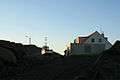 A boat in drydock
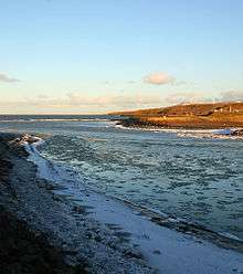 Mouth of Blanda river
References
- ↑ "Statistics Iceland
- ↑ "Hit Iceland information page about Iceland"
- ↑ "Monthly Temperature and Precipitation Averages for Blönduós". Icelandic Meteorological Office. Retrieved 19 March 2017.
- ↑ "Monthly Temperature and Precipitation Averages for Hjaltabakki". Icelandic Meteorological Office. Retrieved 19 March 2017.
External links
- Statistics Iceland
- More information and photos about Blönduós town on Hit Iceland
- Official website

- "Textile Museum Homepage"
- "Textile Center Homepage"
