Bazaar, Kansas
| Bazaar, Kansas | |
|---|---|
| Unincorporated community | |
 old Bazaar schoolhouse | |
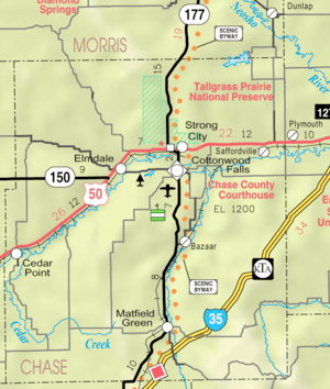 KDOT map of Chase County (legend) | |
| Coordinates: 38°16′19″N 96°32′7″W / 38.27194°N 96.53528°WCoordinates: 38°16′19″N 96°32′7″W / 38.27194°N 96.53528°W[1] | |
| Country | United States |
| State | Kansas |
| County | Chase |
| Township | Bazaar |


Bazaar is an unincorporated community in Chase County, Kansas, United States.[1] The community is part of the Emporia Micropolitan Statistical Area.
History
.jpg)
A post office was established in Bazaar on April 16, 1860. The post office was renamed "Mary" on July 20, 1876, and then back to Bazaar on March 19, 1878. The post office closed on April 26, 1974.[2]
On March 31, 1931, a Transcontinental & Western Air airliner crashed a few miles southwest of Bazaar, killing all on board, including University of Notre Dame coach Knute Rockne. There is a monument located on private property at 38°14′09″N 96°35′12″W / 38.23583°N 96.58667°W, and yearly tours provide access to the site.[3]
Bazaar still serves as a rail depot for local cattle ranching.
Geography
Bazaar is located in the Flint Hills region of the Great Plains.[4] By highway, it is 18 miles (29 km) north of the Kansas Turnpike toll road exit at Cassoday, or 7 miles (11 km) south of the U.S. Route 50 exit at Strong City.
Education
Bazaar is part of Unified School District 284.[5] All students attend schools in Cottonwood Falls.
Transportation
K-177 highway and BNSF Railway both pass north-south through Bazaar.
See also
References
- 1 2 Geographic Names Information System (GNIS) details for Bazaar, Kansas; United States Geological Survey (USGS); October 13, 1978.
- ↑ "Kansas Post Offices, 1828-1961 (archived)". Kansas Historical Society. Archived from the original on October 9, 2013. Retrieved 5 June 2014.
- ↑ 81 Years Since Kansas Plane Crash; The Wichita-Eagle; March 18, 2012.
- ↑ Flint Hills Tourism Coalition
- ↑ USD 284
External links
| Wikimedia Commons has media related to Bazaar, Kansas. |
- Schools
- USD 284, school district for all of Chase County.
- Photos
- History
- Maps
Municipalities and communities of Chase County, Kansas, United States | ||
|---|---|---|
| Cities | 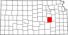 | |
| Unincorporated communities | ||
| Ghost towns | ||
| Townships | ||
| Footnotes | ‡This populated place also has portions in an adjacent county or counties | |