Thurman, Kansas
| Thurman, Kansas | |
|---|---|
| Ghost town | |
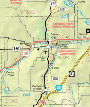 KDOT map of Chase County (legend) | |
| Coordinates: 38°6′3″N 96°31′1″W / 38.10083°N 96.51694°WCoordinates: 38°6′3″N 96°31′1″W / 38.10083°N 96.51694°W[1] | |
| Country | United States |
| State | Kansas |
| County | Chase |
| Elevation[1] | 1,394 ft (425 m) |
| Population | |
| • Total | 0 |
| Time zone | UTC-6 (CST) |
| • Summer (DST) | UTC-5 (CDT) |
| Area code | 620 |
| GNIS ID | 482064 [1] |
|
| |

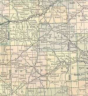
Thurman's location according to a 1914 atlas
Thurman is a ghost town in Chase County, Kansas, United States.[1]
History
Founded in 1874, it experienced a period of decline that concluded in its abandonment in 1944. In 1900, the community was composed of over fifty households, and it included a post office, stores, schools, and a church.[2]
A post office existed in Thurman from August 24, 1874 to January 31, 1909.[3]
Geography
The elevation of the Thurman site is 1,394 feet (425 m), and it is located at 38°6′3″N 96°31′1″W / 38.10083°N 96.51694°W (38.1008519, -96.5169547),[1] in the southeastern part of the county.[4] Today, the site is located in southern Matfield Township.[5]
Further reading
References
- 1 2 3 4 5 Geographic Names Information System (GNIS) details for Thurman, Kansas; United States Geological Survey (USGS); July 1, 1984.
- ↑ Ghost Settlement on the Prairie: A Biography of Thurman, Kansas, University Press of Kansas, 2007. Accessed 2009-06-30.
- ↑ "Kansas Post Offices, 1828-1961 (archived)". Kansas Historical Society. Archived from the original on October 9, 2013. Retrieved 5 June 2014.
- ↑ Page 14 from Atlas of the World, 1914. Accessed 2009-06-30.
- ↑ DeLorme. Kansas Atlas & Gazetteer. 4th ed. Yarmouth: DeLorme, 2009, 50. ISBN 0-89933-342-7.
External links
Municipalities and communities of Chase County, Kansas, United States | ||
|---|---|---|
| Cities | 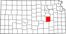 | |
| Unincorporated communities | ||
| Ghost towns | ||
| Townships | ||
| Footnotes | ‡This populated place also has portions in an adjacent county or counties | |
This article is issued from
Wikipedia.
The text is licensed under Creative Commons - Attribution - Sharealike.
Additional terms may apply for the media files.