Homestead Township, Chase County, Kansas
| Homestead Township | |
|---|---|
| Township | |
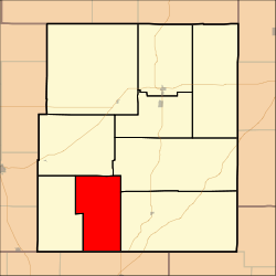 Location within Chase County | |
| Coordinates: 38°09′30″N 096°41′41″W / 38.15833°N 96.69472°WCoordinates: 38°09′30″N 096°41′41″W / 38.15833°N 96.69472°W | |
| Country | United States |
| State | Kansas |
| County | Chase |
| Area | |
| • Total | 54.64 sq mi (141.51 km2) |
| • Land | 54.49 sq mi (141.12 km2) |
| • Water | 0.15 sq mi (0.38 km2) 0.27% |
| Elevation | 1,430 ft (436 m) |
| Population (2000) | |
| • Total | 52 |
| • Density | 1/sq mi (0.4/km2) |
| GNIS feature ID | 0477799 |

Homestead Township is a township in Chase County, Kansas, United States. As of the 2000 census, its population was 52.
Geography
Homestead Township covers an area of 54.64 square miles (141.5 km2).
Communities
The township contains the following settlements:
- Ghost town of Homestead.
Cemeteries
The township contains the following cemeteries:
- Homestead.
Further reading
References
External links
- Chase County Website
- City-Data.com
- Chase County Maps: Current, Historic, KDOT
Municipalities and communities of Chase County, Kansas, United States | ||
|---|---|---|
| Cities | 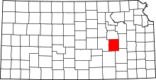 | |
| Unincorporated communities | ||
| Ghost towns | ||
| Townships | ||
| Footnotes | ‡This populated place also has portions in an adjacent county or counties | |
This article is issued from
Wikipedia.
The text is licensed under Creative Commons - Attribution - Sharealike.
Additional terms may apply for the media files.