Bahuni
| Bahuni बाहुनी | ||
|---|---|---|
| Village development committee | ||
| ||
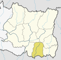
 Bahuni Location in Nepal | ||
| Coordinates: 26°35′N 87°28′E / 26.58°N 87.46°ECoordinates: 26°35′N 87°28′E / 26.58°N 87.46°E | ||
| Country |
| |
| Zone | Kosi Zone | |
| District | Morang District | |
| Government | ||
| • Type | Subdivision of a third-order administrative division. | |
| Area | ||
| • Total | 38.5 km2 (14.9 sq mi) | |
| Population (2011) | ||
| • Total | 12,180 | |
| • Density | 317/km2 (820/sq mi) | |
| Time zone | UTC+5:45 (Nepal Time) | |
| Area code(s) | 021 | |
Bahuni is a part of Belbari municipality in Morang district of province no. 1. There was a Village Development Committee development system here previously (prior to 2017 AD). It lies in the eastern terrain of Nepal. Historically, this area was covered by dense forest. The highway is still covered by North Zone forest. With reference to National Population and Housing Census, 2011, it had a population of 12,180 people living in 2,810 individual households. Among the total population, 5,649 were Males while 6,531 were Females. The population Density was 317 per Km Square. Despite plentiful years have passed by since the last census, the population does not seem to have increased significantly.
This city is located in about 10 KM South from the Mahendra Highway, a major highway in Nepal. Towards its East lies the Bayarban VDC, Hoklabari VDC borders its Southside, Dangihat, Kaseni, are the North and West respective neighbouring cities that are part of the same Belbari Municipality now. Chisang river geographically separates Bahuni from Bayarban VDC and the other Eastern neighbourhoods. This river has been a major trouble for the residents as it not only washes away a significant amount of topsoil converting cultivable fertile lands into the bank of river each year during the monsoon season but also threatens human lives, habitats and domestic animals. The ongoing illegal sand excavation activities from the river have fuelled the problem and made the situation even worse in each succeeding year. One of the markets in this area, Purano Bahuni Bazaar, is historically one of the oldest markets in Morang district. Later on, the bazaar was shifted by the Chatara Canal project towards the Southside and developed under the name Bahuni Bazaar Development Committee. Bahuni also owns and takes responsibility of a community-based forest named as Singha Devi Community Forest located by the East-West highway. The locals are responsible for the preservation, promotion and utilization of the resources.
Although this place has been declared as part of the municipality, the services and facilities required to be tagged as a municipality are lacking in this place. There are a couple of private schools in the region and presence of government educational institute is thin, the existing ones lacking in quality. As few to none higher education providing institutions are available within this place, students are forced to move out to nearby cities and towns like Biratnagar, Ithari, Belbari, Dharan and capital city.
The commuters are limited and bicycle still makes the vital means of transportation for the majority of the residents. Roads are narrow and seldom repaired and so are the bridges. One more interesting problem people had been facing but never spoke about because they were unaware is, although the fertile land provided construction zone, without having being compensated, for the high transmission lines to transmit power from Duhabi substation to the Eastern part of Nepal, the residents themselves were deprived of electricity until recently. A feasibility study was performed in Radhakrishna Nagar of Bahuni to determine the availability and producibility of mineral oil. Due to various technical and political reasons, no further development is seen regarding the actual start of the work.
Industrial activities are limited, micro finances and cooperatives are the running financial institutions. Large machinery, high paying industries, heavy equipment are outnumbering, some argi-processing mills and small-scale machine repair shops are present. Agriculture and foreign remittance are the major sources of income, rice is cultivated and produced in noticeable quantity as the land is equally but highly fertile for the production of wheat, rice, barley, rye, potatoes, jute, mustard and many other cash crops around the year. The dark side of the agricultural practices in this part of the nation is that the farmers still follow the traditional ways enduring difficulties and hardships. Another sad story about the farmers is that their work never gets rewarded as per their skills and dedication.
For entertainment, the place offers various activities. Hanumaan Chalchitra Mandir is the movie theatre that entertains the entire villagers with Nepali, Bhojpuri and Hindi movies. Kaalika Sthan Mandir, named after goddess Kali, which lies near the Chisang river, is a famous temple and a point of attraction in the area. The greenery surrounding the temple, the river banks and the farm fields with crops add a scenic view to the visitors.
Other than the temples and religion, this place offers a great example of cultural diversity. Many minority ethnicities and languages is another feature of this place. Tharu, Chaudhary, Musahar, Baantar, Jhangad are some to be named. some of these ethnic groups are in a phase of extinction. They are in destitute condition and are in real need of government attention. But they lack their representative to have their words and pain delivered to the concerned authority.
Climate
As the climate of this location is similar to that measured in Biratnagar airport, the same report has been presented.
| Month | Jan | Feb | Mar | Apr | May | Jun | Jul | Aug | Sep | Oct | Nov | Dec | Year |
|---|---|---|---|---|---|---|---|---|---|---|---|---|---|
| Average high °C (°F) | 22.7 (72.9) |
26.1 (79) |
30.9 (87.6) |
33.9 (93) |
33.3 (91.9) |
32.9 (91.2) |
32.1 (89.8) |
32.5 (90.5) |
32.1 (89.8) |
31.6 (88.9) |
29.3 (84.7) |
25.4 (77.7) |
30.2 (86.4) |
| Average low °C (°F) | 9.0 (48.2) |
11.1 (52) |
15.6 (60.1) |
20.4 (68.7) |
23.3 (73.9) |
25.2 (77.4) |
25.6 (78.1) |
25.8 (78.4) |
24.7 (76.5) |
21.1 (70) |
15.3 (59.5) |
10.5 (50.9) |
19 (66.1) |
| Average precipitation mm (inches) | 11.7 (0.461) |
13.2 (0.52) |
13.2 (0.52) |
53.1 (2.091) |
186.0 (7.323) |
302.4 (11.906) |
530.8 (20.898) |
378.3 (14.894) |
298.8 (11.764) |
91.8 (3.614) |
5.9 (0.232) |
6.6 (0.26) |
1,891.8 (74.483) |
| Source: Department of Hydrology and Meteorology (Nepal)[2] | |||||||||||||
More about weather: https://weather.com/en-IN/weather/monthly/l/NPPW0903:1:NP (This shows the monthly weather of Belbari Municipality)
References
- ↑ "e-popinfo Nepal". e-popinfo Nepal. Archived from the original on 21 November 2013. Retrieved 21 November 2013.
- ↑ "NORMALS FROM 1981-2010" (PDF). Department of Hydrology and Meteorology (Nepal). Retrieved 20 October 2012.
|