Sainte-Françoise, Centre-du-Québec, Quebec
| Sainte-Françoise | |
|---|---|
| Municipality | |
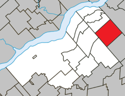 Location within Bécancour RCM. | |
 Sainte-Françoise Location in southern Quebec. | |
| Coordinates: 46°27′N 71°59′W / 46.450°N 71.983°WCoordinates: 46°27′N 71°59′W / 46.450°N 71.983°W[1] | |
| Country |
|
| Province |
|
| Region | Centre-du-Québec |
| RCM | Bécancour |
| Constituted | January 1, 1947 |
| Government[2] | |
| • Mayor | Mario Lyonnais |
| • Federal riding |
Bas-Richelieu— Nicolet—Bécancour |
| • Prov. riding | Nicolet-Bécancour |
| Area[2][3] | |
| • Total | 87.30 km2 (33.71 sq mi) |
| • Land | 86.99 km2 (33.59 sq mi) |
| Population (2011)[3] | |
| • Total | 479 |
| • Density | 5.5/km2 (14/sq mi) |
| • Pop 2006-2011 |
|
| • Dwellings | 226 |
| Time zone | UTC−5 (EST) |
| • Summer (DST) | UTC−4 (EDT) |
| Postal code(s) | G0S 2N0 |
| Area code(s) | 819 |
| Highways |
|
| Website |
www.visitedeferme educative.com |
Sainte-Françoise is a municipality in the Centre-du-Québec region of the province of Quebec in Canada.
References
Adjacent Municipal Subdivisions | ||||||||||
|---|---|---|---|---|---|---|---|---|---|---|
| ||||||||||
| Cities | |
|---|---|
| Municipalities | |
| Parishes | |
| |
This article is issued from
Wikipedia.
The text is licensed under Creative Commons - Attribution - Sharealike.
Additional terms may apply for the media files.