Ayvacık, Çanakkale
| Ayvacık | |
|---|---|
| District | |
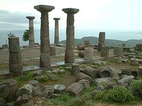 Temple of Athena in Assos, Ayvacık | |
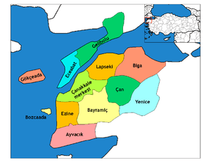 Location of Ayvacık within Turkey. | |
 Ayvacık Location of Ayvacık | |
| Coordinates: 39°36′N 26°24′E / 39.600°N 26.400°E | |
| Country |
|
| Region | Marmara |
| Province | Çanakkale |
| Government | |
| • Mayor | Mehmet Ünal Şahin (AKP) |
| Area[1] | |
| • District | 892.88 km2 (344.74 sq mi) |
| Elevation | 251 m (823 ft) |
| Population (2012)[2] | |
| • Urban | 7,920 |
| • District | 30,448 |
| • District density | 34/km2 (88/sq mi) |
| Time zone | UTC+2 (EET) |
| • Summer (DST) | UTC+3 (EEST) |
| Postal code | 17860 |
| Area code(s) | 286 |
| Licence plate | 17 |
| Website | www.canakkaleayvacik.bel.tr |
Ayvacık is a town and district of Çanakkale Province in the Marmara region of Turkey. According to the 2007 census, population of the district is 30,027, of which 7,457 live in the town of Ayvacık.[3][4] The district covers an area of 893 km2 (345 sq mi),[5] and the town lies at an elevation of 251 m (823 ft). During the Gallipoli campaign in World War I, it was the target of several allied attacks.
See also
Notes
- ↑ "Area of regions (including lakes), km²". Regional Statistics Database. Turkish Statistical Institute. 2002. Retrieved 2013-03-05.
- ↑ "Population of province/district centers and towns/villages by districts - 2012". Address Based Population Registration System (ABPRS) Database. Turkish Statistical Institute. Retrieved 2013-02-27.
- ↑ Statistical Institute
- ↑ GeoHive. "Statistical information on Turkey's administrative units". Retrieved 2009-04-20.
- ↑ Statoids. "Statistical information on districts of Turkey". Archived from the original on 19 May 2009. Retrieved 2009-04-20.
References
- Falling Rain Genomics, Inc. "Geographical information on Ayvacık, Turkey". Retrieved 2009-04-20.
External links
- District municipality's official website (in Turkish)
- Road map of Ayvacık and environs
- Various images of Akliman in Ayvacık, Çanakkale
- Various images of Küçükkuyu in Ayvacık, Çanakkale
Coordinates: 39°36′04″N 26°24′17″E / 39.60111°N 26.40472°E
This article is issued from
Wikipedia.
The text is licensed under Creative Commons - Attribution - Sharealike.
Additional terms may apply for the media files.