Artova
| Artova | |
|---|---|
| Town | |
 | |
 Artova | |
| Coordinates: 40°07′00″N 36°18′06″E / 40.11667°N 36.30167°ECoordinates: 40°07′00″N 36°18′06″E / 40.11667°N 36.30167°E | |
| Country |
|
| Region | Black Sea |
| Province | Tokat |
| Government | |
| • Mayor | Abdullah Öztürk (MHP) |
| Area[1] | |
| • District | 355.98 km2 (137.44 sq mi) |
| Elevation | 1,190 m (3,900 ft) |
| Population (2012)[2] | |
| • Urban | 3,156 |
| • District | 9,450 |
| • District density | 27/km2 (69/sq mi) |
| Time zone | UTC+2 (EET) |
| • Summer (DST) | UTC+3 (EEST) |
| Postal code | 60670 |
| Area code(s) | 356 |
| Licence plate | 60 |
| Website |
www |
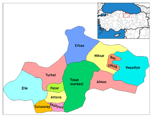
Artova is a town and a district of Tokat Province in the Black Sea region of Turkey. It is located 31 km (19 mi) southwest of Tokat. A railway line through Artova connects the town in the north with Samsun and in the southwest with Sivas.[3]
The town's current mayor is Lütvü Yalçın ([AKP]).
References
- ↑ "Area of regions (including lakes), km²". Regional Statistics Database. Turkish Statistical Institute. 2002. Retrieved 2013-03-05.
- ↑ "Population of province/district centers and towns/villages by districts - 2012". Address Based Population Registration System (ABPRS) Database. Turkish Statistical Institute. Retrieved 2013-02-27.
- ↑ "Artova" (in Turkish). Artova Kaymakamlığı-Tokat. Retrieved 2011-02-12.
This article is issued from
Wikipedia.
The text is licensed under Creative Commons - Attribution - Sharealike.
Additional terms may apply for the media files.