List of Arkansas state parks
There are 52 state parks in the U.S. state of Arkansas, as of 2017.[1] The state parks division of the Arkansas Department of Parks and Tourism (ADPT) is the governing body and operator of all parks, although jurisdiction is shared with other state agencies in a few cases.
The first Arkansas state park, Petit Jean State Park, opened in 1923 following an unsuccessful attempt by a lumber company to donate the Seven Hollows and canyon areas to the federal government as a National Park.[2] Stephen Mather deemed the parcel too small in 1921, but the Arkansas General Assembly passed Act 276, allowing the Commissioner of State Lands to accept donations of land for public use.
The list gives an overview of Arkansas state parks and a brief history of their development since the first park opened in 1923. State parks range in size from 1 acre (0.40 ha) to 11,744 acres (4,753 ha).

Current parks
| Park name | County or counties | Size | Year Established | Water Body(s) | Remarks | Image |
|---|---|---|---|---|---|---|
| Arkansas Museum of Natural Resources | Union County | 19 acres (8 ha) | 1986 | None | Museum preserving and interpreting the history of oil and bromine mining in Arkansas | |
| Arkansas Post Museum | Arkansas County | 8 acres (3.2 ha) | 1997 | None | Museum dedicated to the history of Arkansas Post, Arkansas's territorial capital until 1821. Located on the grounds of the Arkansas Post National Memorial (National Park Service) | 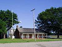 |
| Bull Shoals-White River State Park | Baxter and Marion counties | 732 acres (296 ha) | 1955 | Bull Shoals Lake | Trout fishing destination above and below Bull Shoals Dam with over 100 campsites | 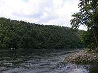 |
| Cane Creek State Park | Lincoln County | 2,053 acres (831 ha) | 1992 | Cane Creek Lake | Wooded lake along Bayou Bartholomew including a hiking trail and camping | 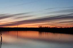 |
| Conway Cemetery State Park | Lafayette County | 11.5 acres (5 ha) | 1986 | None | Historical state park with no recreational services located on James Sevier Conway's (the first governor of Arkansas) former cotton plantation | 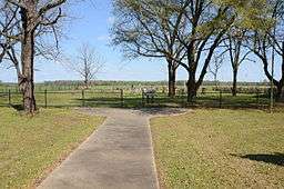 |
| Cossatot River State Park-Natural Area | Howard and Polk county | 5,230 acres (2145 ha) | 1988 | Cossatot River | Class III, IV, and V whitewater rafting river listed on the National Park Service's National Wild and Scenic Rivers System | 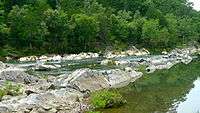 |
| Crater of Diamonds State Park | Pike County | 911 acres (369 ha) | 1972 | None | World's only diamond-bearing site accessible to the public | 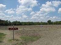 |
| Crowley's Ridge State Park | Greene County | 291 acres (118 ha) | 1937 | Lake Ponder | Park built on the homestead of Benjamin Crowley, dedicated to the culture and history of the Crowley's Ridge region. Includes many structures built in the 1930s by the Civilian Conservation Corps and spring-fed Lake Ponder | 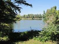 |
| Daisy State Park | Pike County | 276 acres (112 ha) | 1955 | Lake Greeson | Park nestled within the Ouachita Mountains on Lake Greeson near the Ouachita National Forest. Popular for camping, water sports, and fishing | |
| Davidsonville Historic State Park | Randolph County | 163 acres (66 ha) | 1957 | Black River | Historic state park preserving the abandoned frontier river town of Davidsonville. Interpretive tours and signs guide visitors through the historic community bypassed by the Southwest Trail in the 1820s. Fishing is available along three nearby rivers, with 49 campsites | 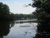 |
| DeGray Lake Resort State Park | Clark and Hot Spring counties | 984 acres (398 ha) | 1974 | DeGray Lake | Resort state park with championship rated golf course, 94 room lodge, and over 100 campsites | 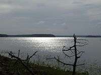 |
| Delta Heritage Trail State Park | Arkansas, Desha and Phillips counties | 960 acres (390 ha) | 2002 | None | Rails to trails conversion of former railroad bed through Arkansas Delta lowlands, currently 14 miles (23 km), planned to be 73 miles (117 km) | |
| Devil's Den State Park | Washington County | 2,500 acres (1000 ha) | 1933 | Lee Creek | Civilian Conservation Corps-built park in the Ozarks with lake, caves, swimming pool and several trails. Includes over 100 campsites, including cabins | 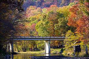 |
| Hampson Archeological Museum State Park | Mississippi County | 5 acres (2 ha) | 1961 | None | Museum displaying archeological artifacts from the Nodena Site, an aboriginal village of the Nodena people dated 1400-1650 CE, and bones from the Island 35 Mastodon | 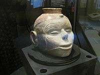 |
| Herman Davis State Park | Mississippi County | 1 acre (0.4 ha) | 1953 | None | Park surrounding a grave and memorial to Herman Davis, a U.S. sniper during World War I | 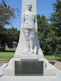 |
| Historic Washington State Park | Hempstead County | 101 acres (41 ha) | 1973 | None | Fifty-three buildings that preserve and interpret the architectural, cultural, and political history of a historic nineteenth century town. | 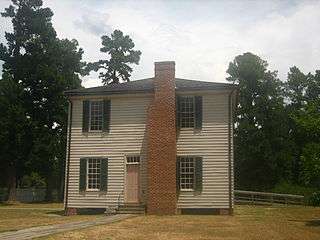 |
| Hobbs State Park – Conservation Area | Benton, Carroll and Madison counties | 12,056 acres (4879 ha) | 1979 | Beaver Lake | Large park in the Boston Mountains along Beaver Lake featuring trails, camping, and a shooting range. | 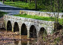 |
| Jacksonport State Park | Jackson County | 164.7 acres (66.7 ha) | 1965 | Black River and White River | Park containing the 1872 Jacksonport courthouse, preserving the culture and history of a former steamboat river town | 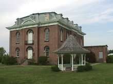 |
| Jenkins' Ferry Battleground State Park | Grant County | 40 acres (16.2 ha) | 1961 | Saline River | One of three battleground sites from the Camden Expedition of the Civil War. Water recreation available on the Saline River | 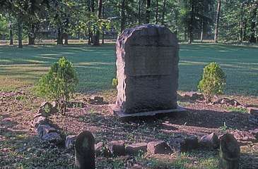 |
| Lake Catherine State Park | Garland and Hot Spring counties | 2,180 acres (882.2 ha) | 1935 | Lake Catherine | Civilian Conservation Corps park created along the lake, resulting in a well-preserved natural shoreline. Park features cabins, campsites, nature programs, marina, hiking trails, and a sand beach swimming area | 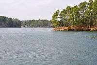 |
| Lake Charles State Park | Lawrence County | 140 acres (57 ha) | 1967 | Lake Charles | Lake is maintained and stocked with fish by the Arkansas Game and Fish Commission; also features camping, hiking, boat ramps and an interpretative nature center | |
| Lake Chicot State Park | Chicot County | 211.6 acres (85.6 ha) | 1957 | Lake Chicot | Largest oxbow lake in the United States; formerly the main channel of the Mississippi River. Park is located within a pecan grove within a bayou environment, offering 122 campsites, 14 cabins, swimming pool, boat shop/marina and interpretative visitor center. | 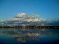 |
| Lake Dardanelle State Park | Pope County | 246 acres (99.6 ha) | 1966 | Lake Dardanelle | Two sites (Russellville and Dardanelle), including 74 campsites, boating, visitor center, and aquarium. Popular for bass fishing, including hosting many major tournaments. | 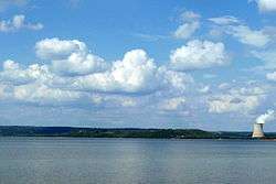 |
| Lake Fort Smith State Park | Crawford County | 260 acres (105.2 ha) | 1967 | Lake Fort Smith | Large lake in the Ozarks offering 30 campsites, 10 cabins, a marina, swimming pool and visitor center | 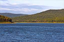 |
| Lake Frierson State Park | Greene County | 114 acres (46.1 ha) | 1975 | Lake Frierson | Reservoir built along Crowley's Ridge known for fishing. Features seven campsites, trails, boat ramp and visitor center | 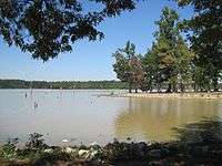 |
| Lake Ouachita State Park | Garland County | 360 acres (145.7 ha) | 1955 | Lake Ouachita | Built surrounding a reservoir, the park features a marina, trails, restaurant, eagle tours, and interpretative information on three historic springs in the park vicinity | 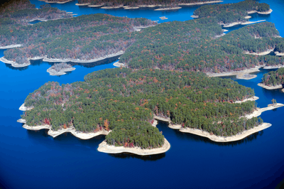 |
| Lake Poinsett State Park | Poinsett County | 132 acres (53.4 ha) | 1963 | Lake Poinsett | Popular with fishing enthusiasts, the park offers 29 campsites, trails and interpretative programs | 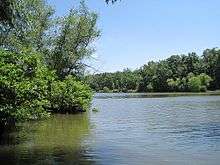 |
| Logoly State Park | Columbia County | 368 acres (148.9 ha) | 1974 | None | Environmental education park containing mature oak-hickory forests, mineral springs and endangered species | 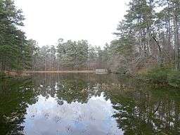 |
| Louisiana Purchase State Park | Lee County, Monroe County, Phillips County | 37.5 acres (15.2 ha) | 1961 | None | Boardwalk through a headwater swamp leading to a monument dedicating the point of beginning of all surveys of the Louisiana Purchase, which allowed for the westward development and expansion of the United States | 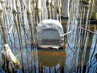 |
| Lower White River Museum State Park | Prairie County | 0.4 acres (0.2 ha) | 1975 | White River | Museum dedicated to the preservation and interpretation of culture, commerce and history along the White River in Arkansas | 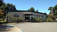 |
| Mammoth Spring State Park | Fulton County | 623.5 acres (25 ha) | 1957 | Mammoth Spring | Park surrounding the large natural spring, offering fishing, boating and hiking, an Arkansas welcome center and museum | 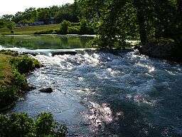 |
| Marks' Mills Battleground State Park | Cleveland County | 6.2 acres (2.5 ha) | 1961 | None | Park commemorating Civil War battle, including exhibits and park area. Also a Red River Campaign National Historic Landmark. | 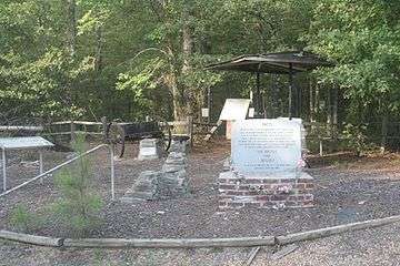 |
| Millwood State Park | Little River County | 824 acres (333 ha) | 1976 | Millwood Lake | Forested area surrounding large lake known for bass fishing, bird watching, hiking and camping. | |
| Mississippi River State Park | Lee County, Phillips County | 536 acres (217 ha) | 2009 | Mississippi River | Newest state park created within the St. Francis National Forest. Park currently includes campground at Bear Creek Lake and birding trail. | |
| Moro Bay State Park | Bradley County | 117 acres (47 ha) | 1972 | Ouachita River | Park at the convergence of Raymond Lake, Moro Bay, and the Ouachita River with visitor center. Popular destination for fishing, water sports, hiking trails and camping. | |
| Mount Magazine State Park | Logan County | 2,234 acres (904 ha) | 1983 | None | The park contains Mossback Ridge, including the peak of Mount Magazine, Arkansas's highest point. Park also contains The Lodge at Mount Magazine, cabins, trails, and a hang gliding area. | 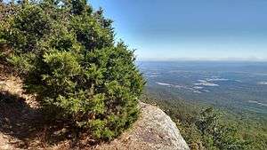 |
| Mount Nebo State Park | Yell County | 2,984 acres (1208 ha) | 1928 | None | One of three mountain state parks in the Arkansas River Valley, includes historic cabins, 14 miles (23 km) of hiking trails, and popular hang-gliding launch points. | 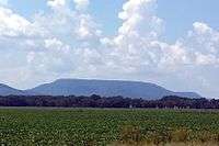 |
| Ozark Folk Center State Park | Stone County | 637 acres (258 ha) | 1973 | None | Located near Mountain View, Arkansas, it preserves the music, culture, and traditions of the Ozark Mountains. Hosts special concerts and regular folk music performances. | 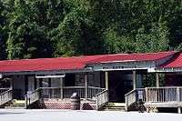 |
| Parkin Archeological State Park | Cross County | 107 acres (43 ha) | 1994 | None | 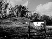 | |
| Petit Jean State Park | Conway County | 3,471 acres (1405 ha) | 1923 | None | Situated atop Petit Jean Mountain in the Arkansas River Valley, offers trails, creeks, and geology throughout the forested mountains | 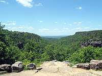 |
| Pinnacle Mountain State Park | Pulaski County | 2,069 acres (837 ha) | 1973 | None | Rocky Pinnacle Mountain emerges where the flat Arkansas Delta intersects the Ouachita Mountains | 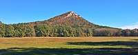 |
| Plantation Agriculture Museum | Lonoke County | 14.5 acres (5.9 ha) | 1985 | None | Former general store serving a community of cotton farmers operating as a museum including over 10,000 artifacts. Grounds also contain farm machinery used on cotton plantations. | 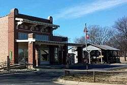 |
| Poison Springs Battleground State Park | Ouachita County | 85 acres (34 ha) | 1961 | None | Preserves and commemorates the Battle of Poison Spring in the American Civil War, which was part of the 1864 Camden Expedition | 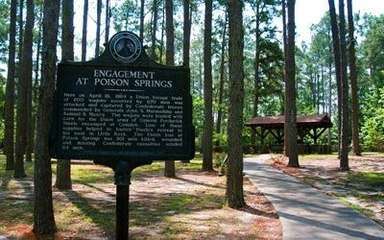 |
| Powhatan Historic State Park | Lawrence County | 9.1 acres (3.7 ha) | 1970 | Black River | Preserves a small nineteenth-century river port town on the Black River | 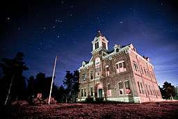 |
| Prairie Grove Battlefield State Park | Washington County | 840 acres (340 ha) | 1957 | None | Preserves and commemorates the Battle of Prairie Grove in the American Civil War. Park includes a museum, gift shop, and several historic structures from the period relocated to the site around a walking trail. | 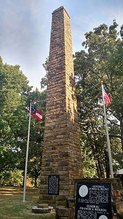 |
| Queen Wilhelmina State Park | Polk County | 460 acres (190 ha) | 1957 | None | Lodge atop Rich Mountain offers 38 guest rooms and is surrounded by forested slopes with creeks, trails, and mountain vistas. Located along the Talimena Scenic Drive. | .jpg) |
| South Arkansas Arboretum | Union County | 13 acres (5.3 ha) | 1991 | None | Arboretum and botanical garden owned by South Arkansas Community College with plants native to the Western Gulf Coastal Plain region. | |
| Toltec Mounds Archeological State Park | Lonoke County | 185 acres (75 ha) | 1975 | None | 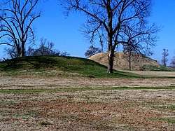 |
185 acres (75 ha)
- Village Creek State Park (Arkansas)
- White Oak Lake State Park
- Withrow Springs State Park
- Woolly Hollow State Park
See also
| Wikimedia Commons has media related to State parks of Arkansas. |
References
- ↑ "Park Finder". Arkansas Department of Parks and Tourism. Retrieved March 5, 2017. Note: this list of all 52 parks is the default reference for current individual Arkansas state parks.
- ↑ "Arkansas Department of Parks and Tourism (ADPT)". Encyclopedia of Arkansas History and Culture. Butler Center for Arkansas Studies at Central Arkansas Library System. February 7, 2012. Missing or empty
|url=(help);|access-date=requires|url=(help)