Archerwill
| Archerwill | |
|---|---|
| Village | |
| Village of Archerwill | |
| Motto(s): "Where You're A Stranger Only Once" | |
 Archerwill Location of Archerwill in Saskatchewan  Archerwill Archerwill (Canada) | |
| Coordinates: 52°26′23″N 103°51′41″W / 52.43972°N 103.86139°W | |
| Country | Canada |
| Provinces and territories of Canada | Saskatchewan |
| Census division | 14 |
| Rural Municipalities (R.M.) | Barrier Valley |
| Founded | 1924 |
| Post Office Founded | March 16, 1925 |
| Incorporated (Village) | January 1, 1947 |
| Government | |
| • Mayor | Jody Haganes (2016) |
| • Governing body | Archerwill Village Council |
| • M.P., Yorkton—Melville | Cathay Wagantall (2015) |
| • M.L.A., Kelvington-Wadena | Hugh Nerlien (2016) |
| Area | |
| • Land | 0.83 km2 (0.32 sq mi) |
| Population (2011) | |
| • Total | 200[1] |
| • Density | 242.1/km2 (627/sq mi) |
| Time zone | UTC-6 (CST) |
| Postal code | S0E 0B0 |
| Area code(s) | 306 / 639 |
| Highways |
|
| Railways | Canadian Pacific |
| Waterways | Barrier Lake, Barrier River, George Williams Lake, Marean Lake, Carps Lake, Nut Lake |
| [2][3][4] | |
Archerwill (population 200[1]) is a village within the Rural Municipality of Barrier Valley No. 397, Saskatchewan, Canada. The village is approximately 55 km (34 mi) north of Wadena, 52 km (32 mi) south of Tisdale and 70 km (43 mi) southeast of the city of Melfort. Since 1981[5] Archerwill has been the administrative centre of the Rural Municipality of Barrier Valley.
History
The community is named, in a syllabic abbreviation, after the secretary-treasurer and two councilors of the executive governing council of the R.M. of Barrier Valley in 1924. They were: Archie Campbell and Ervie Hanson, councilors; and William Pierce, secretary-treasurer.[6]
Archerwill is located on the Wadena-to-Tisdale branch line of the Canadian Pacific Railway. However, the nearly 55-year-old railway station[7] was torn down in the early 1980s; and the nearly 60-year-old Saskatchewan Wheat Pool and UGG elevators[8] were torn down in the 1990s.
The Archerwill Café (probably built in the late 1920s),[9] most recently operating as Diner Thirty Five, burned down in a fire on June 23, 2016. The actions of the Archerwill Volunteer Fire Department, along with the Rose Valley Volunteer Fire Department – who arrived from 17 kilometres (11 mi) away – saved the adjacent Archerwill Hotel and the post office.[10]
Demographics
| Canada census – Archerwill community profile | |||
|---|---|---|---|
| 2011 | 2006 | ||
| Population: | 200 (+8.1% from 2006) | 185 (14.0% from 2001) | |
| Land area: | 0.83 km2 (0.32 sq mi) | 0.83 km2 (0.32 sq mi) | |
| Population density: | 242.1/km2 (627/sq mi) | 223.9/km2 (580/sq mi) | |
| Median age: | 45.2 (M: 45.3, F: 45.0) | 38.8 (M: 40.3, F: 38.0) | |
| Total private dwellings: | 99 | 97 | |
| Median household income: | |||
| References: 2011[11] 2006[12] earlier[13] | |||
Amenities
Archerwill has a Co-op grocery store, Co-op lumber yard/hardware store, Co-op gas station/convenience store[14] and a Co-op fertilizer plant. Archerwill also has an elementary school,[15] a post office,[9] a credit union,[16] an indoor ice skating rink/curling rink,[17] a community hall,[17] a public library, a volunteer fire department/fire hall, a Senior Citizens' Centre, a restaurant, a thrift store, a hotel/bar and a greenhouse/garden centre.
See also
References
- 1 2 http://www12.statcan.gc.ca/census-recensement/2011/dp-pd/prof/index.cfm?Lang=E (accessed December 17, 2012).
- ↑ National Archives, Archivia Net, Post Offices and Postmasters, retrieved 2009-06-27
- ↑ Government of Saskatchewan, MRD Home, Municipal Directory System, archived from the original on January 15, 2016, retrieved 2009-06-27
- ↑ Commissioner of Canada Elections, Library of Parliament (2008), Riding history for Yorkton—Melville (1966– ), retrieved 2008-10-28
- ↑ Pederson 1984, page 3.
- ↑ Pederson 1984, page 10; Barry, People Places, page 19.
- ↑ Pederson 1984, pages 151–152.
- ↑ Pederson 1984, pages 10, 153 and 155.
- 1 2 Pederson 1984, page 11.
- ↑ Anderson, Karen (July 4, 2016). "Archerwill News". Wadena News. 108 (26). p. 8.
- ↑ "2011 Community Profiles". Canada 2011 Census. Statistics Canada. July 5, 2013. Retrieved 2012-12-17.
- ↑ "2006 Community Profiles". Canada 2006 Census. Statistics Canada. March 30, 2011. Retrieved 2009-02-24.
- ↑ "2001 Community Profiles". Canada 2001 Census. Statistics Canada. February 17, 2012.
- ↑ Pederson 1984, pages 14 and 162.
- ↑ Pederson 1984, pages 9, 16, and 79–80.
- ↑ Pederson 1984, pages 165–166.
- 1 2 Pederson 1984, page 17.
- Pederson, Laurette, ed. (1984). The Past to the Present. North Battleford, Saskatchewan: Turner-Warwick Publications Inc.
- Barry, Bill (1998), People Places : The Dictionary of Saskatchewan Place Names, Regina, Saskatchewan: People Places Publishing Ltd, ISBN 1-894022-19-X
External links
Places adjacent to Archerwill | ||||||||||
|---|---|---|---|---|---|---|---|---|---|---|
| ||||||||||
| Subdivisions | |
|---|---|
| Communities | |
| Cities | |
| Topics |
|
| |
| Cities | 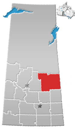 | |
|---|---|---|
| Towns | ||
| Villages | ||
| Resort villages | ||
| Rural municipalities | ||
| Indian reserves | ||
| Unincorporated communities | ||
Coordinates: 52°26′23″N 103°51′41″W / 52.43972°N 103.86139°W