Fosston, Saskatchewan
| Fosston | |
|---|---|
| Village | |
| Village of Fosston | |
| Motto(s): Catch The Fosston Feeling | |
 Fosston Location of Fosston in Saskatchewan  Fosston Fosston (Canada) | |
| Coordinates: 52°12′22″N 103°49′48″W / 52.206°N 103.830°W | |
| Country | Canada |
| Province | Saskatchewan |
| Region | Central |
| Census division | 14 |
| Rural Municipality | Ponass Lake No. 367 |
| Post office Founded | 1908 |
| Incorporated (Village) | 1964 |
| Government | |
| • Type | Municipal |
| • Governing body | Fosston Village Council |
| • Mayor | William Dyck |
| • Administrator | Valerie Bjerland |
| • Federal Electoral District of Yorkton-Melville M.P. | Cathay Wagantall (2015) |
| • Provincial Constituency of Kelvington-Wadena M.L.A. | June Draude (2007) |
| Area | |
| • Total | 0.59 km2 (0.23 sq mi) |
| Population (2016) | |
| • Total | 45 |
| • Density | 76.8/km2 (199/sq mi) |
| Time zone | UTC-6 (CST) |
| Postal code | S0E 0V0 |
| Area code(s) | 306 |
| Highways |
|
| [1][2][3][4] | |
Fosston is a village in the rural municipality of Ponass Lake No. 367, in the Canadian province of Saskatchewan. The village was named after Fosston, Minnesota, the original home of five Rustad brothers, who homesteaded here.[5]
Demographics
| Canada census – Fosston, Saskatchewan community profile | |||
|---|---|---|---|
| 2016 | 2011 | 2006 | |
| Population: | 45 (-18.2% from 2011) | 55 (0.0% from 2006) | 55 (0.0% from 2001) |
| Land area: | 0.59 km2 (0.23 sq mi) | 0.59 km2 (0.23 sq mi) | 0.59 km2 (0.23 sq mi) |
| Population density: | 76.8/km2 (199/sq mi) | 93.9/km2 (243/sq mi) | 93.9/km2 (243/sq mi) |
| Median age: | 56.8 (M: 55.5, F: 57.8) | 58.2 (M: 61.0, F: 56.5) | |
| Total private dwellings: | 35 | 36 | 49 |
| Median household income: | |||
| References: 2016[6] 2011[7] 2006[8] earlier[9] | |||
See also
References
- ↑ National Archives, Archivia Net, Post Offices and Postmasters, archived from the original on 2006-10-06
- ↑ Government of Saskatchewan, MRD Home. "Municipal Directory System". Retrieved 2014-06-21.
- ↑ Canadian Textiles Institute. (2005), CTI Determine your provincial constituency, archived from the original on 2007-09-11
- ↑ Commissioner of Canada Elections, Chief Electoral Officer of Canada (2005), Elections Canada On-line, archived from the original on 2007-04-21
- ↑ Barry, Bill (September 2005). Geographic Names of Saskatchewan. Regina, Saskatchewan: People Places Publishing, Ltd. p. 149. ISBN 1-897010-19-2.
- ↑ "2016 Community Profiles". Canada 2016 Census. Statistics Canada. February 21, 2017. Retrieved 2017-03-15.
- ↑ "2011 Community Profiles". Canada 2011 Census. Statistics Canada. July 5, 2013. Retrieved 2012-05-21.
- ↑ "2006 Community Profiles". Canada 2006 Census. Statistics Canada. March 30, 2011. Retrieved 2009-02-24.
- ↑ "2001 Community Profiles". Canada 2001 Census. Statistics Canada. February 17, 2012.
External links
Places adjacent to Fosston, Saskatchewan | ||||||||||
|---|---|---|---|---|---|---|---|---|---|---|
| ||||||||||
| Subdivisions | |
|---|---|
| Communities | |
| Cities | |
| Topics |
|
| |
| Cities | 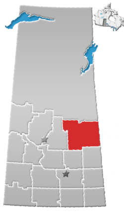 | |
|---|---|---|
| Towns | ||
| Villages | ||
| Resort villages | ||
| Rural municipalities | ||
| Indian reserves | ||
| Unincorporated communities | ||
This article is issued from
Wikipedia.
The text is licensed under Creative Commons - Attribution - Sharealike.
Additional terms may apply for the media files.