Bjorkdale
| Bjorkdale | |
|---|---|
| Village | |
| Village of Bjorkdale | |
| Motto(s): Village in the Valley[1] | |
 Location of Bjorkdale in Saskatchewan  Bjorkdale (Canada) | |
| Coordinates: 52°42′25″N 103°37′19″W / 52.707°N 103.622°W | |
| Country | Canada |
| Province | Saskatchewan |
| Region | Central |
| Census division | 14 |
| Rural Municipality | Bjorkdale No. 426 |
| Incorporated (Village) | 1968 |
| Government | |
| • Type | Municipal |
| • Governing body | Bjorkdale Village Council |
| • Mayor | James Majewski |
| • Administrator | Kate Clarke |
| Area | |
| • Total | 1.39 km2 (0.54 sq mi) |
| Population | |
| • Total | 201 |
| • Density | 145.1/km2 (376/sq mi) |
| Time zone | CST |
| Postal code | S0E 0E0 |
| Area code(s) | 306 |
| Highways |
|
| Railways | Abandoned |
| Website | https://www.villageofbjorkdale.ca/ |
Bjorkdale /ˈbɜːrkdeɪl/ (2016 population 201) is a village within the Rural Municipality of Bjorkdale No. 426, Saskatchewan, Canada. The village is located at the junctions of Highway 23, 679 & 776, approximately 78 kilometres (48 mi) east of the city of Melfort.
Demographics
| Canada census – Bjorkdale community profile | |||
|---|---|---|---|
| 2016 | 2011 | 2006 | |
| Population: | 201 (+ 1.0% from 2011) | 199 (-1% from 2006) | 201 (-12.2% from 2001) |
| Land area: | 1.39 km2 (0.54 sq mi) | 1.39 km2 (0.54 sq mi) | 1.39 km2 (0.54 sq mi) |
| Population density: | 145.1/km2 (376/sq mi) | 143.7/km2 (372/sq mi) | 145.1/km2 (376/sq mi) |
| Median age: | 43.5 (M: 43.2, F: 45.0) | 44.2 (M: 44.0, F: 44.5) | 45.2 (M: 43.0, F: 46.2) |
| Total private dwellings: | 101 | 97 | 102 |
| Median household income: | |||
| References: 2016[2] 2011[3] 2006[4] earlier[5] | |||
See also
References
- ↑ Village in the Valley
- ↑ "2016 Community Profiles". Canada 2016 Census. Statistics Canada. February 21, 2017.
- ↑ "2011 Community Profiles". Canada 2011 Census. Statistics Canada. July 5, 2013. Retrieved 2012-06-21.
- ↑ "2006 Community Profiles". Canada 2006 Census. Statistics Canada. March 30, 2011. Retrieved 2009-02-24.
- ↑ "2001 Community Profiles". Canada 2001 Census. Statistics Canada. February 17, 2012.
External links
Places adjacent to Bjorkdale | ||||||||||
|---|---|---|---|---|---|---|---|---|---|---|
| ||||||||||
| Subdivisions | |
|---|---|
| Communities | |
| Cities | |
| Topics |
|
| |
| Cities | 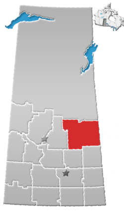 | |
|---|---|---|
| Towns | ||
| Villages | ||
| Resort villages | ||
| Rural municipalities | ||
| Indian reserves | ||
| Unincorporated communities | ||
Coordinates: 52°42′25″N 103°37′19″W / 52.707°N 103.622°W
This article is issued from
Wikipedia.
The text is licensed under Creative Commons - Attribution - Sharealike.
Additional terms may apply for the media files.