Aylsham, Saskatchewan
| Aylsham | |
|---|---|
| Village | |
| Village of Aylsham | |
 Location of Aylsham in Saskatchewan  Aylsham, Saskatchewan (Canada) | |
| Coordinates: 53°06′48″N 103°28′55″W / 53.1132°N 103.4819°W | |
| Country | Canada |
| Province | Saskatchewan |
| Region | East-central Saskatchewan |
| Census division | 14 |
| Rural Municipality | Nipawin |
| Government | |
| • Type | Aylsham Village Council |
| Population (2006) | |
| • Total | 92 |
| Time zone | CST |
| Postal code | S0E 0C0 |
| Area code(s) | 306 |
Aylsham (2006 Population 92) is a village within the Rural Municipality of Nipawin No. 487, Saskatchewan, Canada. The village is approximately 65 km northeast of the city of Melfort. Aylsham was named by its migrating settlers after Aylsham, Norfolk, England.
Demographics
| Canada census – Aylsham, Saskatchewan community profile | |||
|---|---|---|---|
| 2006 | |||
| Population: | 92 (-13.2% from 2001) | ||
| Land area: | 0.48 km2 (0.19 sq mi) | ||
| Population density: | 190.6/km2 (494/sq mi) | ||
| Median age: | 35.7 (M: 38.0, F: 30.0) | ||
| Total private dwellings: | 46 | ||
| Median household income: | $NA | ||
| References: 2006[1] earlier[2] | |||
Climate
| Climate data for Aylsham | |||||||||||||
|---|---|---|---|---|---|---|---|---|---|---|---|---|---|
| Month | Jan | Feb | Mar | Apr | May | Jun | Jul | Aug | Sep | Oct | Nov | Dec | Year |
| Record high °C (°F) | 6 (43) |
7.5 (45.5) |
17 (63) |
31.1 (88) |
35 (95) |
38.5 (101.3) |
34.5 (94.1) |
35.5 (95.9) |
33.3 (91.9) |
27 (81) |
17.8 (64) |
11 (52) |
38.5 (101.3) |
| Average high °C (°F) | −14.3 (6.3) |
−9.5 (14.9) |
−2.4 (27.7) |
8.9 (48) |
17.9 (64.2) |
22 (72) |
23.9 (75) |
23.3 (73.9) |
16.7 (62.1) |
8.8 (47.8) |
−3.5 (25.7) |
−11.7 (10.9) |
6.7 (44.1) |
| Daily mean °C (°F) | −19.2 (−2.6) |
−14.6 (5.7) |
−7.8 (18) |
3.1 (37.6) |
11.1 (52) |
15.7 (60.3) |
17.7 (63.9) |
16.7 (62.1) |
10.7 (51.3) |
3.6 (38.5) |
−7.4 (18.7) |
−16.2 (2.8) |
1.1 (34) |
| Average low °C (°F) | −24.1 (−11.4) |
−19.7 (−3.5) |
−13.2 (8.2) |
−2.7 (27.1) |
4.2 (39.6) |
9.4 (48.9) |
11.4 (52.5) |
10 (50) |
4.6 (40.3) |
−1.6 (29.1) |
−11.2 (11.8) |
−20.7 (−5.3) |
−4.5 (23.9) |
| Record low °C (°F) | −44.4 (−47.9) |
−44 (−47) |
−37 (−35) |
−29.4 (−20.9) |
−9 (16) |
−2 (28) |
1.1 (34) |
−2 (28) |
−7.8 (18) |
−22 (−8) |
−37.5 (−35.5) |
−42 (−44) |
−44.4 (−47.9) |
| Average precipitation mm (inches) | 17.6 (0.693) |
14.1 (0.555) |
19.4 (0.764) |
23.9 (0.941) |
46.2 (1.819) |
79.2 (3.118) |
80.4 (3.165) |
60.4 (2.378) |
46.1 (1.815) |
33 (1.3) |
23 (0.91) |
22.4 (0.882) |
465.6 (18.331) |
| Source: Environment Canada[3] | |||||||||||||
Notable people
- Greg Classen Former NHL hockey player, currently under contract with EHC Basel
See also
References
- ↑ "2006 Community Profiles". Canada 2006 Census. Statistics Canada. March 30, 2011. Retrieved 2010-12-12.
- ↑ "2001 Community Profiles". Canada 2001 Census. Statistics Canada. February 17, 2012.
- ↑ Environment Canada Canadian Climate Normals 1971–2000, accessed 23 July 2010
External links
Places adjacent to Aylsham, Saskatchewan | ||||||||||
|---|---|---|---|---|---|---|---|---|---|---|
| ||||||||||
| Subdivisions | |
|---|---|
| Communities | |
| Cities | |
| Topics |
|
| |
| Cities | 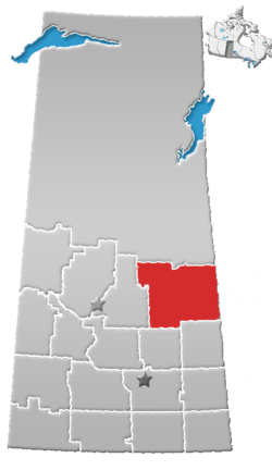 | |
|---|---|---|
| Towns | ||
| Villages | ||
| Resort villages | ||
| Rural municipalities | ||
| Indian reserves | ||
| Unincorporated communities | ||
Coordinates: 53°12′N 103°48′W / 53.200°N 103.800°W
This article is issued from
Wikipedia.
The text is licensed under Creative Commons - Attribution - Sharealike.
Additional terms may apply for the media files.