Codette
| Codette | |
|---|---|
| Village | |
| Village of Codette | |
 Codette Location of Codette in Saskatchewan  Codette Codette (Canada) | |
| Coordinates: 53°09′52″N 104°00′48″W / 53.164407°N 104.013320°W | |
| Country |
|
| Province |
|
| Region | East-central |
| Census division | 14 |
| Rural Municipality | Nipawin No. 487 |
| Government | |
| • Type | Municipal |
| • Governing body | Codette Village Council |
| • Mayor | Malcolm Haveroen |
| • Administrator | Ashley Lonson |
| Area | |
| • Land | 0.37 km2 (0.14 sq mi) |
| Population (2016) | |
| • Total | 189 |
| • Density | 539.2/km2 (1,397/sq mi) |
| Time zone | UTC-6 (CST) |
| Postal code | S0E 0P0 |
| Area code(s) | 306 |
| Highways |
|
Codette is a village within the Rural Municipality of Nipawin No. 487, Saskatchewan, Canada. The village had a population of 198 in the 2016 Census, (a -3.4 decrease from the 2011 Census). The village is located 10 km south of Nipawin at the junction of Highway 35 and Highway 789.
The community shares its name with nearby Codette Lake, a man-made lake on the Saskatchewan River, blocked by the Francois Finlay Dam.
Demographics
| Canada census – Codette community profile | |||
|---|---|---|---|
| 2016 | 2011 | 2006 | |
| Population: | 198 (-3.4% from 2011) | 205 (-7.2% from 2006) | 221 (-6.8% from 2001) |
| Land area: | 0.37 km2 (0.14 sq mi) | 0.37 km2 (0.14 sq mi) | 0.37 km2 (0.14 sq mi) |
| Population density: | 539.2/km2 (1,397/sq mi) | 556.3/km2 (1,441/sq mi) | 601.9/km2 (1,559/sq mi) |
| Median age: | 50.5 (M: 52.8, F: 46.9) | 46.1 (M: 47.0, F: 43.5) | 44.2 (M: 47.0, F: 40.8) |
| Total private dwellings: | 105 | 112 | 113 |
| Median household income: | |||
| References: 2016[1] 2011[2] 2006[3] earlier[4] | |||
See also
References
- ↑ "2016 Community Profiles". Canada 2016 Census. Statistics Canada. February 21, 2017. Retrieved 2017-03-15.
- ↑ "2011 Community Profiles". Canada 2011 Census. Statistics Canada. July 5, 2013. Retrieved 2013-02-22.
- ↑ "2006 Community Profiles". Canada 2006 Census. Statistics Canada. March 30, 2011. Retrieved 2013-02-22.
- ↑ "2001 Community Profiles". Canada 2001 Census. Statistics Canada. February 17, 2012.
External links
| Subdivisions | |
|---|---|
| Communities | |
| Cities | |
| Topics |
|
| |
| Cities | 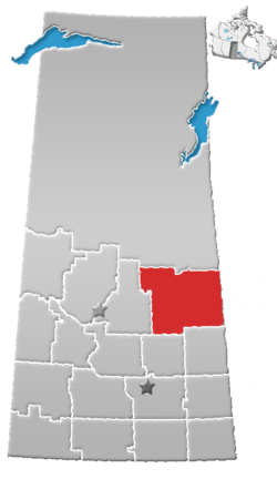 | |
|---|---|---|
| Towns | ||
| Villages | ||
| Resort villages | ||
| Rural municipalities | ||
| Indian reserves | ||
| Unincorporated communities | ||
Coordinates: 53°16′44″N 104°01′33″W / 53.27889°N 104.02583°W
This article is issued from
Wikipedia.
The text is licensed under Creative Commons - Attribution - Sharealike.
Additional terms may apply for the media files.