Anginda peak
| Anginda peak | |
|---|---|
| അങ്ങിണ്ട മുടി | |
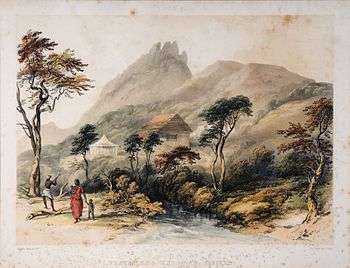 Sispara pass. Anginda is background | |
| Highest point | |
| Elevation | 2,383 m (7,818 ft) |
| Coordinates | 11°12′26″N 76°27′51″E / 11.20722°N 76.46417°ECoordinates: 11°12′26″N 76°27′51″E / 11.20722°N 76.46417°E |
| Geography | |
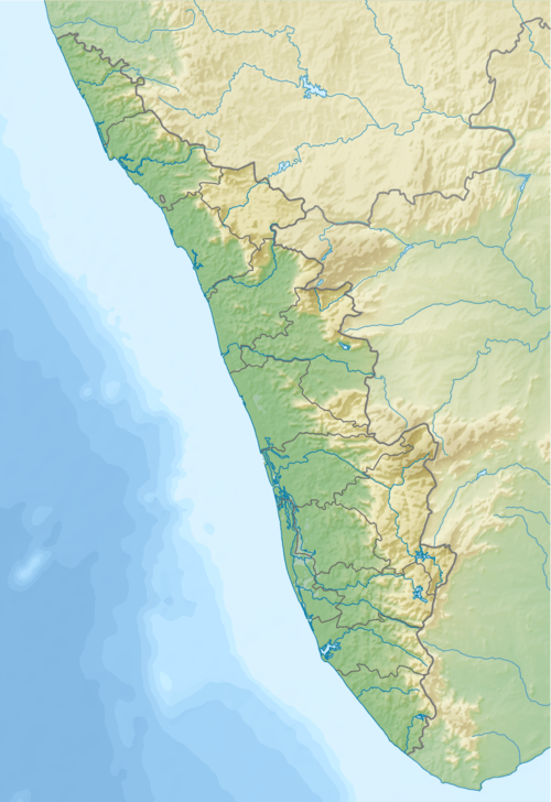 Anginda peak Location of Anginda Peak in Kerala | |
| Location | Border of Mannarkad Taluk, Palakkad District, Nilambur Taluk, Malappuram district, Kerala and Kundha Taluk, Nilgiris district, Tamil Nadu ,India |
| Parent range | Western Ghats |
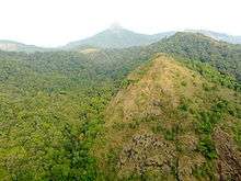
Anginda peak (അങ്ങിണ്ട മുടി) is a mountain in the Nilgiri Hills of the Western Ghats in Palakkad district Kerala, South India. It has an elevation of 2,383 metres (7,818 ft) and is the highest peak in Silent Valley National Park.[1] It is just south of Sispara pass, and forms the southernmost boundary of Mukurthi National Park in Tamil Nadu. There is an unobstructed view of Anginda from the 30 m observation tower at Sairandhri Visitors Center.
Anginda peak
There is a population of the endemic and endangered Nilgiri laughing-thrush at the Anginda-Sispara belt inside the Silent Valley National Park. Serious trekkers can take a 4-day trek route, starting from Mukkali through Sairandhri, Poochipara, Walakkad and Sispara to Anginda.
Citations
- ↑ Logan 2000, p. 6
References
- Logan, William (2000), Malabar Manual (Volume 1), Asian Educational Services, ISBN 81-206-0446-6 .
- Pillai, Sridevi (25 March 2007), Ecowatch- A birder's trail, The Hindu, retrieved 8 December 2009
- Nair, Sajita (2005) Valley of Silence. Gateway for India. retrieved 6 September 2007.
This article is issued from
Wikipedia.
The text is licensed under Creative Commons - Attribution - Sharealike.
Additional terms may apply for the media files.