Kansas's 2nd congressional district
| Kansas's 2nd congressional district | |
|---|---|
.tif.png) Kansas' 2nd congressional district – since January 3, 2013. | |
| Current Representative | Lynn Jenkins (R–Topeka) |
| Distribution |
|
| Population (2015) | 715,752 |
| Median income | 50,087 |
| Ethnicity |
|
| Cook PVI | R+10[1] |
Kansas' 2nd congressional district is a congressional district in the U.S. state of Kansas that covers most of the eastern part of the state, except for the core of the Kansas City Metropolitan Area. The district encompasses less than a quarter of the state. The state capital of Topeka and Lawrence, home of one of the state's universities, The University of Kansas, are both located within this district.
The district is currently represented by Republican congresswoman Lynn Jenkins.
History
Kansas had but one representative in the U.S. House of Representatives until after the 1870 U.S. Census, which showed that the state was entitled to three members of the lower branch of the national legislature. In 1872, three representatives-at-large were elected, but by the act of March 2, 1874, the legislature divided the state into three districts. The 2nd Congressional District was composed of the counties of Montgomery, Wilson, Labette, Cherokee, Crawford, Neosho, Bourbon, Allen, Anderson, Linn, Miami, Franklin, Johnson, Douglas and Wyandotte.
No changes were made in until after the 1880 U.S. Census, which gave the state seven representatives. On March 5, 1883, Governor George Washington Glick approved an act of the legislature which reduced the 2nd Congressional District to only include the counties of Wyandotte, Johnson, Douglas, Miami, Franklin, Anderson, Linn, Allen and Bourbon.
Although the 1890 U.S. Census showed the population of Kansas to be large enough to entitle the state to eight representatives, no additional district was created until 1905. By the act of March 9, 1905, the state was divided into eight districts with the 2nd Congressional district being composed of the counties of Wyandotte, Johnson, Douglas, Miami, Franklin, Anderson, Linn, Allen and Bourbon.[2]
Reapportionment for 2002 placed the western half of Lawrence as well as Miami County into the 2nd Congressional District and cut out the counties of Geary, Montgomery and Nemaha.
Reapportionment in 2012 meant the 2nd Congressional District included the entirety of Lawrence in the 2nd Congressional District. The District's boundaries were altered to remove Manhattan, home of Kansas State University, and portions of Miami County while adding all of Montgomery County and Nemaha County and portions of Marshall County.
Demographics
Following redistricting after the 2000 U.S. Census,[3] there were 672,102 people, 257,856 households, and 173,309 families residing in the district. The population density was 47.6/mi² over a land area of 14,133 square miles (36,600 km2). There were 280,213 housing units at an average density of 19.8/mi². The racial makeup of the district is 89.01% White, 5.06% Black or African American, 1.26% Native American, 0.97% Asian, 0.06% Pacific Islander, 1.52% from other races, and 2.12% from two or more races. Hispanic or Latino of any race were 3.81% of the population.
There were 257,856 households out of which 34.60% had children under the age of 18 living with them, 54.48% were married couples living together, 9.20% had a female householder with no husband present, and 32.79% were non-families. 26.73% of all households were made up of individuals and 10.63% had someone living alone who was 65 years of age or older. The average household size was 2.49 and the average family size was 3.02.
In the district the population distribution by age is 25.34% under the age of 18, 11.88% from 18 to 24, 27.54% from 25 to 44, 21.70% from 45 to 64, and 13.54% who were 65 years of age or older. The median age was 35.3 years. For every 100 females, there were 99.08 males. For every 100 females age 18 and over, there were 96.85 males.
The median income for a household in the district is $37,855, and the median income for a family was $47,095. Males had a median income of $32,033 versus $24,230 for females. The per capita income for the district was $18,595. About 7.1% of families and 11.2% of the population were below the poverty line, including 12.0% of those under age 18 and 9.3% of those age 65 or over.
Among the population aged 16 years and older, 64.5% was in the civilian labor force and 1.9% were in the armed forces. Of the employed civilian workers, 20.6% were government workers and 7.5% were self-employed. Management, professional, and related occupations employed 32.3% of the work force and sales and office occupations employ 25.4%. Only 0.8% were employed in farming, fishing, and forestry occupations. The largest employment by industry was: educational, health and social services, 24.5%; manufacturing, 12.3%; and retail trade, 11.4%. Agriculture, forestry, fishing and hunting, and mining industries only employed 3.0%.
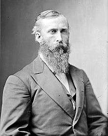
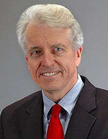
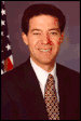
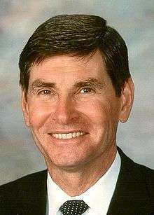
List of representatives
- Parties
Democratic (9) Populist (1) Republican (17)


.jpg)
.jpg)


.jpg)

.jpg)


.jpg)
Election results from presidential races
| Year | Office | Results | Political parties that won the district |
|---|---|---|---|
| 2000 | President | George W. Bush 54 - Al Gore 41% | Republican Party (United States) |
| 2004 | President | George W. Bush 59 - John Kerry 39% | Republican Party (United States) |
| 2008 | President | John McCain 55 - Barack Obama 43% | Republican Party (United States) |
| 2012 | President | Mitt Romney 56 - Barack Obama 42% | Republican Party (United States) |
| 2016 | President | Donald Trump 56 - Hillary Clinton 37% | Republican Party (United States) |
Recent election results
2002
| Party | Candidate | Votes | % | |
|---|---|---|---|---|
| Republican | Jim Ryun* | 126,169 | 60.45 | |
| Democratic | Dan Lykins | 78,286 | 37.51 | |
| Libertarian | Art Clack | 4,263 | 2.04 | |
| Total votes | 208,718 | 100.00 | ||
| Republican hold | ||||
2004
| Party | Candidate | Votes | % | |
|---|---|---|---|---|
| Republican | Jim Ryun* | 165,325 | 56.15 | |
| Democratic | Nancy Boyda | 121,532 | 41.28 | |
| Libertarian | Dennis Hawver | 7,579 | 2.57 | |
| Total votes | 294,436 | 100.00 | ||
| Republican hold | ||||
2006
| Party | Candidate | Votes | % | |||
|---|---|---|---|---|---|---|
| Democratic | Nancy Boyda | 111,759 | 50.60 | |||
| Republican | Jim Ryun* | 104,128 | 47.15 | |||
| Reform | Roger Tucker | 4,980 | 2.26 | |||
| Total votes | 220,867 | 100.00 | ||||
| Democratic gain from Republican | ||||||
2008
| Party | Candidate | Votes | % | |||
|---|---|---|---|---|---|---|
| Republican | Lynn Jenkins | 155,532 | 50.61 | |||
| Democratic | Nancy Boyda* | 142,013 | 46.21 | |||
| Reform | Leslie Martin | 5,080 | 1.65 | |||
| Libertarian | Robert Garrard | 4,683 | 1.52 | |||
| Total votes | 262,027 | 100.00 | ||||
| Republican gain from Democratic | ||||||
2010
| Party | Candidate | Votes | % | |
|---|---|---|---|---|
| Republican | Lynn Jenkins* | 130,034 | 63.13 | |
| Democratic | Cheryl Hudspeth | 66,588 | 32.33 | |
| Libertarian | Robert Garrard | 9,353 | 4.54 | |
| Total votes | 205,975 | 100.00 | ||
| Republican hold | ||||
2012
| Party | Candidate | Votes | % | |
|---|---|---|---|---|
| Republican | Lynn Jenkins* | 167,463 | 57.0 | |
| Democratic | Tobias Schlingensiepen | 113,735 | 38.7 | |
| Libertarian | Dennis Hawver | 12,520 | 4.2 | |
| Total votes | 293,718 | 100.00 | ||
| Republican hold | ||||
2014
| Party | Candidate | Votes | % | |
|---|---|---|---|---|
| Republican | Lynn Jenkins* | 128,742 | 57.0 | |
| Democratic | Margie Wakefield | 87,153 | 38.6 | |
| Libertarian | Christopher Clemmons | 9,791 | 4.3 | |
| Total votes | 225,686 | 99.9 | ||
| Republican hold | ||||
2016
| Party | Candidate | Votes | % | |
|---|---|---|---|---|
| Republican | Lynn Jenkins* | 181,228 | 60.9 | |
| Democratic | Britani Potter | 96,840 | 32.5 | |
| Libertarian | James Houston Bales | 19,333 | 6.5 | |
| Total votes | 297,401 | 99.9 | ||
| Republican hold | ||||
Historical district boundaries

See also
See also
References
- ↑ "Partisan Voting Index – Districts of the 115th Congress" (PDF). The Cook Political Report. April 7, 2017. Retrieved April 7, 2017.
- ↑ Frank W. Blackmar, ed. (1912). "Congressional Districts". Kansas: a cyclopedia of state history, embracing events, institutions, industries, counties, cities, towns, prominent persons, etc ... I. Chicago: Standard Pub Co. pp. 400–401.
- ↑ "American FactFinder". United States Census Bureau. Retrieved 2008-01-31.
- ↑ http://www.sos.ks.gov/elections/14elec/2014%20General%20Election%20Official%20Results.pdf
- ↑ https://www.sos.ks.gov/elections/16elec/2016_General_Election_Official_Results.pdf
- Martis, Kenneth C. (1989). The Historical Atlas of Political Parties in the United States Congress. New York: Macmillan Publishing Company.
- Martis, Kenneth C. (1982). The Historical Atlas of United States Congressional Districts. New York: Macmillan Publishing Company.
- Congressional Biographical Directory of the United States 1774–present