Hubei
Hubei (湖北; formerly Hupeh) is a landlocked province of the People's Republic of China, and is part of the Central China region. The name of the province means "north of the lake", referring to its position north of Dongting Lake.[6] The provincial capital, Wuhan, serves as a major transportation hub and the political, cultural, and economic hub of central China.
Hubei Province 湖北省 | |
|---|---|
| Name transcription(s) | |
| • Chinese | 湖北省 (Húběi Shěng) |
| • Abbreviation | HB / 鄂 (pinyin: È) |
      (clockwise from top)
| |
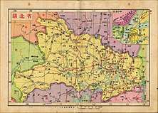
.svg.png) Map showing the location of Hubei Province | |
| Coordinates: 31°12′N 112°18′E | |
| Capital (and largest city) | Wuhan |
| Divisions | 13 prefectures, 102 counties, 1235 townships |
| Government | |
| • Secretary | Ying Yong |
| • Governor | Wang Xiaodong |
| Area | |
| • Total | 185,900 km2 (71,800 sq mi) |
| Area rank | 13th |
| Highest elevation | 3,105 m (10,187 ft) |
| Population (2015)[3] | |
| • Total | 58,500,000 |
| • Rank | 9th |
| • Density | 310/km2 (820/sq mi) |
| • Density rank | 12th |
| Demographics | |
| • Ethnic composition | Han: 95.6% Tujia: 3.7% Miao: 0.4% |
| • Languages and dialects | Southwestern Mandarin, Jianghuai Mandarin, Gan, Xiang |
| ISO 3166 code | CN-HB |
| GDP (2017) | CNY 3.65 trillion USD 540.94 billion [4] (7th) |
| • per capita | CNY 61,971 USD 9,179 (11th) |
| HDI (2018) | 0.762[5] (high) (12th) |
| Website | Hubei.gov.cn (Simplified Chinese) |
| Hubei | |||||||||||||||||||||||||||||||||||||||||
|---|---|---|---|---|---|---|---|---|---|---|---|---|---|---|---|---|---|---|---|---|---|---|---|---|---|---|---|---|---|---|---|---|---|---|---|---|---|---|---|---|---|
.svg.png) "Hubei" in Chinese characters | |||||||||||||||||||||||||||||||||||||||||
| Chinese | 湖北 | ||||||||||||||||||||||||||||||||||||||||
| Postal | Hupeh | ||||||||||||||||||||||||||||||||||||||||
| Literal meaning | "North of the (Dongting) Lake" | ||||||||||||||||||||||||||||||||||||||||
| |||||||||||||||||||||||||||||||||||||||||
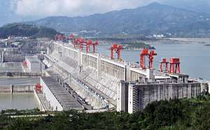
Hubei's name is officially abbreviated to "鄂" (È), an ancient name associated with the eastern part of the province since the State of E of the Western Zhou dynasty of c. 1045–771 BCE; a popular name for Hubei is "楚" (Chǔ) (suggested by that of the powerful State of Chu, which existed in the area during the Eastern Zhou dynasty of 770 – 256 BCE). Hubei borders the provinces of Henan to the north, Anhui to the east, Jiangxi to the southeast, Hunan to the south, Chongqing to the west, and Shaanxi to the northwest. The high-profile Three Gorges Dam is located at Yichang, in the west of the province.
History
The Hubei region was home to sophisticated Neolithic cultures.[7][8] By the Spring and Autumn period (770–476 BC), the territory of today's Hubei was part of the powerful State of Chu. Chu was nominally a tributary state of the Zhou dynasty, and it was itself an extension of the Chinese civilization that had emerged some centuries before in the north; but it was also a culturally unique blend of northern and southern culture, and was a powerful state that held onto much of the middle and lower Yangtze River, with power extending northwards into the North China Plain.[9]
During the Warring States period (475–221 BC) Chu became the major adversary of the upstart State of Qin to the northwest (in what is now Shaanxi province), which began to assert itself by outward expansionism. As wars between Qin and Chu ensued, Chu lost more and more land: first its dominance over the Sichuan Basin, then (in 278 BC) its heartland, which correspond to modern Hubei. In 223 BC Qin chased down the remnants of the Chu regime, which had fled eastwards, as part of Qin's bid for the conquest of all China.
Qin founded the Qin dynasty in 221 BC, the first unified state in the region. Qin was succeeded by the Han dynasty in 206 BC, which established the province (zhou) of Jingzhou in what is now Hubei and Hunan. The Qin and Han played an active role in the agricultural colonization of Hubei, maintaining a system of river dikes to protect farmland from summer floods.[10] Towards the end of the Han dynasty in the beginning of the 3rd century, Jingzhou was ruled by regional warlord Liu Biao. After his death, Liu Biao's realm was surrendered by his successors to Cao Cao, a powerful warlord who had conquered nearly all of north China; but in the Battle of Red Cliffs, warlords Liu Bei and Sun Quan drove Cao Cao out of Jingzhou. Liu Bei then took control of Jingzhou; he went on to conquer Yizhou (the Sichuan Basin), but lost Jingzhou to Sun Quan; for the next few decades Jingzhou was controlled by the Wu Kingdom, ruled by Sun Quan and his successors.
.jpg)
The incursion of northern nomadic peoples into the region at the beginning of the 4th century began nearly three centuries of division into a nomad-ruled (but increasingly Sinicized) north and a Han Chinese-ruled south. Hubei, to the South, remained under southern rule for this entire period, until the unification of China by the Sui dynasty in 589. In 617 the Tang dynasty replaced Sui, and later on the Tang dynasty placed what is now Hubei under several circuits: Jiangnanxi Circuit in the south; Shannandong Circuit in the west, and Huainan Circuit in the east. After the Tang dynasty disintegrated in the 10th century, Hubei came under the control of several regional regimes: Jingnan in the center, Wu (later Southern Tang) to the east, and the Five Dynasties to the north.
The Song dynasty reunified the region in 982 and placed most of Hubei into Jinghubei Circuit, a longer version of Hubei's current name. Mongols conquered the region in 1279, and under their rule the province of Huguang was established, covering Hubei, Hunan, and parts of Guangdong and Guangxi. During the Mongol rule, in 1331, Hubei was devastated by an outbreak of the Black Death, striking England, Belgium, and Italy by June 1348, which according to Chinese sources spread during the following three centuries to decimate populations throughout Eurasia.[11]
The Ming dynasty drove out the Mongols in 1368. Their version of Huguang province was smaller, and corresponded almost entirely to the modern provinces of Hubei and Hunan combined. While Hubei was geographically removed from the centers of the Ming power. During the last years of the Ming, today's Hubei was ravaged several times by the rebel armies of Zhang Xianzhong and Li Zicheng. The Manchu Qing dynasty which had much of the region in 1644, soon split Huguang into the modern provinces of Hubei and Hunan. The Qing dynasty, however, continued to maintain a Viceroy of Huguang, one of the most well-known being Zhang Zhidong, whose modernizing reforms made Hubei (especially Wuhan) into a prosperous center of commerce and industry. The Huangshi/Daye area, south-east of Wuhan, became an important center of mining and metallurgy.
In 1911 the Wuchang Uprising took place in modern-day Wuhan, overthrowing the Qing dynasty and establishing the Republic of China. In 1927 Wuhan became the seat of a government established by left-wing elements of the Kuomintang, led by Wang Jingwei; this government was later merged into Chiang Kai-shek's government in Nanjing. During World War II the eastern parts of Hubei were conquered and occupied by Japan while the western parts remained under Chinese control.
During the Cultural Revolution in the 1960s, Wuhan saw fighting between rival Red Guard factions. In July 1967, civil strife struck the city in the Wuhan Incident ("July 20th Incident"), an armed conflict between two hostile groups who were fighting for control over the city at the height of the Cultural Revolution.[12]
As the fears of a nuclear war increased during the time of Sino-Soviet border conflicts in the late 1960s, the Xianning prefecture of Hubei was chosen as the site of Project 131, an underground military command headquarters.[13]
The province—and Wuhan in particular—suffered severely from the 1954 Yangtze River Floods. Large-scale dam construction followed, with the Gezhouba Dam on the Yangtze River near Yichang started in 1970 and completed in 1988; the construction of the Three Gorges Dam, further upstream, began in 1993. In the following years, authorities resettled millions of people from western Hubei to make way for the construction of the dam. A number of smaller dams have been constructed on the Yangtze's tributaries as well.
The Xianning Nuclear Power Plant is planned in Dafanzhen, Tongshan County, Xianning to host at least four 1,250-megawatt (MW) AP1000 pressurized water reactors. Work on the site began in 2010; the first reactor was planned to start construction in 2011 and go online in 2015.[1] However, construction of the first phase has yet to start as of 2018.
On 1 December 2019, the first case of COVID-19 in the 2019–20 coronavirus pandemic was identified in the city of Wuhan. In January 2020, the SARS-CoV-2 virus was officially identified, forcing local and federal governments to implement quarantine zones across Hubei province.15 cities were partially or fully locked down, affecting 57 million people directly. Following severe outbreaks in numerous other countries, including in different areas of the world, the outbreak was subsequently declared to be a pandemic in March 2020. However, after more than eight weeks, the lockdown on most cities in the province was lifted.
Geography
The Jianghan Plain takes up most of central and southern Hubei, while the west and the peripheries are more mountainous, with ranges such as the Wudang Mountains, the Jing Mountains, the Daba Mountains, and the Wu Mountains (in rough north-to-south order). The Dabie Mountains lie to the northeast of the Janghan Plain, on the border with Henan and Anhui; the Tongbai Mountains lie to the north on the border with Henan; to the southeast, the Mufu Mountains form the border with Jiangxi. The highest peak in Hubei is Shennong Peak, found in the Daba Mountains of the forestry area of Shennongjia; it has an altitude of 3105 m.
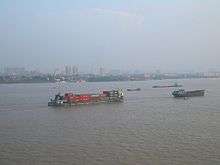
The two major rivers of Hubei are the Yangtze River and its left tributary, the Han River; they lend their names to the Jianghan Plain – Jiang representing the Yangtze and han representing the Han River. The Yangtze River enters Hubei from the west via the Three Gorges; the eastern half of the Three Gorges (Xiling Gorge and part of Wu Gorge) lie in western Hubei, while the western half is in neighbouring Chongqing. The Han River enters the province from the northwest. After crossing most of the province, the two great rivers meet at the center of Wuhan, the provincial capital.
Among the notable tributaries of the Yangtze within the province are the Shen Nong Stream (a small northern tributary, severely affected by the Three Gorges Dam project); the Qing, a major waterway of southwestern Hubei; the Huangbo near Yichang; and the Fushui River in the southeast.
Thousands of lakes dot the landscape of Hubei's Jianghan Plain, giving Hubei the name of "Province of Lakes"; the largest of these lakes are Liangzi Lake and Hong Lake. The numerous hydrodams have created a number of large reservoirs, the largest of which is the Danjiangkou Reservoir on the Han River, on the border between Hubei and Henan.
Hubei has a humid subtropical climate (Cfa or Cwa under the Köppen climate classification), with four distinct seasons. Winters are cool to cold, with average temperatures of 1 to 6 °C (34 to 43 °F) in January, while summers are hot and humid, with average temperatures of 24 to 30 °C (75 to 86 °F) in July; punishing temperatures of 40 °C (104 °F) or above are widely associated with Wuhan, the provincial capital. The mountainous districts of western Hubei, in particular Shennongjia, with their cooler summers, attract numerous visitors from Wuhan and other lowland cities.
Besides the capital Wuhan, other important cities are Jingmen; Shiyan, a center of automotive industry and the gateway to the Wudang Mountains; Yichang, the main base for the gigantic hydroelectric projects of southwestern Hubei; and Shashi.
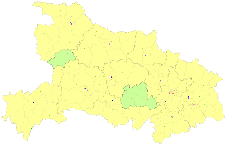
Administrative divisions
Hubei is divided into thirteen prefecture-level divisions (of which there are twelve prefecture-level cities (including a sub-provincial city) and one autonomous prefecture), as well as three directly administered county-level cities (all sub-prefecture-level cities) and one directly administered county-level forestry area. At the end of 2017, the total population is 59.02 million.[14]
| Administrative divisions of Hubei | |||||||||||
|---|---|---|---|---|---|---|---|---|---|---|---|
| Division code[15] | Division | Area in km2[16] | Population 2010[17] | Seat | Divisions[18] | ||||||
| Districts | Counties | Aut. counties | CL cities* | ||||||||
| 420000 | Hubei Province | 185900.00 | 57,237,740 | Wuhan city | 39 | 36 | 2 | 26 | |||
| 420100 | Wuhan city | 8549.09 | 9,785,392 | Jiang'an District | 13 | ||||||
| 420200 | Huangshi city | 4582.85 | 2,429,318 | Xialu District | 4 | 1 | 1 | ||||
| 420300 | Shiyan city | 23674.41 | 3,340,843 | Maojian District | 3 | 4 | 1 | ||||
| 420500 | Yichang city | 21227.00 | 4,059,686 | Xiling District | 5 | 3 | 2 | 3 | |||
| 420600 | Xiangyang city | 19724.41 | 5,500,307 | Xiangcheng District | 3 | 3 | 3 | ||||
| 420700 | Ezhou city | 1593.54 | 1,048,672 | Echeng District | 3 | ||||||
| 420800 | Jingmen city | 12192.57 | 2,873,687 | Dongbao District | 2 | 1 | 2 | ||||
| 420900 | Xiaogan city | 8922.72 | 4,814,542 | Xiaonan District | 1 | 3 | 3 | ||||
| 421000 | Jingzhou city | 14068.68 | 5,691,707 | Shashi District | 2 | 3 | 3 | ||||
| 421100 | Huanggang city | 17446.63 | 6,162,072 | Huangzhou District | 1 | 7 | 2 | ||||
| 421200 | Xianning city | 9749.84 | 2,462,583 | Xian'an District | 1 | 4 | 1 | ||||
| 421300 | Suizhou city | 9614.94 | 2,162,222 | Zengdu District | 1 | 1 | 1 | ||||
| 422800 | Enshi Autonomous Prefecture | 24061.25 | 3,290,294 | Enshi city | 6 | 2 | |||||
| 429004 | Xiantao city** | 2538.00 | 1,175,085 | Jingling Subdistrict | 1 | ||||||
| 429005 | Qianjiang city** | 2004.00 | 946,277 | Yuanlin Subdistrict | 1 | ||||||
| 429006 | Tianmen city** | 2,622.00 | 1,418,913 | Shazui Subdistrict | 1 | ||||||
| 429021 | Shennongjia Forestry District ** | 3253.00 | 76,140 | Songbai town | 1 | ||||||
Sub-provincial cities
* - including Forestry district | |||||||||||
| Administrative divisions in Chinese and varieties of romanizations | ||||
|---|---|---|---|---|
| English | Chinese | Pinyin | ||
| Hubei Province | 湖北省 | Húběi Shěng | ||
| Wuhan city | 武汉市 | Wǔhàn Shì | ||
| Huangshi city | 黄石市 | Huángshí Shì | ||
| Shiyan city | 十堰市 | Shíyàn Shì | ||
| Yichang city | 宜昌市 | Yíchāng Shì | ||
| Xiangyang city | 襄阳市 | Xiāngyáng Shì | ||
| Ezhou city | 鄂州市 | Èzhōu Shì | ||
| Jingmen city | 荆门市 | Jīngmén Shì | ||
| Xiaogan city | 孝感市 | Xiàogǎn Shì | ||
| Jingzhou city | 荆州市 | Jīngzhōu Shì | ||
| Huanggang city | 黄冈市 | Huánggāng Shì | ||
| Xianning city | 咸宁市 | Xiánníng Shì | ||
| Suizhou city | 随州市 | Suízhōu Shì | ||
| Enshi Autonomous Prefecture | 恩施自治州 | Ēnshī Zhōu | ||
| Xiantao city | 仙桃市 | Xiāntáo Shì | ||
| Qianjiang city | 潜江市 | Qiánjiāng Shì | ||
| Tianmen city | 天门市 | Tiānmén Shì | ||
| Shennongjia Forestry District | 神农架林区 | Shénnóngjià Línqū | ||
The thirteen Prefecture and four directly administered county-level divisions of Hubei are subdivided into 103 county-level divisions (39 districts, 24 county-level cities, 37 counties, 2 autonomous counties, 1 forestry district; the directly administered county-level divisions are included here). Those are in turn divided into 1234 township-level divisions (737 towns, 215 townships, nine ethnic townships, and 273 subdistricts).
Urban areas
| Population by urban areas of prefecture & county cities | |||||
|---|---|---|---|---|---|
| # | City | Urban area[19] | District area[19] | City proper[19] | Census date |
| 1 | Wuhan | 7,541,527 | 9,785,388 | 9,785,388 | 2010-11-01 |
| 2 | Xiangyang[lower-alpha 1] | 1,433,057 | 2,199,690 | 5,500,307 | 2010-11-01 |
| 3 | Yichang | 1,049,363 | 1,411,380 | 4,059,686 | 2010-11-01 |
| 4 | Jingzhou | 904,157 | 1,154,086 | 5,691,707 | 2010-11-01 |
| 5 | Shiyan[lower-alpha 2] | 724,016 | 767,920 | 3,340,841 | 2010-11-01 |
| (5) | Shiyan (new district)[lower-alpha 2] | 173,085 | 558,355 | see Shiyan | 2010-11-01 |
| 6 | Huangshi | 691,963 | 691,963 | 2,429,318 | 2010-11-01 |
| 7 | Tianmen | 612,515 | 1,418,913 | 1,418,913 | 2010-11-01 |
| 8 | Ezhou | 607,739 | 1,048,668 | 1,048,668 | 2010-11-01 |
| 9 | Xiaogan | 582,403 | 908,266 | 4,814,542 | 2010-11-01 |
| 10 | Xiantao | 553,029 | 1,175,085 | 1,175,085 | 2010-11-01 |
| 11 | Hanchuan | 468,868 | 1,015,507 | see Xiaogan | 2010-11-01 |
| 12 | Daye | 449,998 | 909,724 | see Huangshi | 2010-11-01 |
| 13 | Zaoyang | 442,367 | 1,004,741 | see Xiangyang | 2010-11-01 |
| 14 | Zhongxiang | 439,019 | 1,022,514 | see Jingmen | 2010-11-01 |
| 15 | Qianjiang | 437,757 | 946,277 | 946,277 | 2010-11-01 |
| 16 | Jingmen | 426,119 | 632,954 | 2,873,687 | 2010-11-01 |
| 17 | Suizhou | 393,173 | 618,582 | 2,162,222 | 2010-11-01 |
| 18 | Xianning | 340,723 | 512,517 | 2,462,583 | 2010-11-01 |
| 19 | Enshi | 320,107 | 749,574 | part of Enshi Prefecture | 2010-11-01 |
| 20 | Macheng | 302,671 | 849,090 | see Huanggang | 2010-11-01 |
| 21 | Yingcheng | 302,026 | 593,812 | see Xiaogan | 2010-11-01 |
| 22 | Honghu | 278,685 | 819,446 | see Jingzhou | 2010-11-01 |
| 23 | Guangshui | 272,402 | 755,910 | see Suizhou | 2010-11-01 |
| 24 | Songzi | 271,514 | 765,911 | see Jingzhou | 2010-11-01 |
| 25 | Wuxue | 270,882 | 644,247 | see Huanggang | 2010-11-01 |
| 26 | Huanggang | 267,860 | 366,769 | 6,162,069 | 2010-11-01 |
| (27) | Jingshan[lower-alpha 3] | 266,341 | 636,776 | see Jingmen | 2010-11-01 |
| 28 | Anlu | 237,409 | 568,590 | see Xiaogan | 2010-11-01 |
| 29 | Zhijiang | 218,396 | 495,995 | see Yichang | 2010-11-01 |
| 30 | Shishou | 213,851 | 577,022 | see Jingzhou | 2010-11-01 |
| 31 | Laohekou | 212,645 | 471,482 | see Xiangyang | 2010-11-01 |
| 32 | Chibi | 202,542 | 478,410 | see Xianning | 2010-11-01 |
| 33 | Yicheng | 201,945 | 512,530 | see Xiangyang | 2010-11-01 |
| 34 | Lichuan | 195,749 | 654,094 | part of Enshi Prefecture | 2010-11-01 |
| 35 | Danjiangkou | 190,021 | 443,755 | see Shiyan | 2010-11-01 |
| 36 | Dangyang | 183,823 | 468,293 | see Yichang | 2010-11-01 |
| 37 | Yidu | 176,233 | 384,598 | see Yichang | 2010-11-01 |
- Formerly known as Xiangfan PLC until 2 December 2010.
- New district established after census: Yunyang (Yunxian County). The new district not included in the urban area & district area count of the pre-expanded city.
- Jingshan County is currently known as Jingshan CLC after census.
Politics
Secretaries of the CPC Hubei Committee:
- Li Xiannian (李先念): 1949−1954
- Wang Renzhong (王任重): 1954−1966
- Zhang Tixue (张体学): 1966−1967
- Zeng Siyu (曾思玉): 1970−1973
- Zhao Xinchu (赵辛初): 1973−1978
- Chen Pixian (陈丕显): 1978−1982
- Guan Guangfu (关广富): 1983−1994
- Jia Zhijie (贾志杰): 1994−2001
- Jiang Zhuping (蒋祝平): 2001
- Yu Zhengsheng (俞正声): 2001−2007
- Luo Qingquan (罗清泉): 2007−2011
- Li Hongzhong (李鸿忠): 2011−2016
- Jiang Chaoliang (蒋超良): 2016−2020
- Ying Yong (应勇): 2020−present[20]
Governors of Hubei:
- Li Xiannian (李先念): 1949−1954
- Liu Zihou (刘子厚): 1954−1956
- Zhang Tixue (张体学): 1956−1967
- Zeng Siyu (曾思玉): 1968−1973
- Zhao Xinchu (赵辛初): 1973−1978
- Chen Pixian (陈丕显): 1978−1980
- Han Ningfu (韩宁夫): 1980−1982
- Huang Zhizhen (黄知真): 1982−1986
- Guo Zhenqian (郭振乾): 1986−1990
- Guo Shuyan (郭树言): 1990−1993
- Jia Zhijie (贾志杰): 1993−1995
- Jiang Zhuping (蒋祝平): 1995−2001
- Zhang Guoguang (张国光): 2001−2002
- Luo Qingquan (罗清泉): 2002−2007
- Li Hongzhong (李鸿忠): 2007−2010
- Wang Guosheng (王国生): 2010−2016
- Wang Xiaodong (王晓东): 2016−present
Economy
Hubei is often called the "Land of Fish and Rice" (鱼米之乡). Important agricultural products in Hubei include cotton, rice, wheat, and tea, while industries include automobiles, metallurgy, machinery, power generation, textiles, foodstuffs and high-tech commodities.[21]
Mineral resources that can be found in Hubei in significant quantities include borax, hongshiite, wollastonite, garnet, marlstone, iron, phosphorus, copper, gypsum, rutile, rock salt, gold amalgam, manganese and vanadium. The province's recoverable reserves of coal stand at 548 million tons, which is modest compared to other Chinese provinces. Hubei is well known for its mines of fine turquoise and green faustite.

Once completed, the Three Gorges Dam in western Hubei will provide plentiful hydroelectricity, with an estimated annual power production of 84,700 Gwh. Existing hydroelectric stations include Gezhouba, Danjiangkou, Geheyan, Hanjiang, Duhe, Huanglongtan, Bailianhe, Lushui and Fushui.
Hubei's economy ranks 7th in the country and its nominal GDP for 2018 was 3.9 trillion yuan (US$595 billion) and a per capita of 66,799 RMB (US$10,099) in 2018, tripled since 2010.
Economic and Technological Development Zones
- Hubei Jingzhou Chengnan Economic Development Zone was established in 1992 under the approval of Hubei Government. Three major industries include textile, petroleum and chemical processing, with a combined output accounts for 90% of its total output. The zone also enjoys a well-developed transportation network—only 6 kilometres (3.7 mi) to the airport and 4 kilometres (2.5 mi) to the railway station.[22]
- Wuhan East Lake High-Tech Development Zone is a national level high-tech development zone. Optical-electronics, telecommunications, and equipment manufacturing are the core industries of Wuhan East Lake High-Tech Development Zone (ELHTZ) while software outsourcing and electronics are also encouraged. ELHTZ is China's largest production centre for optical-electronic products with key players like Changfei Fiber-optical Cables (the largest fiber-optical cable maker in China), Fenghuo Telecommunications and Wuhan Research Institute of Post and Telecommunications (the largest research institute in optical telecommunications in China). Wuhan ELHTZ represents the development centre for China's laser industry with key players such as HUST Technologies and Chutian Laser being based in the zone.[23]
- Wuhan Economic and Technological Development Zone is a national level industrial zone incorporated in 1993.[24] Its size is about 10-25 square km and it plans to expand to 25-50 square km. Industries encouraged in Wuhan Economic and Technological Development Zone include automobile production/assembly, biotechnology/pharmaceuticals, chemicals production and processing, food/beverage processing, heavy industry, and telecommunications equipment.
- Wuhan Export Processing Zone was established in 2000. It is located in Wuhan Economic & Technology Development Zone, planned to cover land of 2.7 km2 (1.0 sq mi). The first 0.7 km2 (0.27 sq mi) area has been launched.[25]
- Wuhan Optical Valley (Guanggu) Software Park is in Wuhan East Lake High-Tech Development Zone. Wuhan Optics Valley Software Park is jointly developed by East Lake High-Tech Development Zone and Dalian Software Park Co., Ltd.[26] The planned area is 0.67 km2 (0.26 sq mi) with total floor area of 600,000 square meters. The zone is 8.5 km (5.28 mi) from the 316 National Highway and is 46.7 km (29.02 mi) from the Wuhan Tianhe Airport.
- Xiangyang New & Hi-Tech Industrial Development Zone
Demographics
| Historical population | ||
|---|---|---|
| Year | Pop. | ±% |
| 1912[27] | 29,590,000 | — |
| 1928[28] | 26,699,000 | −9.8% |
| 1936-37[29] | 25,516,000 | −4.4% |
| 1947[30] | 20,976,000 | −17.8% |
| 1952[31] | 21,470,000 | +2.4% |
| 1954[32] | 27,789,693 | +29.4% |
| 1964[33] | 33,709,344 | +21.3% |
| 1982[34] | 47,804,150 | +41.8% |
| 1990[35] | 53,969,210 | +12.9% |
| 2000[36] | 59,508,870 | +10.3% |
| 2010[37] | 57,237,740 | −3.8% |
| Wuhan (Hankou) part of Hubei Province until 1927; dissolved in 1949 and incorporated into Hubei Province. | ||
Han Chinese form the dominant ethnic group in Hubei. A considerable Miao and Tujia population live in the southwestern part of the province, especially in Enshi Tujia and Miao Autonomous Prefecture.
On October 18, 2009, Chinese officials began to relocate 330,000 residents from the Hubei and Henan provinces that will be affected by the Danjiangkou Reservoir on the Han river. The reservoir is part of the larger South-North Water Transfer Project.[38]
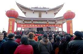
Religion
The predominant religions in Hubei are Chinese folk religions, Taoist traditions and Chinese Buddhism. According to surveys conducted in 2007 and 2009, 6.5% of the population believes and is involved in cults of ancestors, while 0.58% of the population identifies as Christian, declining from 0.83% in 2004.[39] The reports did not give figures for other types of religion; 92.92% of the population may be either irreligious or involved in worship of nature deities, Buddhism, Confucianism, Taoism, folk religious sects.
Culture


People in Hubei speak Mandarin dialects; most of these dialects are classified as Southwestern Mandarin dialects, a group that also encompasses the Mandarin dialects of most of southwestern China.
Perhaps the most celebrated element of Hubei cuisine is the Wuchang bream, a freshwater bream that is commonly steamed.
Types of traditional Chinese opera popular in Hubei include Hanju (simplified Chinese: 汉剧; traditional Chinese: 漢劇; pinyin: Hàn Jù) and Chuju (楚剧; Chǔ Jù).
The Shennongjia area is the alleged home of the Yeren, a wild undiscovered hominid that lives in the forested hills.
The people of Hubei are given the uncomplimentary nickname "Nine-headed Birds" by other Chinese, from a mythological creature said to be very aggressive and hard to kill. "In the sky live nine-headed birds. On the earth live Hubei people." (天上九头鸟,地上湖北佬; Tiānshàng jiǔ tóu niǎo, dìshàng Húběi lǎo)
Wuhan is one of the major culture centers in China.
Hubei is thought to be the province that originated the card game of Dou Di Zhu.
Education
The Huazhong University of Science and Technology(HUST), Wuhan University and many other institutions in Wuhan make it a hub of higher education and research in China. Wuhan is the city that has the largest college student population in the world (1.3 million) studying in its 89 universities.
Universities
.jpeg)
- Huazhong University of Science and Technology
- Wuhan University
- Central China Normal University (Huazhong Normal University)
- Wuhan University of Technology
- Huazhong Agricultural University
- Hubei University of Technology
- Zhongnan University of Economics and Law
- China University of Geosciences
- Jianghan University
- Hubei University
- Hubei University of Economics
- Hubei University of Education
- China Three Gorges University(yichang)
- Wuhan Institute of Technology
- Wuhan University of Science and Technology
- Yangtze University
- South-Central University for Nationalities
- Hubei Institute of Fine Arts
- Wuhan Technology and Business University
- Wuhan Technical College of Communications
Transportation
Prior to the construction of China's national railway network, the Yangtze and Hanshui Rivers had been the main transportation arteries of Hubei for many centuries, and still continue to play an important transport role.
Historically, Hubei's overland transport network was hampered by the lack of bridges across the Yangtze River, which divides the province into northern and southern regions. The first bridge across the Yangtze in Hubei, the Wuhan Yangtze River Bridge was completed in 1957, followed by the Zhicheng Bridge in 1971. As of October 2014, Hubei had 23 bridges and tunnels across the Yangtze River, including nine bridges and three tunnels in Wuhan.
Rail
The railway from Beijing reached Wuhan in 1905, and was later extended to Guangzhou, becoming the first north-to-south railway mainline to cross China. A number of other lines crossed the province later on, including the Jiaozuo-Liuzhou Railway and Beijing-Kowloon Railway, respectively, in the western and eastern part of the province.
The first decade of the 21st century has seen a large amount of new railway construction in Hubei. The Wuhan–Guangzhou High-Speed Railway, roughly parallel to the original Wuhan-Guangzhou line, opened in late 2009, it was subsequently extended to the north, to Beijing becoming the Beijing–Guangzhou high-speed railway. An east-west high-speed corridor connecting major cities along the Yangtze, the Shanghai–Wuhan–Chengdu passenger railway was gradually opened between 2008 and 2012, the Wuhan–Yichang railway section of it opening in 2012.[40] The Wuhan–Xiaogan intercity railway was opened in December 2016 and it was extended when the Wuhan–Shiyan high-speed railway opened in November 2019.[41][42]
Air
Hubei's main airport is Wuhan Tianhe International Airport. Yichang Sanxia Airport serves the Three Gorges region. There are also passenger airports in Xiangyang, Enshi, and Jingzhou (Shashi Airport, named after the city's Shashi District).
Tourism
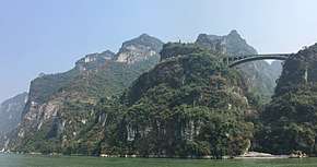
The province's best-known natural attraction (shared with the adjacent Chongqing municipality) is the scenic area of the Three Gorges of the Yangtze. Located in the far west of the province, the gorges can be conveniently visited by one of the numerous tourist boats (or regular passenger boats) that travel up the Yangtze from Yichang through the Three Gorges and into the neighboring Chongqing municipality.
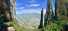
The mountains of western Hubei, in particular in Shennongjia District, offer a welcome respite from Wuhan's and Yichang's summer heat, as well as skiing opportunities in winter. The tourist facilities in that area concentrate around Muyu in the southern part of Shennongjia, the gateway to Shennongjia National Nature Reserve (神农架国家自然保护区). Closer to the provincial capital, Wuhan, is the Mount Jiugong (Jiugongshan) national park, in Tongshan County near the border with Jiangxi.
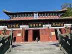
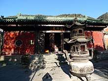
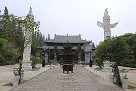
A particular important site of both natural and cultural significance is Mount Wudang (Wudangshan) in the northwest of the province. Originally created early in the Ming dynasty, its building complex has been listed by UNESCO since 1994 as a World Heritage Site.
Other historic attractions in Hubei include:
- The old Jingzhou City

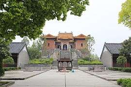
- The Xianling Mausoleum, built by the Ming dynasty Jiajing Emperor for his parents at their fief near Zhongxiang[43]
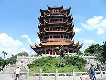
- The Yellow Crane Tower in Wuhan
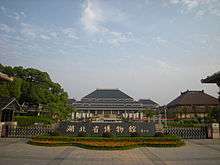
- The Hubei Provincial Museum in Wuhan, with extensive archaeological and cultural exhibits and performance presentations of ancient music and dance. This is one of the best places to learn about the ancient state of Chu, which flourished in the territory of present-day Hubei during the Eastern Zhou dynasty and developed its own unique culture, quite distinct from that of the Shang/Zhou civilization of northern China.
The province also has historical sites connected with China's more recent history, such as the Wuchang Uprising Memorial in Wuhan, Project 131 site (a Cultural-Revolution-era underground military command center) in Xianning, and the National Mining Park (国家矿山公园) in Huangshi.[44]
Sports

Professional sports teams in Hubei include:
- Wuhan Zall F.C. plays in Chinese Football Association Super League, the highest level football league in China.
Twinning
In 2005, Hubei province signed a twinning agreement with Telemark county of Norway, and a "Norway-Hubei Week" was held in 2007.
See also
- 1954 Yangtze River floods
- List of prisons in Hubei
- Major national historical and cultural sites in Hubei
- 2019–20 coronavirus pandemic
Notes
- The data was collected by the Chinese General Social Survey (CGSS) of 2009 and by the Chinese Spiritual Life Survey (CSLS) of 2007, reported and assembled by Xiuhua Wang (2015)[39] in order to confront the proportion of people identifying with two similar social structures: ① Christian churches, and ② the traditional Chinese religion of the lineage (i.e. people believing and worshipping ancestral deities often organised into lineage "churches" and ancestral shrines). Data for other religions with a significant presence in China (deity cults, Buddhism, Taoism, folk religious sects, Islam, et. al.) was not reported by Wang.
- This may include:
- Buddhists;
- Confucians;
- Deity worshippers;
- Taoists;
- Members of folk religious sects;
- Small minorities of Muslims;
- People not bounded to nor practicing any institutional or diffuse religion.
References
Citations
- "Hubei--Survey". Ministry Of Commerce - People's Republic Of China. 25 April 2007. Archived from the original on 5 August 2013. Retrieved 8 April 2018.
Hubei {...} an area of 185,900 square km.
- 湖北 [Hubei] (in Chinese). The Central People's Government of the People's Republic of China. 26 March 2013. Archived from the original on 8 July 2016. Retrieved 7 June 2016.
全省国土总面积18.59万平方公里
- "Communiqué of the National Bureau of Statistics of People's Republic of China on Major Figures of the 2010 Population Census [1] (No. 2)". National Bureau of Statistics of China. 29 April 2011. Archived from the original on 27 July 2013. Retrieved 4 August 2013.
- 湖北省2017年国民经济和社会发展统计公报 [Statistical Communiqué of Hubei on the 2017 National Economic and Social Development] (in Chinese). Statistical Bureau of Hubei. 2018-02-27. Archived from the original on 2018-06-22. Retrieved 2018-06-22.
- "Sub-national HDI - Subnational HDI - Global Data Lab". globaldatalab.org. Retrieved 2020-04-17.
- (in Chinese) Origin of the Names of China's Provinces Archived 2016-04-27 at the Wayback Machine, People's Daily Online.
- Zhang, Chi (張弛) (2013). "The Qujialing-Shijiahe Culture in the Middle Yangzi River Valley". In Anne P. Underhill (ed.). A Companion to Chinese Archaeology. Chichester: John Wiley & Sons. pp. 510–34. doi:10.1002/9781118325698. ISBN 9781444335293.
- Flad, Rowan K.; Chen, Pochan (2013). Ancient Central China: Centers and Peripheries along the Yangzi River. Cambridge: Cambridge University Press. ISBN 978-0521727662.
- Constance A. Cook and John S. Major, eds. Defining Chu: Image and Reality in Ancient China, (Honolulu: University of Hawai’i Press, 1999); Lothar von Falkenhausen, Chinese Society in the Age of Confucius (1000–250 BC): The Archaeological Evidence (Los Angeles: Cotsen Institute of Archaeology, 2006), 262–88.
- Brian Lander. State Management of River Dikes in Early China: New Sources on the Environmental History of the Central Yangzi Region . T'oung Pao 100.4-5 (2014): 325–362.
- Benedict, C.A. (1996). Bubonic Plague in Nineteenth-century China. Stanford University Press. p. 10. ISBN 9780804726610. Retrieved 2016-01-05.
- Thomas W. Robinson (1971). "The Wuhan Incident: Local Strife and Provincial Rebellion During the Cultural Revolution". The China Quarterly (47): 413–18. JSTOR 652320.
- 神秘131工程:60年代修建的防核地下指挥部 [Mysterious Project 131: An underground nuclear command headquarters constructed in the 1960s]. xjqmx.gov.cn (in Chinese).
- 中国统计年鉴—2018. National Bureau of Statistics of the People's Republic of China. 2019.
- 中华人民共和国县以上行政区划代码 (in Chinese). Ministry of Civil Affairs. Archived from the original on 2015-04-02. Retrieved 2015-12-11.
- Shenzhen Bureau of Statistics. 《深圳统计年鉴2014》 (in Chinese). China Statistics Print. Archived from the original on 2015-05-12. Retrieved 2015-05-29.
- Census Office of the State Council of the People's Republic of China; Population and Employment Statistics Division of the National Bureau of Statistics of the People's Republic of China (2012). 中国2010人口普查分乡、镇、街道资料 (1 ed.). Beijing: China Statistics Print. ISBN 978-7-5037-6660-2.
- Ministry of Civil Affairs (August 2014). 《中国民政统计年鉴2014》 (in Chinese). China Statistics Print. ISBN 978-7-5037-7130-9.
- 国务院人口普查办公室、国家统计局人口和社会科技统计司编 (2012). 中国2010年人口普查分县资料. Beijing: China Statistics Print. ISBN 978-7-5037-6659-6.
- "Coronavirus: Beijing's purge over virus takes down top Communist Party officials in Hubei". Retrieved 2020-02-13.
- "Archived copy". Archived from the original on 2017-06-30. Retrieved 2011-10-31.CS1 maint: archived copy as title (link)
- "RightSite.asia | Hubei Jingzhou Chengnan Economic Development Zone". Archived from the original on 2010-11-13. Retrieved 2010-06-10.
- "RightSite.asia | Wuhan East Lake High-Tech Development Zone". Archived from the original on 2015-05-26. Retrieved 2010-06-10.
- "RightSite.asia | Wuhan Economic and Technological Development Zone". Archived from the original on May 26, 2015.
- "RightSite.asia | Wuhan Export Processing Zone". Archived from the original on May 26, 2015.
- "RightSite.asia | Wuhan Optical Valley (Guanggu) Software Park". Archived from the original on 2015-01-11. Retrieved 2010-06-10.
- 1912年中国人口. Archived from the original on 24 September 2015. Retrieved 6 March 2014.
- 1928年中国人口. Archived from the original on 24 September 2015. Retrieved 6 March 2014.
- 1936-37年中国人口. Archived from the original on 24 September 2015. Retrieved 6 March 2014.
- 1947年全国人口. Archived from the original on 13 September 2013. Retrieved 6 March 2014.
- Joseph Laffan Morse, ed. (1955). The Universal Standard Encyclopedia. 12. New York: Unicorn Publishers Inc. p. 4482.
pop. (1952 est.) 21,470,000.
- 中华人民共和国国家统计局关于第一次全国人口调查登记结果的公报. National Bureau of Statistics of China. Archived from the original on 2009-08-05.
- 第二次全国人口普查结果的几项主要统计数字. National Bureau of Statistics of China. Archived from the original on 2012-09-14.
- 中华人民共和国国家统计局关于一九八二年人口普查主要数字的公报. National Bureau of Statistics of China. Archived from the original on 2012-05-10.
- 中华人民共和国国家统计局关于一九九〇年人口普查主要数据的公报. National Bureau of Statistics of China. Archived from the original on 2012-06-19.
- 现将2000年第五次全国人口普查快速汇总的人口地区分布数据公布如下. National Bureau of Statistics of China. Archived from the original on 2012-08-29.
- "Communiqué of the National Bureau of Statistics of People's Republic of China on Major Figures of the 2010 Population Census". National Bureau of Statistics of China. Archived from the original on 2013-07-27.
- China to resettle 330,000 people The Philadelphia Inquirer Archived 2009-10-21 at the Wayback Machine
- China General Social Survey 2009, Chinese Spiritual Life Survey (CSLS) 2007. Report by: Xiuhua Wang (2015, p. 15) Archived 2015-09-25 at the Wayback Machine
- 汉宜高铁拟本月开通 届时每日将开行20对列车 (in Chinese). 10 May 2012.
- 武孝城际铁路正式开通 市民可以坐城铁赶飞机 [Wuhan–Xiaogan intercity railway officially opens; city residents can take the line to catch flights]. chinanews.com Hubei (in Chinese). 2016-12-01.
- "Wuhan – Shiyan high speed line opens". Railway Gazette International. 29 November 2019. Retrieved 1 December 2019.
- Eric N. Danielson, "The Ming Ancestor Tomb Archived 2014-12-30 at the Wayback Machine"
- "Mining for tourism in Hubei" Archived 2008-10-11 at the Wayback Machine, By Li Jing (China Daily). Updated: 2008-09-22
Sources
- Economic profile for Hubei at HKTDC
External links
| Wikimedia Commons has media related to Hubei. |
| Wikivoyage has a travel guide for Hubei. |
Hubei topics | |
|---|---|
Wuhan (capital) | |
| General | |
| Geography |
|
| Education |
|
| Culture |
|
| Cuisine |
|
| Visitor attractions |
|
| |
| Provinces | ||
|---|---|---|
| Autonomous regions |
| |
| Municipalities | ||
| Special administrative regions | ||
| Other |
| |
Note: Taiwan is claimed by the People's Republic of China but administered by the Republic of China (see Political status of Taiwan). | ||
| Authority control |
|
|---|