Heilongjiang
Heilongjiang (![]()
Heilongjiang Province 黑龙江省 | |
|---|---|
Province | |
| Name transcription(s) | |
| • Chinese | 黑龙江省 (Hēilóngjiāng Shěng) |
| • Abbreviation | HL / 黑 (pinyin: Hēi) |
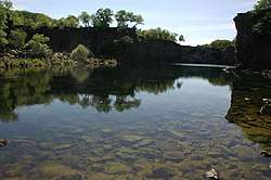 Landscape of Jingpo Lake | |
.svg.png) Map showing the location of Heilongjiang Province | |
| Coordinates: 48°N 129°E | |
| Named for | 黑 hēi—black 龙 lóng—dragon 江 jiāng—river "Amur River" |
| Capital (and largest city) | |
| Divisions | 13 prefectures, 130 counties, 1274 townships |
| Government | |
| • Secretary | Zhang Qingwei |
| • Governor | Wang Wentao |
| Area | |
| • Total | 454,800 km2 (175,600 sq mi) |
| Area rank | 6th |
| Highest elevation | 1,690 m (5,540 ft) |
| Population (2010)[2] | |
| • Total | 38,312,224 |
| • Rank | 15th |
| • Density | 84/km2 (220/sq mi) |
| • Density rank | 28th |
| Demographics | |
| • Ethnic composition | Han: 95% Manchu: 3% Korean: 1% Mongol: 0.4% Hui: 0.3% |
| • Languages and dialects | Northeastern Mandarin, Jilu Mandarin, Jiaoliao Mandarin |
| ISO 3166 code | CN-HL |
| GDP (2017 [3]) | CNY 1.62 trillion USD 239.93 billion (21st) |
| • per capita | CNY 42,699 USD 6,324 (25th) |
| HDI (2017) | 0.741 [4] (high) (12th) |
| Website | www |
| Heilongjiang | |||||||||||||||||||||||||||||||
|---|---|---|---|---|---|---|---|---|---|---|---|---|---|---|---|---|---|---|---|---|---|---|---|---|---|---|---|---|---|---|---|
.svg.png) "Heilongjiang" in Simplified (top) and Traditional (bottom) Chinese characters | |||||||||||||||||||||||||||||||
| Chinese name | |||||||||||||||||||||||||||||||
| Simplified Chinese | 黑龙江 | ||||||||||||||||||||||||||||||
| Traditional Chinese | 黑龍江 | ||||||||||||||||||||||||||||||
| Postal | Heilungkiang | ||||||||||||||||||||||||||||||
| Literal meaning | "Black Dragon River" | ||||||||||||||||||||||||||||||
| |||||||||||||||||||||||||||||||
| Mongolian name | |||||||||||||||||||||||||||||||
| Mongolian script | ᠬᠠᠷᠠᠮᠦ᠌ᠷᠡᠨ | ||||||||||||||||||||||||||||||
| |||||||||||||||||||||||||||||||
| Manchu name | |||||||||||||||||||||||||||||||
| Manchu script | ᠰᠠᡥᠠᠯᡳᠶᠠᠨ ᠮᡠᠯᠠ ᠮᡤᠣᠯᠣ | ||||||||||||||||||||||||||||||
| Romanization | Sahaliyan'ula golo | ||||||||||||||||||||||||||||||
The province takes its name from the Heilong River (Chinese name of the Amur), which marks the border between the People's Republic of China and Russia. Heilongjiang contains China's northernmost point (in Mohe City along the Amur) and easternmost point (at the junction of the Amur and Ussuri rivers).
Heilongjiang has significant agricultural production,[5] and raw materials, such as timber, oil and coal.
Etymology
"Heilongjiang" literally means Black Dragon River, which is the Chinese name for the more well known western name, Amur. The one-character abbreviation is 黑 (pinyin: Hēi). The Manchu name of the region is Sahaliyan ula (literally, "Black River"), from which the name of Sakhalin is derived, and the Mongolian name with the same meaning is Qaramörin. It is sometimes spelt "Heilungkiang", especially in older English texts.
History
| History of the Priamurye region |
|---|
| also including Heilongjiang, Amur Oblast and southern part of Khabarovsk Krai |
|
Ancient Chinese records and other sources state that Heilongjiang was inhabited by people such as the Sushen, Buyeo, the Mohe, Balhae, and the Khitan. Mongolic Donghu people lived in Inner Mongolia and the western part of Heilongjiang.[6] Some names are Manchu or Mongolian.[7] The eastern portion of Heilongjiang was ruled by the kingdom of Balhae between the 7th and 10th centuries. The Jurchen Jin dynasty (1115–1234) that subsequently ruled much of north China arose within the borders of modern Heilongjiang.

Heilongjiang as an administrative entity was created in 1683, during the Kangxi era of the Manchu Qing Dynasty, from the northwestern part of the Jilin province.[8] This Heilongjiang Province only included the western part of today's Heilongjiang Province, and was under the supervision of the General of Heilongjiang (Sahaliyan Ula i Jiyanggiyūn) (the title is also translated as the Military Governor of Heilongjiang; jiyanggiyūn is the Manchu reading of the Chinese word 將軍 jiāngjūn; "military leader, general" and is cognate with Japanese shōgun), whose power extended, according to the Treaty of Nerchinsk, as far north as the Stanovoy Mountains. The eastern part of what's today Heilongjiang remained under the supervision of the General of Jilin (Girin i Jiyanggiyūn), whose power reached the East Sea of Korea. These areas deep in Manchuria were closed off to Han Chinese migration.
The original seat of the Military Governor of Heilongjiang, as established in 1683, was in Heilongjiang City (also known as Aigun or Heihe, or, in Manchu, Saghalien Ula), located on the Amur River. However, already in 1690 the seat of the governor was transferred to Nenjiang (Mergen) on the Nen River, and, in 1699, further south to Qiqihar. According to modern historians, the moves may have been driven by supply considerations: Nenjiang and Qiqihar are connected by a convenient waterway (Nen River) with southern Manchuria, whereas accessing Aigun (Heihe) would require either sailing all the way down the Sungari River until its confluence with the Amur and then up the Amur to Heihe, or using a portage over the Lesser Xing'an Mountains between the Nen River valley and the Amur valley. An additional advantage of Qiqihar may have been its location at the junction of a northbound road (to Nenjiang) and a westbound one (to Mongolia), enabling its garrison to defend both against the Russians and the Ölöt Mongols.[9]
Little Qing Military presence existed north of Aigun. According to the 18th- and early-20th-century European sources, and the reports of the Russians in the 1850s, the farthest Qing "advance guard" post was at Ulusu-Modon (Ulussu-Mudan) (Chinese: 乌鲁苏穆丹), near the Amur River's famous 's'-shaped meander. (The post was actually on the left bank of the river, lost to the Russians in 1860.)
In 1858 and 1860, the Qing government was forced to give up all land beyond the Amur and Ussuri Rivers to the Russian Empire, cutting off the Qing Empire from the Sea of Japan and giving Heilongjiang its present northern and eastern borders. At the same time, Manchuria was opened to Han Chinese migration by the Qing government. By the early twentieth century, due to the Chuang Guandong, the Han Chinese had become the dominant ethnic group in the region.[10]
In 1931, Japanese forces invaded Heilongjiang. In 1932, the Japanese completed their conquest of the province, which became part of the Japanese puppet state of Manchukuo.
In 1945, Japanese forces in Manchuria were defeated by the Soviet Army. During the Chinese Civil War, Soviet forces aided the Chinese communists. Heilongjiang became the first province to be completely controlled by the communists and Harbin the first major city to be controlled by them.
At the beginning of communist rule, Heilongjiang included only the western portion of the present-day province, and had its capital at Qiqihar. The remaining area was the province of Songjiang; its capital was Harbin. In 1954, these two provinces were merged into present-day Heilongjiang. During the Cultural Revolution, Heilongjiang was also expanded to include Hulunbuir League and some other areas previously in Inner Mongolia; this has since mostly been reversed.

Geography
Heilongjiang is a land of varied topography. Much of the province is dominated by mountain ranges such as the Greater Khingan Range and Lesser Khingan Range, Zhangguangcai Mountains, Laoye Mountains, and Wanda Mountains. The highest peak is Mount Datudingzi at 1,690 metres (5,540 ft), located on the border with Jilin province. The Greater Khingan Range contains China's largest remaining virgin forest and is an important area for China's forestry industry.
The east and southwest of the province, which are relatively flat and low in altitude, contain the Muling River, the Naoli River, the Songhua River, the Nen River, and the Mudan River, all tributaries of the Amur, while the northern border forms part of the Amur valley. Xingkai Lake (or Khanka Lake) is found on the border with Russia's Primorsky Krai.
Climate
A humid continental climate (Köppen Dwa or Dwb) predominates in the province, though areas in the far north are subarctic (Köppen Dwc).[11] Winters are long and bitter, with an average of −31 to −15 °C (−24 to 5 °F) in January, and summers are short and warm to very warm with an average of 18 to 23 °C (64 to 73 °F) in July. The annual average rainfall is 400 to 700 millimetres (16 to 28 in), concentrated heavily in summer. Clear weather is prevalent throughout the year, and in the spring, the Songnen Plain and the Sanjiang Plain provide abundant sources of wind energy.
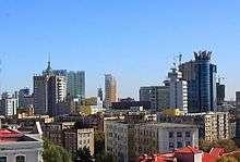
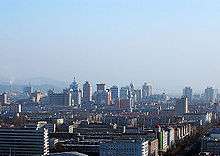
The province's largest cities include Harbin, Qiqihar, Mudanjiang, Jiamusi, Daqing, Jixi, Shuangyashan, Hegang, Qitaihe, Yichun, and Heihe.
| City | July (°C) | July (°F) | January (°C) | January (°F) |
|---|---|---|---|---|
| Harbin | 27.9/18.3 | 82.2/64.9 | –12.5/–24.1 | 9.5/–11.4 |
| Jiamusi | 27.6/17.7 | 81.7/63.9 | –12.7/–24 | 9.1/–11.2 |
| Hegang | 26.5/17.4 | 80/63.3 | –12.7/–20.8 | 9.1/–5.4 |
| Yichun | 27.1/15.5 | 80.8/59.9 | –14.5/–29.1 | 5.9/–20.4 |
Transport
A road and highway proposal was accepted in 2006; the project plans to develop 38,000 kilometres (24,000 miles) of new roads and expand Heilongjiang's total road network to 2,300,000 kilometres (1,400,000 miles).
There are 60 rail lines of around 5,300 kilometres (3,300 miles) including a section of the Asia-Europe Continental Bridge. The Harbin–Dalian High-Speed Railway, completed in 2012, stretches from Harbin, Heilongjiang's capital, to Dalian in Liaoning province via Changchun and Shenyang comprising 23 stops. It is expected to transport 37 million passengers per year by 2020 and 51 million by 2030.
Major airports include Harbin Taiping International Airport, Qiqihar Airport, Mudanjiang Airport, Jiamusi Airport and Heihe Airport. Harbin International Airport is capable of handling six million passengers every year and connects to over 70 domestic and international cities.
Tongjiang-Nizhneleninskoye railway bridge
The Tongjiang-Nizhneleninskoye railway bridge was proposed in 2007 by Valery Solomonovich Gurevich, the vice-chairman of the Jewish Autonomous Oblast in Russia. The railway bridge over the Amur River will connect Tongjiang with Nizhneleninskoye, a village in the Jewish Autonomous Oblast.[12]
The Chinese portion of the bridge was finished in July 2016.[13] In December 2016, work began on the Russian portion of the bridge. The bridge is expected to open in October 2019.[14]
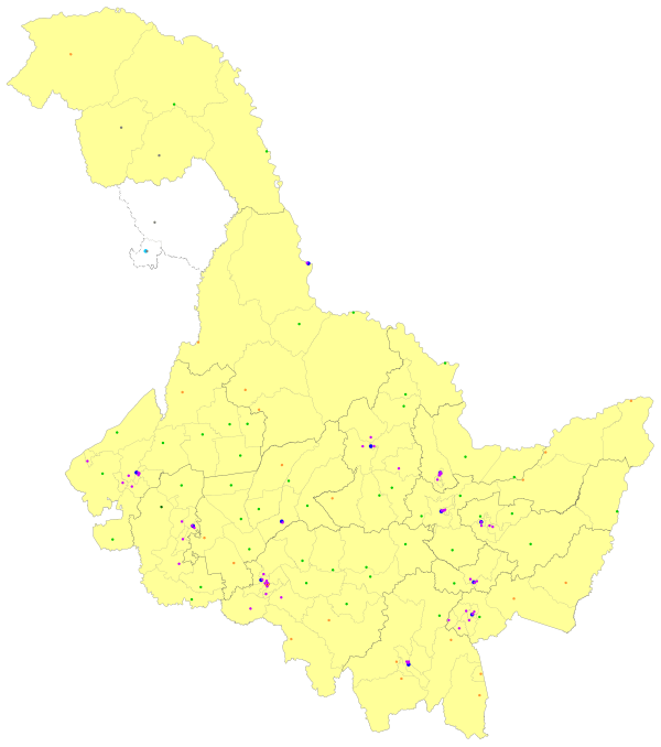
Administrative divisions
Heilongjiang is divided into thirteen prefecture-level divisions: twelve prefecture-level cities (including a sub-provincial city) and one prefecture:
| Administrative divisions of Heilongjiang | |||||||||||
|---|---|---|---|---|---|---|---|---|---|---|---|
 Qiqihar
Jixi
Hegang
Shuangyashan
Daqing
Yichun
Jiamusi
Qitaihe
Mudanjiang
Heihe
Suihua
Daxing'anling
Prefecture ☐ Jiagedaqi Dist. & Songling Dist.
is de facto subordinate to Daxing'anling Pref. but de jure part of Oroqen Aut. Ban., Inner Mongolia. | |||||||||||
| Division code[15] | Division | Area in km2[16] | Population 2010[17] | Seat | Divisions[18] | ||||||
| Districts* | Counties | Aut. counties | CL cities | ||||||||
| 230000 | Heilongjiang Province | 454800.00 | 38,312,224 | Harbin city | 54 | 45 | 1 | 21 | |||
| 230100 | Harbin city | 53523.50 | 10,635,971 | Songbei District | 9 | 7 | 2 | ||||
| 230200 | Qiqihar city | 42205.81 | 5,367,003 | Jianhua District | 7 | 8 | 1 | ||||
| 230300 | Jixi city | 22488.46 | 1,862,161 | Jiguan District | 6 | 1 | 2 | ||||
| 230400 | Hegang city | 14679.98 | 1,058,665 | Xiangyang District | 6 | 2 | |||||
| 230500 | Shuangyashan city | 22036.19 | 1,462,626 | Jianshan District | 4 | 4 | |||||
| 230600 | Daqing city | 21222.03 | 2,904,532 | Sartu District | 5 | 3 | 1 | ||||
| 230700 | Yichun city | 32759.66 | 1,148,126 | Yimei District | 4 | 5 | 1 | ||||
| 230800 | Jiamusi city | 32704.00 | 2,552,097 | Qianjin District | 4 | 3 | 3 | ||||
| 230900 | Qitaihe city | 6221.42 | 920,419 | Taoshan District | 3 | 1 | |||||
| 231000 | Mudanjiang city | 38679.80 | 2,798,723 | Dong'an District | 4 | 1 | 5 | ||||
| 231100 | Heihe city | 66802.65 | 1,673,898 | Aihui District | 1 | 2 | 3 | ||||
| 231200 | Suihua city | 34964.17 | 5,416,439 | Beilin District | 1 | 6 | 3 | ||||
| 232700 | Daxing'anling Prefecture | 46,755.00≈ | 511,564 | Jiagedaqi District** (de facto); Mohe city (de jure) | 4** | 2 | 1 | ||||
Sub-provincial cities
* - including Ethnic districts | |||||||||||
| Administrative divisions in Chinese and varieties of romanizations | ||||
|---|---|---|---|---|
| English | Chinese | Pinyin | ||
| Heilongjiang Province | 黑龙江省 | Hēilóngjiāng Shěng | ||
| Harbin city | 哈尔滨市 | Hā'ěrbīn Shì | ||
| Qiqihar city | 齐齐哈尔市 | Qíqíhā'ěr Shì | ||
| Jixi city | 鸡西市 | Jīxī Shì | ||
| Hegang city | 鹤岗市 | Hègǎng Shì | ||
| Shuangyashan city | 双鸭山市 | Shuāngyāshān Shì | ||
| Daqing city | 大庆市 | Dàqìng Shì | ||
| Yichun city | 伊春市 | Yīchūn Shì | ||
| Jiamusi city | 佳木斯市 | Jiāmùsī Shì | ||
| Qitaihe city | 七台河市 | Qītáihé Shì | ||
| Mudanjiang city | 牡丹江市 | Mǔdānjiāng Shì | ||
| Heihe city | 黑河市 | Hēihé Shì | ||
| Suihua city | 绥化市 | Suíhuà Shì | ||
| Daxing'anling Prefecture | 大兴安岭地区 | Dàxīng'ānlǐng Dìqū | ||
(Additional information regarding the last prefecture can be found at Greater Khingan.)
The thirteen Prefecture of Heilongjiang are subdivided into 128 county-level divisions (65 districts, 20 county-level cities, 42 counties, and one autonomous county). Those are in turn divided into 1,284 township-level divisions (473 towns, 400 townships, 58 ethnic townships, and 353 subdistricts).
Urban areas
| Population by urban areas of prefecture & county cities | |||||
|---|---|---|---|---|---|
| # | City | Urban area[19] | District area[19] | City proper[19] | Census date |
| 1 | Harbin[lower-alpha 1] | 4,933,054 | 5,878,939 | 10,635,971 | 2010-11-01 |
| (1) | Harbin (new district)[lower-alpha 1] | 244,898 | 825,634 | see Harbin | 2010-11-01 |
| 2 | Daqing | 1,433,698 | 1,649,825 | 2,904,532 | 2010-11-01 |
| 3 | Qiqihar | 1,314,720 | 1,553,788 | 5,367,003 | 2010-11-01 |
| 4 | Mudanjiang | 790,623 | 965,154 | 2,798,723 | 2010-11-01 |
| 5 | Jixi | 746,889 | 862,959 | 1,862,165 | 2010-11-01 |
| 6 | Yichun[lower-alpha 2] | 694,019 | 428,306 | 1,148,126 | 2010-11-01 |
| 7 | Jiamusi | 631,357 | 881,711 | 2,552,097 | 2010-11-01 |
| 8 | Hegang | 600,941 | 664,471 | 1,058,665 | 2010-11-01 |
| 9 | Qitaihe | 503,678 | 620,987 | 920,471 | 2010-11-01 |
| 10 | Shuangyashan | 481,110 | 501,827 | 1,462,626 | 2010-11-01 |
| 11 | Suihua | 364,225 | 877,114 | 5,418,153 | 2010-11-01 |
| 12 | Zhaodong | 358,606 | 903,067 | see Suihua | 2010-11-01 |
| 13 | Shangzhi | 269,699 | 585,386 | see Harbin | 2010-11-01 |
| 14 | Wuchang | 259,836 | 881,224 | see Harbin | 2010-11-01 |
| 15 | Bei'an | 248,471 | 436,444 | see Heihe | 2010-11-01 |
| 16 | Tieli[lower-alpha 2] | 235,148 | 349,369 | see Yichun | 2010-11-01 |
| 17 | Nehe | 233,724 | 625,892 | see Qiqihar | 2010-11-01 |
| 18 | Anda | 223,486 | 472,826 | see Suihua | 2010-11-01 |
| 19 | Hailin | 216,633 | 400,859 | see Mudanjiang | 2010-11-01 |
| 20 | Fujin | 215,237 | 437,165 | see Jiamusi | 2010-11-01 |
| 21 | Hulin | 193,028 | 317,884 | see Jixi | 2010-11-01 |
| 22 | Hailun | 188,461 | 769,437 | see Suihua | 2010-11-01 |
| 23 | Mishan | 176,612 | 407,451 | see Jixi | 2010-11-01 |
| 24 | Wudalianchi | 148,465 | 326,391 | see Heihe | 2010-11-01 |
| 25 | Heihe | 147,042 | 211,313 | 1,673,899 | 2010-11-01 |
| 26 | Jiagedaqi[lower-alpha 3] | 142,465 | 154,359 | part of Daxing'anling Prefecture | 2010-11-01 |
| 27 | Ning'an | 128,469 | 437,452 | see Mudanjiang | 2010-11-01 |
| 28 | Suifenhe | 128,363 | 132,315 | see Mudanjiang | 2010-11-01 |
| 29 | Muling | 112,882 | 293,271 | see Mudanjiang | 2010-11-01 |
| (30) | Dongning[lower-alpha 4] | 112,425 | 200,716 | see Mudanjiang | 2010-11-01 |
| 31 | Tongjiang | 99,829 | 179,791 | see Jiamusi | 2010-11-01 |
| (32) | Fuyuan[lower-alpha 5] | 74,435 | 126,694 | see Jiamusi | 2010-11-01 |
| (33) | Mohe[lower-alpha 6] | 71,307 | 83,414 | part of Daxing'anling Prefecture | 2010-11-01 |
- New district established after census: Shuangcheng (Shuangcheng CLC). The new district not included in the urban area & district area count of the pre-expanded city.
- The stats are reorganized after Yichun reorganization in July 2019.
- Jiagedaqi Administrative Zone is a special urban area jurisdiction that is de jure part of Hulunbuir, Inner Mongolia but, currently de facto under Daxing'anling Prefecture control.
- Dongning County is currently known as Dongning CLC after census.
- Fuyuan County is currently known as Fuyuan CLC after census.
- Mohe County is currently known as Mohe CLC after census.
Politics
List of Secretaries of the CPC Heilongjiang Committee:
- Zhang Qilong (张启龙; 1949–1950)
- Zhao Dezun (赵德尊; 1950–1953)
- Feng Jixin (冯纪新; 1953–1954)
- Ouyang Qin (欧阳钦; 1954–1965)
- Pan Fusheng (潘复生; 1965–1971)
- Wang Jiadao (汪家道; 1971–1974)
- Liu Guangtao (刘光涛; 1977)
- Yang Yichen (杨易辰; 1977–1983)
- Li Li'an (李力安; 1983–1985)
- Sun Weiben (孙维本; 1985–1994)
- Yue Qifeng (岳岐峰; 1994–1997)
- Xu Youfang (徐有芳; 1997–2003)
- Song Fatang (宋法棠; 2003–2005)
- Qian Yunlu (钱运录; 2005–2008)
- Ji Bingxuan (吉炳轩; 2008–2013)
- Wang Xiankui (王宪魁; March 2013 – April 2017)
- Zhang Qingwei (张庆伟; April 2017 – incumbent)
List of Governors:
- Yu Yifu (于毅夫; 1949–1952)
- Zhao Dezun (赵德尊; 1952–1953)
- Chen Lei (陈雷; 1953–1954)
- Han Guang (韩光; 1954–1956)
- Ouyang Qin (欧阳钦; 1956–1958)
- Li Fanwu (李范五; 1958–1966)
- Pan Fusheng (潘复生; 1967–1971)
- Wang Jiadao (汪家道; 1971–1974)
- Liu Guangtao (刘光涛; February 1977 – December 1977)
- Yang Yichen (杨易辰; December 1977 – 1979)
- Chen Lei (陈雷; 1979–1985)
- Hou Jie (侯捷; 1985–1989)
- Shao Qihui (邵奇惠; 1989–1994)
- Tian Fengshan (田凤山; 1994–2000)
- Song Fatang (宋法棠; 2000–2003)
- Zhang Zuoji (张左己; 2003 – December 2007)
- Li Zhanshu (栗战书; December 2007 – August 2010)
- Wang Xiankui (王宪魁; August 2010 – March 2013)
- Lu Hao (陆昊; March 2013 – March 2018)
- Wang Wentao (王文涛; March 2018 – incumbent)
Economy
The agriculture of Heilongjiang, heavily defined by its cold climate, is based upon crops such as soybeans, maize, wheat and potatoes.[20][5] Commercial crops grown include beets, flax, sunflowers and even rice.[21]
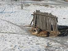
Heilongjiang is also an important source of lumber for China. Pine, especially the Korean pine and larch are the most important forms of lumber produced in Heilongjiang. Forests are mostly to be found in the Greater Khingan Mountains and Lesser Khingan Mountains, which are also home to protected animal species such as the Siberian tiger, the red-crowned crane, and the lynx.
Herding in Heilongjiang is centered upon horses and cattle; the province has the largest number of milk cows and the highest production of milk among all the province-level divisions of China.
Petroleum is of great importance in Heilongjiang, and the Daqing oilfields are an important source of petroleum for China. Coal, gold, and graphite are other important minerals to be found in Heilongjiang. Heilongjiang also has great potential for wind power, with potential capacity for 134 Gigawatts of power production.[22]
Heilongjiang is part of northeast China, the country's traditional industrial base. Industry is focused upon coal, petroleum, lumber, machinery, and food. Due to its location, Heilongjiang is also an important gateway for trade with Russia. Since a wave of privatization led to the closure of uncompetitive factories in the 1990s, Manchuria has suffered from stagnation. As a result, the government has started the Revitalize Northeast China campaign to deal with this problem, promoting the private sectors as the preferred method of economic reform.
At least five miners were killed after a coal mine fire in Heilongjiang it was reported on September 21, 2008.[23]
Its GDP has been rising steadily since 2003, growing 37% from 2003 to 2007. The value of the private economy reached RMB234 billion in 2006 and accounted for 37.6 percent of the GDP. In that year, the tax revenue from private enterprises hit RMB20.5 billion.
Private enterprises in Heilongjiang led the overall economic growth of the province. Many leading private enterprises have begun to emerge. The province's three major private enterprises, namely the Heilongjiang Sunflower Medicine Ltd, Qitaihe Yidaxin Coal Co., and Heilongjiang Yiyang Group, each contributed more than RMB100 million in tax revenue in 2007.
During the first decade of this century, many private investors were involved in large construction projects in Heilongjiang. In 2006, 928 large projects absorbed private capital of RMB5 million each, and 101 projects attracted RMB100 million each within the province. In line with the central government's policy to revitalize the Northeast, Heilongjiang also restructured its six pillar industries, namely equipment manufacturing, petrochemicals, food processing, energy, pharmaceuticals, and forest and timber processing.
In 2017, Heilongjiang's nominal GDP was 1.62 trillion yuan (ca. US$240 billion), with an annual growth rate of 12.2%. Its per capita GDP was 42,699 yuan (US$6,324). In 2006 the per capita disposable income of urban residents in Heilongjiang reached 11,581 yuan (US$1,667), a rise of 13% from the previous year. The per capita net income of rural residents in the province reached 4,856 yuan (US$700), a rise of 17.5% from 2007.[24]
Economic and technological development zones
- Daqing New & Hi-Tech Industrial Development Zone
- Daqing New & Hi-Tech Industrial Development Zone was constructed in April 1992 and was then approved as a national high-tech zone by the State Council later that year. Its initial zone area is 208.54 km2, and it recently expanded the area by 32.45 km2.[25]
- Heihe Border Economic Cooperation Area
- Harbin Economic and Technological Development Zone
- Harbin New & Hi-Tech Industrial Development Zone
- Harbin High-tech Zone was set up in 1988 and was approved by the State Council as a national development zone in 1991. It has a total area of 34 km2 in the centralized parks, subdivided into Nangang, Haping Road and Yingbin Road Centralized Parks. The Nangang Centralized Park is designated for the incubation of high-tech projects and research and development base of enterprises as well as tertiary industries such as finance, insurance, services, catering, tourism, culture, recreation and entertainment, where the headquarters of major well-known companies and their branches in Harbin are located; the Haping Road Centralized Park is a comprehensive industrial basis for the investment projects of automobile and automobile parts manufacturing, medicines, foodstuffs, electronics, textile; the Yingbin Road Centralized Park is mainly for high-tech incubation projects, high-tech industrial development.[26]
- Sino-Russia Dongning-Piurtaphca Trade Zone
- Sino-Russia Dongning-Piurtaphca Trade Zone was approved by the State Council in 2000 and was completed in 2005. The zone has a planned area of 275.4 hectares. The Chinese part of the zone has a 22-hectare trade center with four subsidiary areas, A, B, C, and D, in which more than 6,000 stalls are already set up, mainly dealing with clothes, household appliances, food, construction materials, etc.[27]
- Suifenhe Border Economic Cooperation Area
- Suifenhe Border Economic Cooperation District (Suifenhe BECD) is located in the north of Suifenhe City, and borders Russia to the east. Suifenhe BECD is the largest among the three state-level border-trade zones of Heilongjiang, in terms of investor numbers. Suifenhe BECD has a convenient transport network. The Binzhou-Suifenhe Railway, which connects the Russian Far East Railway, is an important port for export. The railway distance between Suifenhe and Harbin is 548 km (341 mi). Buguranikinai, the corresponding Russian port city, is 21 km (13 mi) away.[28]
Demographics
| Historical population | ||
|---|---|---|
| Year | Pop. | ±% p.a. |
| 1912[29] | 2,029,000 | — |
| 1928[30] | 3,725,000 | +3.87% |
| 1936–37[31] | 3,751,000 | +0.09% |
| 1947[32] | 2,844,000 | −2.49% |
| 1954[33] | 11,897,309 | +22.68% |
| 1964[34] | 20,118,271 | +5.39% |
| 1982[35] | 32,665,546 | +2.73% |
| 1990[36] | 35,214,873 | +0.94% |
| 2000[37] | 36,237,576 | +0.29% |
| 2010[38] | 38,312,224 | +0.56% |
| Established in 1923; dissolved in 1932 and incorporated into Manchukuo / Heilongjiang Province (present). Harbin part of Heilongjiang Province until 1947–1949 and 1953–1954. Dongsheng SAR dissolved in 1932 and incorporated into Manchukuo / Heilongjiang Province (present). Songjiang Province dissolved in 1955 and incorporated into Heilongjiang Province. Hejiang Province dissolved in 1949 and incorporated into Songjiang Province / Heilongjiang Province (present). Nenjiang Province dissolved in 1949 and incorporated into Heilongjiang Province. | ||
The majority of Heilongjiang's population is Han Chinese, while other ethnic minorities include the Manchus, Koreans, Mongols, Hui, Xibe, and Hezhen
| Ethnic groups in Heilongjiang (2000 census) | ||
|---|---|---|
| Nationality | Population | Percentage |
| Han Chinese | 34,465,039 | 95.20% |
| Manchu | 1,037,080 | 2.86% |
| Koreans | 388,458 | 1.07% |
| Mongol | 141,495 | 0.39% |
| Hui | 124,003 | 0.34% |
| Xibe | 43,608 | 0.12% |
| Hezhe | 8,886 | 0.03% |
Excludes members of the People's Liberation Army in active service.
Source:[39]
Religion
Most of Heilongjiang's residents are either non-religious or practice Chinese folk religions, including Taoism. Manchu shamanism is practiced by many Manchu people. Chinese Buddhism and Tibetan Buddhism have an important presence in the province.
Culture
Heilongjiang's culture is part of a culture of Northeast China that is relatively homogeneous across this region, known in Mandarin Chinese as "Dongbei" (the northeast).
Media
Heilongjiang Television and Harbin Economy Radio serve as broadcasters.
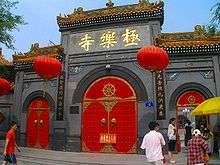
Tourism
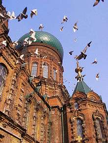
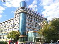
Harbin, the provincial capital, is a city of contrasts, with Chinese, Russian, and eclectic worldwide influences clearly apparent. Bukui Mosque, a national heritage site, is the largest glazed-tile building in the province.[40] Eastern Orthodox, Roman Catholic, and Protestant churches as well as synagogues dot the city.[41]
The long, cold winter is the backdrop for its famed ice sculpture exhibitions. In 2007 already the 8th Ice and Snow World opened to visitors in Harbin. More than 2,000 ice sculptures were on display at the annual event.[42]
Wudalianchi Lakes are a series of five lakes formed between 1719 and 1721 when volcanic eruption shaped one section of a tributary of the Amur into five interconnected lakes. The second lake in particular is renowned for its irregular geological sights. Lake Jingbo, in Ning'an County, is a section of the Mudan River that has been narrowed and shaped by volcanic eruption into a series of sights, including the Diaoshuilou Falls.
The province has a zoological park called "Harbin Siberian Tiger Park".[43]
Colleges and universities
- Northeast Forestry University
- Harbin Institute of Technology
- Harbin Engineering University
- Northeast Agricultural University
- Harbin University of Science and Technology
- Heilongjiang University
- Heilongjiang International University
- Heilongjiang Institute of Technology
- Harbin Medical University
- Daqing Staff and Workers University
- Northeast Petroleum University
- Heilongjiang University of Traditional Chinese Medicine
- Heilongjiang Commercial University
- Harbin Normal University
- Heilongjiang August First Land Reclamation University
- Qiqihar University
Sports
Heilongjiang is in the forefront of promoting winter sports and winter-featured sports industry in China.[44] For example, it is promoting bandy as an Olympic sport.[45]
Events and leagues
- 2009 Winter Universiade
- 2018 Bandy World Championship, Division B
- Asia League Ice Hockey
See also
- Major national historical and cultural sites in Heilongjiang
References
- Economic profile for Heilongjiang at HKTDC
- "Doing Business in China – Survey". Ministry Of Commerce – People's Republic Of China. Archived from the original on 5 August 2013. Retrieved 5 August 2013.
- "Communiqué of the National Bureau of Statistics of People's Republic of China on Major Figures of the 2010 Population Census [1] (No. 2)". National Bureau of Statistics of China. 29 April 2011. Archived from the original on 27 July 2013. Retrieved 4 August 2013.
- 黑龙江省2017年国民经济和社会发展统计公报 [Statistical Communiqué of Heilongjiang on the 2017 National Economic and Social Development] (in Chinese). Heilongjiang Bureau of Statistics. 2018-04-11. Archived from the original on 2018-06-22. Retrieved 2018-06-22.
- "Sub-national HDI" (PDF). 2017. Retrieved 2019-07-18.
- "Heilongjiang and China's Food Security". Stratfor. 2012-03-05. Retrieved 2019-10-20.
- Origins of Minority Ethnic Groups in Heilongjiang Archived 2014-03-22 at the Wayback Machine
- 浅谈黑龙江省地名的特点. iqh.net.cn (in Chinese).
- Edmonds, Richard Louis (1985). Northern Frontiers of Qing China and Tokugawa Japan: A Comparative Study of Frontier Policy. University of Chicago, Department of Geography; Research Paper No. 213. p. 6. ISBN 0-89065-118-3.
- Edmonds (1985), pp. 115–117
- Patrick Fuliang Shan, "Taming China's Wilderness: Immigration, Settlement, and the Shaping of the Heilongjiang Frontier, 1900–1931," Ashgate, 2014, ISBN 978-1-4094-6389-4
- Updated Asian map of the Köppen climate classification system
- Proposed bridge to boost bilateral trade, China Daily, June 19, 2007.
- Andrew Higgins (July 16, 2016). "An Unfinished Bridge, and Partnership, Between Russia and China". The New York Times. Retrieved July 17, 2016.
- "Russia, China launch construction of bridge across Amur river". Russia certai. December 25, 2016.
- 中华人民共和国县以上行政区划代码 (in Chinese). Ministry of Civil Affairs.
- Shenzhen Bureau of Statistics. 《深圳统计年鉴2014》 (in Chinese). China Statistics Print.|url=http://www.sztj.gov.cn/nj2014/indexce.htm Archived 2015-05-12 at the Wayback Machine |date=|accessdate=2015-05-29}}
- Census Office of the State Council of the People's Republic of China; Population and Employment Statistics Division of the National Bureau of Statistics of the People's Republic of China (2012). 中国2010人口普查分乡、镇、街道资料 (1 ed.). Beijing: China Statistics Print. ISBN 978-7-5037-6660-2.
- Ministry of Civil Affairs (August 2014). 《中国民政统计年鉴2014》 (in Chinese). China Statistics Print. ISBN 978-7-5037-7130-9.
- 中国2010年人口普查分县资料. Compiled by 国务院人口普查办公室 [Department of Population Census of the State Council], 国家统计局人口和社会科技统计司编 [Department of Population and Social Science and Statistics, National Bureau of Statistics]. Beijing: China Statistics Print. 2012. ISBN 978-7-5037-6659-6.CS1 maint: others (link)
- 李景华 (1990). 马铃薯. Encyclopedia of China. Encyclopedia of China Publishing House. Archived from the original on 2013-10-15.
- "Harbin — the capital city of China's high-quality rice". China Daily. 2017-10-17. Retrieved 2019-10-20.
- Zhang, Yuning; Tang, Ningning; Niu, Yuguang; Du, Xiaoze (2016-12-01). "Wind energy rejection in China: Current status, reasons and perspectives". Renewable and Sustainable Energy Reviews. 66: 322–344. doi:10.1016/j.rser.2016.08.008. ISSN 1364-0321.
- "50 dead in Chinese mining accidents." CNN. Retrieved on December 27, 2008.
- 2006年黑龙江省农民人均收入达3552元 增长10.3%. northeast.cn (in Chinese). 2007-01-18. Archived 2007-11-13 at the Wayback Machine
- RightSite.asia | Daqing New & Hi-Tech Industrial Development Zone
- RightSite.asia | Harbin New & Hi-Tech Industrial Zone
- RightSite.asia | Sino-Russia Dongning-Piurtaphca Trade Zone
- RightSite.asia | Suifenhe Border Economic Cooperation District
- 1912年中国人口. Retrieved 6 March 2014.
- 1928年中国人口. Retrieved 6 March 2014.
- 1936-37年中国人口. Retrieved 6 March 2014.
- 1947年全国人口. Retrieved 6 March 2014.
- 中华人民共和国国家统计局关于第一次全国人口调查登记结果的公报. National Bureau of Statistics of China. Archived from the original on 2009-08-05.
- 第二次全国人口普查结果的几项主要统计数字. National Bureau of Statistics of China. Archived from the original on 2012-09-14.
- 中华人民共和国国家统计局关于一九八二年人口普查主要数字的公报. National Bureau of Statistics of China. Archived from the original on 2012-05-10.
- 中华人民共和国国家统计局关于一九九〇年人口普查主要数据的公报. National Bureau of Statistics of China. Archived from the original on 2012-06-19.
- 现将2000年第五次全国人口普查快速汇总的人口地区分布数据公布如下. National Bureau of Statistics of China. Archived from the original on 2012-08-29.
- "Communiqué of the National Bureau of Statistics of People's Republic of China on Major Figures of the 2010 Population Census". National Bureau of Statistics of China. Archived from the original on 2013-07-27.
- Department of Population, Social, Science and Technology Statistics of the National Bureau of Statistics of China (国家统计局人口和社会科技统计司); Department of Economic Development of the State Ethnic Affairs Commission of China (国家民族事务委员会经济发展司), eds. (2003). 《2000年人口普查中国民族人口资料》 (in Chinese). Beijing: Publishing House of Minority Nationalities. ISBN 7-105-05425-5.CS1 maint: multiple names: editors list (link), 2 volumes
- Bukui Mosque, a popular tourist attraction
- "China Expat city Guide". China Expat. 2008. Retrieved 2009-02-08.
- Ice and Snow Festival in Harbin
- DK (2014-06-02). DK Eyewitness Travel Guide: China. Penguin Books. p. 457. ISBN 978-1465430939.
- "2018 World Bandy Championship Men's Group B will be held in Harbin on 27th". Archived from the original on 2018-01-18. Retrieved 2018-12-12.
- HEILONGJIANG PROVINCE PROMOTES BANDY AS OLYMPIC SPORT!
External links
| Wikimedia Commons has media related to Heilongjiang. |
- Heilongjiang Government website

- Heilongjiang International University
Places adjacent to Heilongjiang | |
|---|---|
Heilongjiang topics | |
|---|---|
Harbin (capital) | |
| General | |
| Geography |
|
| Education |
|
| Visitor attractions |
|
| |
| Provinces | ||
|---|---|---|
| Autonomous regions |
| |
| Municipalities | ||
| Special administrative regions | ||
| Other |
| |
Note: Taiwan is claimed by the People's Republic of China but administered by the Republic of China (see Political status of Taiwan). | ||
| Authority control |
|
|---|