Youngtown, Arizona
Youngtown is a town in Maricopa County, Arizona, United States. According to the 2010 census, the population of the town is 6,156.[4] Youngtown is the oldest retirement community in the United States.
Youngtown, Arizona | |
|---|---|
 Maricopa Lake in a thunderstorm, Youngtown | |
 Seal | |
| Motto(s): "First in Concept – Fostering Community Pride – Building Quality of Life"[1] | |
 Location of Youngtown in Maricopa County, Arizona. | |
 Youngtown, Arizona Location in the United States | |
| Coordinates: 33°35′41″N 112°17′56″W | |
| Country | United States |
| State | Arizona |
| County | Maricopa |
| Government | |
| • Mayor | Michael LeVault[2] |
| Area | |
| • Total | 1.49 sq mi (3.87 km2) |
| • Land | 1.49 sq mi (3.85 km2) |
| • Water | 0.01 sq mi (0.02 km2) |
| Elevation | 1,138 ft (347 m) |
| Population | |
| • Total | 6,156 |
| • Estimate (2018)[5] | 6,836 |
| • Density | 4,597.18/sq mi (1,775.00/km2) |
| Time zone | UTC-7 (MST (no DST)) |
| ZIP code | 85363 |
| Area code(s) | 623 |
| FIPS code | 04-85400 |
| Website | Town of Youngtown, Arizona |
History
In 1954, two developers bought 320 acres (1.3 km2) of farmland and built the United States' first planned community dedicated exclusively to retirees. Designed by Ben Schleifer, the community was ironically named Youngtown.[6] In 1996, the town, citing its age restrictions, denied extending the stay of a 16-year-old child to live in the community. In response, Arizona Attorney General Grant Woods investigated and determined that the age ordinance was unenforceable. In response, Youngtown repealed the age restrictions in 1999.[7]
Geography
Youngtown is located at 33°35′41″N 112°17′56″W (33.594603, −112.298776),[8] on the east bank of the Agua Fria River, just south of US 60. It is bordered on the west by El Mirage and on the east by the much larger retirement community of Sun City.
According to the United States Census Bureau, the town has a total area of 1.3 square miles (3.4 km2), all of it land.
Demographics
| Historical population | |||
|---|---|---|---|
| Census | Pop. | %± | |
| 1970 | 1,886 | — | |
| 1980 | 2,254 | 19.5% | |
| 1990 | 2,542 | 12.8% | |
| 2000 | 3,010 | 18.4% | |
| 2010 | 6,156 | 104.5% | |
| Est. 2018 | 6,836 | [5] | 11.0% |
| U.S. Decennial Census[9] | |||
At the 2000 census, there were 3,010 people, 1,641 households, and 746 families living in the town. The population density was 2,296.1 people per square mile (887.2/km²). There were 1,783 housing units at an average density of 1,360.1 per square mile (525.5/km²). The racial makeup of the town was 88.90% White, 1.36% Black or African American, 0.50% Native American, 0.60% Asian, 0.27% Pacific Islander, 7.24% from other races, and 1.13% from two or more races. 12.72% of the population were Hispanic or Latino of any race.
Of the 1,641 households 7.7% had children under the age of 18 living with them, 35.5% were married couples living together, 8.0% had a female householder with no husband present, and 54.5% were non-families. 50.3% of households were one person and 36.6% were one person aged 65 or older. The average household size was 1.74 and the average family size was 2.48.
The age distribution was 9.9% under the age of 18, 3.5% from 18 to 24, 12.8% from 25 to 44, 23.4% from 45 to 64, and 50.4% 65 or older. The median age was 65 years. For every 100 females, there were 70.1 males. For every 100 females age 18 and over, there were 66.6 males.
The median household income was $23,164 and the median family income was $29,329. Males had a median income of $30,000 versus $22,500 for females. The per capita income for the town was $16,749. About 9.6% of families and 13.1% of the population were below the poverty line, including 33.1% of those under age 18 and 8.5% of those age 65 or over.
Education
The Peoria Unified School District serves a portion of Youngtown.[10]
References
- "Town of Youngtown, Arizona". Town of Youngtown, Arizona. Retrieved August 24, 2012.
- "Mayor's Office". Youngtown, AZ. Retrieved November 25, 2015.
- "2018 U.S. Gazetteer Files". United States Census Bureau. Retrieved July 1, 2019.
- "U.S. Census website". United States Census Bureau. Retrieved July 10, 2014.
- "Population and Housing Unit Estimates". Retrieved June 4, 2019.
- Youngtown timeline
- http://aux.zicklin.baruch.cuny.edu/jrer/papers/pdf/past/vol26n03/02.255_276.pdf
- "US Gazetteer files: 2010, 2000, and 1990". United States Census Bureau. February 12, 2011. Retrieved April 23, 2011.
- "Census of Population and Housing". Census.gov. Retrieved June 4, 2016.
- "Municipalities and Schools within the PUSD." (Archive) Peoria Unified School District. Retrieved on October 18, 2012.
External links
Municipalities and communities of Maricopa County, Arizona, United States | ||
|---|---|---|
| Cities | 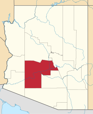 | |
| Towns | ||
| CDPs | ||
| Populated places |
| |
| Indian reservations | ||
| Ghost towns/ former populated places | ||
| Footnotes | ‡This populated place also has portions in an adjacent county or counties | |
Category:Planned communities
| Authority control |
|
|---|