Maricopa Colony, Arizona
Maricopa Colony is a census-designated place (CDP) in Maricopa County, Arizona, United States, located in the federally recognized Gila River Indian Community. The population was 709 at the 2010 census. It is located near the Phoenix Metropolitan Area, around Baseline Road and 83rd Avenue.
Maricopa Colony, Arizona | |
|---|---|
 Location of Maricopa Colony in Maricopa County, Arizona. | |
 Maricopa Colony, Arizona Location in the United States | |
| Coordinates: 33°22′35″N 112°14′12″W | |
| Country | United States |
| State | Arizona |
| County | Maricopa |
| Area | |
| • Total | 5.49 sq mi (14.21 km2) |
| • Land | 5.49 sq mi (14.21 km2) |
| • Water | 0.00 sq mi (0.00 km2) |
| Population (2010) | |
| • Total | 709 |
| • Estimate (2016)[2] | N/A |
| Time zone | UTC-7 (MST (no DST)) |
| FIPS code | 04-44450 |
Demographics
| Historical population | |||
|---|---|---|---|
| Census | Pop. | %± | |
| U.S. Decennial Census[3] | |||
As of the census[4] of 2010, there were 709 people living in the CDP. The racial makeup of the CDP was 1.27% White, 0.28% Black or African American, 92.24% Native American, 0.14% Asian, 3.10% from other races, and 2.96% from two or more races. 14.25% of the population were Hispanic or Latino of any race.
Municipalities and communities of Maricopa County, Arizona, United States | ||
|---|---|---|
| Cities | 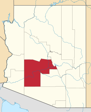 | |
| Towns | ||
| CDPs | ||
| Populated places |
| |
| Indian reservations | ||
| Ghost towns/ former populated places | ||
| Footnotes | ‡This populated place also has portions in an adjacent county or counties | |
Notes
- "2016 U.S. Gazetteer Files". United States Census Bureau. Retrieved Jul 18, 2017.
- "Population and Housing Unit Estimates". Retrieved June 9, 2017.
- "Census of Population and Housing". Census.gov. Retrieved June 4, 2016.
- "Archived copy". Archived from the original on 2011-07-21. Retrieved 2011-07-09.CS1 maint: archived copy as title (link)
This article is issued from Wikipedia. The text is licensed under Creative Commons - Attribution - Sharealike. Additional terms may apply for the media files.