Aguila, Arizona
Aguila is a CDP in Maricopa County, Arizona, United States. It is located on U.S. Route 60 approximately 25 miles west of Wickenburg, or at approximately 50000 N. 510th Ave. Major economic activities include cantaloupe farming and formerly included mining. It uses the same street numbering system as Phoenix. As of the 2010 census, the population of Aguila was 798.
Aguila, Arizona | |
|---|---|
 The Aguila Depot, built in 1907 by the Santa Fe, Prescott and Phoenix Railway. | |
 Location of Aguila in Maricopa County, Arizona. | |
 Aguila, Arizona Location in the United States | |
| Coordinates: 33°56′34″N 113°10′27″W | |
| Country | United States |
| State | Arizona |
| County | Maricopa |
| Area | |
| • Total | 1.57 sq mi (4.07 km2) |
| • Land | 1.57 sq mi (4.07 km2) |
| • Water | 0.00 sq mi (0.00 km2) |
| Population (2010) | |
| • Total | 798 |
| • Estimate (2016)[2] | N/A |
| Time zone | UTC−7 (Mountain (MST)) |
| Area code(s) | 928 |
| FIPS code | 04-00730 |

Demographics
| Historical population | |||
|---|---|---|---|
| Census | Pop. | %± | |
| 1920 | 174 | — | |
| 1930 | 528 | 203.4% | |
| 2010 | 798 | — | |
| Source:[3] | |||
Aguila first appeared on the 1920 U.S. Census as the 52nd Precinct of Maricopa County.[4] In 1930, it simply appeared as the Aguila Precinct. It was recorded as having a Spanish/Hispanic majority for that census[5] (the census would not separately feature that racial demographic again until 1980). With the combination of all county precincts into 3 districts in 1940, it did not formally appear again until 2010, when it was made a census-designated place (CDP).[6]
As of the census[7] of 2010, there were 798 people living in the CDP. The population density was 508.1 people per square mile. The racial makeup of the CDP was 64.66% White, 1.00% Black or African American, 3.63% Native American, 0.38% Asian, 0.25% Pacific Islander, 28.07% from other races, and 2.01% from two or more races. 69.42% of the population were Hispanic or Latino of any race.
Climate
This area has a large amount of sunshine year round due to its stable descending air and high pressure. According to the Köppen Climate Classification system, Aguila has a desert climate, abbreviated "Bwh" on climate maps.[8]
| Climate data for Aguila | |||||||||||||
|---|---|---|---|---|---|---|---|---|---|---|---|---|---|
| Month | Jan | Feb | Mar | Apr | May | Jun | Jul | Aug | Sep | Oct | Nov | Dec | Year |
| Average high °F (°C) | 62.4 (16.9) |
65.8 (18.8) |
70.9 (21.6) |
80.2 (26.8) |
88.9 (31.6) |
98.8 (37.1) |
102.6 (39.2) |
100.4 (38.0) |
95.3 (35.2) |
85 (29) |
71.7 (22.1) |
63.7 (17.6) |
82.1 (27.8) |
| Average low °F (°C) | 33.1 (0.6) |
35.7 (2.1) |
38.9 (3.8) |
44.5 (6.9) |
51.8 (11.0) |
60.6 (15.9) |
70.2 (21.2) |
69.7 (20.9) |
62.4 (16.9) |
50.3 (10.2) |
38.5 (3.6) |
33.3 (0.7) |
49.1 (9.5) |
| Average precipitation inches (cm) | 1 (2.5) |
1.1 (2.8) |
0.9 (2.3) |
0.4 (1.0) |
0.1 (0.25) |
0.1 (0.25) |
0.9 (2.3) |
1.4 (3.6) |
0.7 (1.8) |
0.5 (1.3) |
0.6 (1.5) |
1 (2.5) |
8.7 (22) |
| Source: Weatherbase [9] | |||||||||||||
References
- "2016 U.S. Gazetteer Files". United States Census Bureau. Retrieved July 18, 2017.
- "Population and Housing Unit Estimates". Retrieved June 9, 2017.
- "Archived copy". Archived from the original on July 21, 2011. Retrieved October 18, 2013.CS1 maint: archived copy as title (link)
- http://www2.census.gov/prod2/decennial/documents/06229686v1-7ch02.pdf
- https://www2.census.gov/prod2/decennial/documents/10612963v3p1ch02.pdf
- ftp://ftp2.census.gov/library/publications/2012/dec/cph-1-4.pdf
- "Archived copy". Archived from the original on July 21, 2011. Retrieved October 18, 2013.CS1 maint: archived copy as title (link)
- Climate Summary for Aguila, Arizona
- "Weatherbase: Historical Weather for Aguila, Arizona". Weatherbase. 2011. Retrieved on November 24, 2011.
External links
Municipalities and communities of Maricopa County, Arizona, United States | ||
|---|---|---|
| Cities | 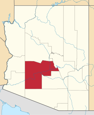 | |
| Towns | ||
| CDPs | ||
| Populated places |
| |
| Indian reservations | ||
| Ghost towns/ former populated places | ||
| Footnotes | ‡This populated place also has portions in an adjacent county or counties | |