Yasuoka, Nagano
Yasuoka (泰阜村, Yasuoka-mura) is a village located in Nagano Prefecture, Japan. As of 1 April 2019, the village had an estimated population of 1,622 in 688 households,[1] and a population density of 25 persons per km². The total area of the village is 64.59 square kilometres (24.94 sq mi).
Yasuoka 泰阜村 | |
|---|---|
Village | |
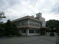 Yasuoka Village Hall | |
 Flag  Seal | |
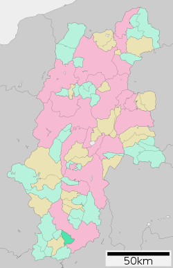 Location of Yasuoka in Nagano Prefecture | |
 Yasuoka | |
| Coordinates: 35°22′38.6″N 137°50′45.5″E | |
| Country | Japan |
| Region | Chūbu (Kōshin'etsu) |
| Prefecture | Nagano |
| District | Shimoina |
| Area | |
| • Total | 64.59 km2 (24.94 sq mi) |
| Population (April 2019) | |
| • Total | 1,622 |
| • Density | 25/km2 (65/sq mi) |
| Time zone | UTC+9 (Japan Standard Time) |
| Symbols | |
| • Tree | Pine |
| • Flower | Erythronium japonicum |
| • Bird | Copper pheasant |
| Phone number | 0260-26-2111 |
| Address | 3236-1 Yasuoka-mura, Shimoina-gun, Nagano-ken 399-1895 |
| Website | Official website |
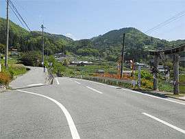
Geography
Yasuoka is located in mountainous far south of Nagano Prefecture. The Tenryū River runs through the northern portion of the village.
Demographics
Per Japanese census data,[2] the population of Yasuoka has declined severely in recent years.
| Historical population | ||
|---|---|---|
| Year | Pop. | ±% |
| 1940 | 3,964 | — |
| 1950 | 4,620 | +16.5% |
| 1960 | 4,139 | −10.4% |
| 1970 | 3,189 | −23.0% |
| 1980 | 2,613 | −18.1% |
| 1990 | 2,386 | −8.7% |
| 2000 | 2,237 | −6.2% |
| 2010 | 1,911 | −14.6% |
Climate
The town has a climate characterized by hot and humid summers, and cold winters (Köppen climate classification Cfa). The average annual temperature in Yasuoka is 11.9 °C. The average annual rainfall is 1904 mm with September as the wettest month. The temperatures are highest on average in August, at around 23.8 °C, and lowest in January, at around 0.3 °C.[3]
History
The area of present-day Yasuoka was part of ancient Shinano Province. The village of Yasuoka established on April 1, 1889 by the establishment of the modern municipalities system. In the late 1930s, a large number of inhabitants from Yasuoka were settled in Manchukuo.[4]
Education
Yasuoka has one public elementary school and one public middle school operated by the village government. The village does not have a high school.
Transportation
Highway
- The village is not served by any national highway
References
External links

- Official Website (in Japanese)
| Authority control |
|
|---|
Nagano (capital) | |
| Core city |
|
| Special city | |
| Cities | |
| Districts | |