Minamimaki, Nagano
Minamimaki (南牧村, Minamimaki-mura) is a village located in Nagano Prefecture, Japan. As of 1 April 2019, the village had an estimated population of 2924 in 1091 households,[1] and a population density of 22 persons per km². The total area of the village is 133.09 square kilometres (51.39 sq mi).
Minamimaki 南牧村 | |
|---|---|
Village | |
 Minamimaki Village Hall | |
 Flag  Seal | |
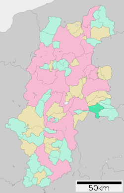 Location of Minamimaki in Nagano Prefecture | |
 Minamimaki | |
| Coordinates: 36°1′15″N 138°29′31.7″E | |
| Country | Japan |
| Region | Chūbu (Kōshin'etsu) |
| Prefecture | Nagano |
| District | Minamisaku |
| Area | |
| • Total | 133.09 km2 (51.39 sq mi) |
| Population (April 2019) | |
| • Total | 2,924 |
| • Density | 22/km2 (57/sq mi) |
| Time zone | UTC+9 (Japan Standard Time) |
| Symbols | |
| • Tree | Prunus serrulata |
| • Flower | Lily of the valley |
| • Bird | Eurasian skylark |
| Phone number | 0267-78-2121 |
| Address | 1051 Uminokuchi Minamimaki-mura, Minamisaku-gun, Nagano-ken 384-1211 |
| Website | http://www.minamimakimura.jp/ |
Geography
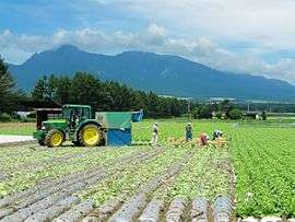
Minamimaki is located in mountainous eastern Nagano Prefecture at an average altitude of between 1000 and 1500 meters, bordered by Yamanashi Prefecture to the south. The Southern Yatsugatake Volcanic Group is partly located within this village.
Surrounding municipalities
Demographics
Per Japanese census data,[2] the population of Minamimaki has remained relatively steady over the past 50 years.
| Historical population | ||
|---|---|---|
| Year | Pop. | ±% |
| 1940 | 3,029 | — |
| 1950 | 4,087 | +34.9% |
| 1960 | 4,112 | +0.6% |
| 1970 | 3,604 | −12.4% |
| 1980 | 3,435 | −4.7% |
| 1990 | 3,582 | +4.3% |
| 2000 | 3,540 | −1.2% |
| 2010 | 3,528 | −0.3% |
Climate
The village has a humid continental climate characterized by warm and humid summers, and cold winters with heavy snowfall (Köppen climate classification Dfb). The average annual temperature in Minamimaki is 6.6 °C. The average annual rainfall is 1660 mm with September as the wettest month. The temperatures are highest on average in August, at around 19.5 °C, and lowest in January, at around -5.5 °C.[3]
| Climate data for Nobeyama (1981 - 2010), altitude 1350 meters | |||||||||||||
|---|---|---|---|---|---|---|---|---|---|---|---|---|---|
| Month | Jan | Feb | Mar | Apr | May | Jun | Jul | Aug | Sep | Oct | Nov | Dec | Year |
| Record high °C (°F) | 11.9 (53.4) |
15.6 (60.1) |
20.1 (68.2) |
24.9 (76.8) |
26.0 (78.8) |
28.6 (83.5) |
30.7 (87.3) |
31.0 (87.8) |
29.1 (84.4) |
24.9 (76.8) |
19.7 (67.5) |
16.9 (62.4) |
31.0 (87.8) |
| Average high °C (°F) | −0.1 (31.8) |
0.5 (32.9) |
4.7 (40.5) |
11.9 (53.4) |
16.5 (61.7) |
19.5 (67.1) |
23.1 (73.6) |
24.2 (75.6) |
19.8 (67.6) |
14.1 (57.4) |
9.1 (48.4) |
3.4 (38.1) |
12.3 (54.1) |
| Daily mean °C (°F) | −5.3 (22.5) |
−4.9 (23.2) |
−0.8 (30.6) |
5.6 (42.1) |
10.6 (51.1) |
14.5 (58.1) |
18.4 (65.1) |
19.2 (66.6) |
15.2 (59.4) |
8.8 (47.8) |
3.5 (38.3) |
−2.0 (28.4) |
6.9 (44.4) |
| Average low °C (°F) | −11.9 (10.6) |
−11.5 (11.3) |
−6.7 (19.9) |
−0.6 (30.9) |
4.7 (40.5) |
9.9 (49.8) |
14.5 (58.1) |
15.2 (59.4) |
11.2 (52.2) |
3.8 (38.8) |
−2.1 (28.2) |
−8.1 (17.4) |
1.5 (34.7) |
| Record low °C (°F) | −25.1 (−13.2) |
−26.0 (−14.8) |
−25.3 (−13.5) |
−18.7 (−1.7) |
−6.6 (20.1) |
−0.5 (31.1) |
4.8 (40.6) |
5.0 (41.0) |
−2.2 (28.0) |
−8.9 (16.0) |
−14.1 (6.6) |
−23.1 (−9.6) |
−26.0 (−14.8) |
| Average precipitation mm (inches) | 50.3 (1.98) |
56.2 (2.21) |
98.1 (3.86) |
102.3 (4.03) |
127.5 (5.02) |
174.9 (6.89) |
202.1 (7.96) |
176.0 (6.93) |
210.5 (8.29) |
136.7 (5.38) |
66.9 (2.63) |
38.4 (1.51) |
1,439.9 (56.69) |
| Average precipitation days (≥ 1.0 mm) | 6.9 | 7.2 | 11.5 | 10.5 | 11.4 | 13.9 | 15.8 | 12.8 | 12.6 | 9.9 | 8.0 | 5.9 | 126.4 |
| Mean monthly sunshine hours | 168.9 | 161.3 | 179.3 | 191.8 | 176.7 | 131.5 | 142.0 | 168.5 | 124.3 | 141.9 | 164.0 | 173.5 | 1,924.4 |
| Source 1: Japan Meteorological Agency | |||||||||||||
| Source 2: 観測史上1位~10位の値 | |||||||||||||
Politics and Government
Elections
History
The area of present-day MInamimaki was part of ancient Shinano Province. The modern village of Minamimaki was created with the establishment of the municipalities system on April 1, 1889.
Transportation
Railway
Highway
Local attractions
- Nobeyama radio observatory
- Yadegawa ruins, a Japanese Paleolithic period trace and National Historic Site
References
External links

- Official Website (in Japanese)
| Authority control |
|
|---|
Nagano (capital) | |
| Core city |
|
| Special city | |
| Cities | |
| Districts | |