Taihang Mountains
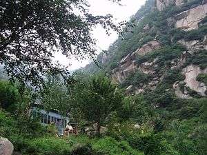
The Taihang Mountains (Chinese: 太行山; pinyin: Tàiháng Shān) are a Chinese mountain range running down the eastern edge of the Loess Plateau in Shanxi, Henan and Hebei provinces. The range extends over 400 kilometres (250 mi) from north to south and has an average elevation of 1,500 to 2,000 metres (4,900 to 6,600 feet). The principal peak is Xiao Wutaishan (2,882 metres (9,455 feet)). The Taihang's eastern peak is Cangyan Shan in Hebei; Baishi Mountain forms its northern tip.
| Taihang Mountains | |
|---|---|
 | |
| Highest point | |
| Peak | Xiao Wutaishan |
| Elevation | 2,882 m (9,455 ft) |
| Dimensions | |
| Length | 400 km (250 mi) |
| Geography | |
| Countries | China |
| Provinces | Shanxi, Henan and Hebei |
| Range coordinates | 38°N 113°E |
The name of Shanxi Province, meaning "west of the mountains", derives from its location west of the Taihang Mountains,[1] as does the name of Shandong Province (east of the mountains).[2]
The Red Flag Canal is located on the south edge of the Taihang Mountains.
The Shitai Passenger Railway crosses under the Taihang Mountains via the Taihang Tunnel, which, at almost 28 kilometres (17 mi), is the third longest railway tunnel in China.
See also
References
External links
| Wikimedia Commons has media related to Taihang Shan Mountains. |
- "A Walk in the Taihang Mountains". Shanghai Star. 2005-03-10. Archived from the original on 2005-03-22. Retrieved 2014-01-30.
Mountain ranges of China | |
|---|---|
| Northwest China | |
| Qinghai-Tibet and Southwest China | |
| Northeast China | |
| Northern China | |
| Central China | |
| Southern China | |
Hebei topics | |
|---|---|
Shijiazhuang (capital) | |
| General | |
| Geography |
|
| Education |
|
| Culture | |
| Visitor attractions |
|
| |
Henan topics | |
|---|---|
Zhengzhou (capital) | |
| General | |
| Geography | |
| Education | |
| Culture |
|
| Cuisine | |
| Visitor attractions | |
| |
Shanxi topics | |
|---|---|
Taiyuan (capital) | |
| General | |
| Geography | |
| Education | |
| Culture |
|
| Visitor attractions | |
| |
| Authority control |
|
|---|