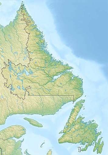
Woody Point, Newfoundland and Labrador
Woody Point is a town located in the heart of Gros Morne National Park, on the western coast of Newfoundland. Situated on Bonne Bay, the Town of Woody Point encompasses three areas: Curzon Village, Woody Point and Winterhouse Brook. It has a total population of 281[3] residents. Woody Point is a Registered Heritage District and has a waterfront with many heritage buildings and four Registered Newfoundland and Labrador Heritage Structures. The community is served by Route 431.
Woody Point | |
|---|---|
Town | |
 Woody Point from lookout | |
 Woody Point Location of Woody Point in Newfoundland | |
| Coordinates: 49°30′N 57°56′W | |
| Country | |
| Province | |
| Settled | 1849 |
| Incorporated | 1956 |
| Area | |
| • Total | 2.91 km2 (1.12 sq mi) |
| Elevation | 25 m (82 ft) |
| Population (2016) | |
| • Total | 282 |
| • Density | 97/km2 (250/sq mi) |
| Time zone | UTC– 3:30 (Newfoundland Time) |
| • Summer (DST) | UTC– 2:30 (Newfoundland Daylight) |
| Postal code span | A0K |
| Area code(s) | 709 |
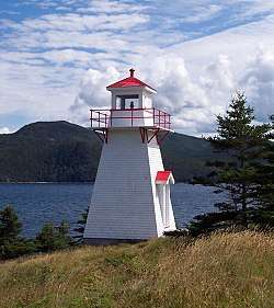 Woody Point Lighthouse in 2006 | |
 Woody Point Lighthouse Newfoundland and Labrador | |

| |
| Location | Woody Point Newfoundland Canada |
|---|---|
| Coordinates | 49°30′17.26″N 57°54′45.11″W |
| Year first constructed | 1919 (first) 1952 (second) |
| Year first lit | 1959 (current) |
| Construction | wooden tower |
| Tower shape | square frustum tower with balcony and lantern |
| Markings / pattern | white tower, red lantern roof |
| Tower height | 6 metres (20 ft) |
| Focal height | 14 metres (46 ft) |
| Light source | solar power |
| Range | 4 nautical miles (7.4 km; 4.6 mi) |
| Characteristic | Fl R 4s. |
| Admiralty number | H0168 |
| CHS number | CCG 200 |
| NGA number | 2644 |
| ARLHS number | CAN-703 |
| Managing agent | Canadian Coast Guard[1][2] |
History
French Shore
Europeans were slow to settle the west coast of Newfoundland. The British were concentrated on the east coast, and the French were on the Grand Banks. The 1713 Treaty of Utrecht gave the French some area on the west coast which was extended in 1783 to the entire coast.
British settlement was spreading, as well. In 1800 the first British settlement in the Bonne Bay area occurred in Woody Point with the establishment of the firm of Joseph Bird from Sturminster Newton. He had an agent and premises to serve the British fishing interests which were principally migratory at this point. When fishermen began to stay during the winter rather than return to England, the pattern for permanent settlement was laid.
By 1904, the French had left the area to pursue fisheries farther up the coast. By this time, Woody Point was bustling. It was considered the capital of the area with banking and customs offices, merchants, and a harbour full of domestic and foreign vessels.
First settlers
John Roberts and his wife, Emma, together with their four children are considered to be the first settlers of Woody Point. They came in 1849. By 1872, there were 129 families residing in the Bonne Bay area.
In 1873, the Bonne Bay Post Office was established in the home of J.R. Roberts, John Roberts' nephew. This house was one of the first built in the area and is still standing today. It is a blue clapboarded structure on the Shore Road left of the downtown. Plans are being made to restore this house.
Solomon Wilton was the second settler to Woody Point. It was Wilton who donated the land on which the present day Church of the Epiphany was built. A school and parsonage once stood on this spot. These early founding families are laid to rest in the Anglican cemetery on Shore Road.
Major events
In 1922, when Woody Point was experiencing the height of its population and commercial success, a devastating fire ripped through the downtown. The wind quickly carried the flames which shot all the way across the Bay to Norris Point. In all, 58 buildings were destroyed. The degree of commerce in the town never returned to the pre-fire level.
Most of the buildings currently on the waterfront date from after 1922, but there are some exceptions. The lighthouse was built in 1919. Also, the large grey and green house to the right of the Seaside Deli was built in the 1890s. This house was the scene of a riot in 1938.
Unable to bear the hardships of the Depression and the 6¢ a day dole ration, the residents demanded a meeting with Commissioner Wood. He came ashore long enough to say no to the demands and tried to get back aboard the M/V Shulamite. Six men had gotten aboard to try to keep the vessel docked, but the Captain put full speed astern and broke the lines. The men were taken to Corner Brook for the night, whilst Sir Wood was barricaded in this house, which served as the courthouse in those times, for his own protection. The next day the men were returned and Sir Wilfred left for Corner Brook.
Gallery
 View from Norris Point
 August sky over the table lands
.jpg) Winter in Woody Point
Winter in Woody Point.jpg) Bonne Bay
Bonne Bay WP huskies
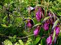 Spring Orchids
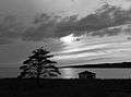 Sunset on Bonne Bay
 Westie on the Lookout
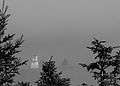 Lighthouse in fog
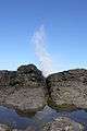 Rocks at Green Point
 Ron & Sandy

Geography and Climate
Woody Point is underlain by a bedrock of mélange, with metagabbro and related rock on higher areas.[4] Soils of the community and its surrounding region have been placed in the Serpentine Cove association.[5] Woody Point has a humid continental climate (Köppen Dfb) with extremely high winter snowfall and a strong winter seasonal lag, causing February to be the clearly coldest month. Summers are moderated by its seaside position, whereas precipitation remains high year round and rainfall is occurring during milder spells during winters.
| Climate data for Woody Point | |||||||||||||
|---|---|---|---|---|---|---|---|---|---|---|---|---|---|
| Month | Jan | Feb | Mar | Apr | May | Jun | Jul | Aug | Sep | Oct | Nov | Dec | Year |
| Record high °C (°F) | 15 (59) |
12.8 (55.0) |
16.5 (61.7) |
22.5 (72.5) |
25 (77) |
27 (81) |
29.5 (85.1) |
30.6 (87.1) |
27 (81) |
22 (72) |
18.5 (65.3) |
16.1 (61.0) |
30.6 (87.1) |
| Average high °C (°F) | −3.5 (25.7) |
−4.4 (24.1) |
0 (32) |
5.4 (41.7) |
10.9 (51.6) |
16.2 (61.2) |
20.2 (68.4) |
19.9 (67.8) |
15.6 (60.1) |
9.6 (49.3) |
4.4 (39.9) |
−0.7 (30.7) |
7.8 (46.0) |
| Average low °C (°F) | −10.7 (12.7) |
−12.6 (9.3) |
−8.6 (16.5) |
−1.8 (28.8) |
2.6 (36.7) |
7.6 (45.7) |
11.9 (53.4) |
12.1 (53.8) |
8.3 (46.9) |
3.3 (37.9) |
−1.1 (30.0) |
−7 (19) |
0.3 (32.5) |
| Record low °C (°F) | −25 (−13) |
−31 (−24) |
−31 (−24) |
−18 (0) |
−7.2 (19.0) |
−1 (30) |
2.8 (37.0) |
2.8 (37.0) |
−1.7 (28.9) |
−6.7 (19.9) |
−13 (9) |
−22.5 (−8.5) |
−31 (−24) |
| Average precipitation mm (inches) | 230.9 (9.09) |
128.3 (5.05) |
99.4 (3.91) |
68.6 (2.70) |
80.2 (3.16) |
113 (4.4) |
112 (4.4) |
124.9 (4.92) |
133.7 (5.26) |
163.2 (6.43) |
168.9 (6.65) |
197.6 (7.78) |
1,620.7 (63.81) |
| Average rainfall mm (inches) | 28.1 (1.11) |
17.1 (0.67) |
30.5 (1.20) |
47.2 (1.86) |
76.2 (3.00) |
113.0 (4.45) |
112.0 (4.41) |
124.9 (4.92) |
133.7 (5.26) |
160.5 (6.32) |
119.8 (4.72) |
35.0 (1.38) |
998 (39.3) |
| Average snowfall cm (inches) | 202.8 (79.8) |
111.2 (43.8) |
68.8 (27.1) |
21.4 (8.4) |
4.0 (1.6) |
0.0 (0.0) |
0.0 (0.0) |
0.0 (0.0) |
0.0 (0.0) |
2.8 (1.1) |
49.1 (19.3) |
162.6 (64.0) |
622.7 (245.1) |
| Average precipitation days (≥ 0.2 mm) | 26.0 | 19.1 | 14.9 | 11.2 | 12.3 | 13.2 | 14.7 | 14.2 | 15.8 | 18.2 | 20.1 | 23.5 | 203.2 |
| Average rainy days (≥ 0.2 mm) | 3.5 | 2.4 | 4.5 | 7.5 | 11.6 | 13.2 | 14.7 | 14.2 | 15.8 | 17.8 | 12.4 | 5.0 | 122.6 |
| Average snowy days (≥ 0.2 cm) | 23.8 | 17.7 | 11.8 | 4.5 | 0.8 | 0.0 | 0.0 | 0.0 | 0.0 | 0.8 | 9.2 | 20.0 | 88.6 |
| Source: Environment Canada[6] | |||||||||||||
Arts and Culture
Woody Point is home to the Writers at Woody Point festival[7] and Gros Morne Summer Music.[8]
See also
References
- Central and Western Newfoundland The Lighthouse Directory. University of North Carolina at Chapel Hill. Retrieved 16 February 2017
- List of Lights, Pub. 110: Greenland, The East Coasts of North and South America (Excluding Continental U.S.A. Except the East Coast of Florida) and the West Indies (PDF). List of Lights. United States National Geospatial-Intelligence Agency. 2016.
- Population and dwelling counts
- http://gac.esd.mun.ca/nl/pdf/Field%20Guide%202003.pdf From the Intertidal Zone to the Upper Mantle – The Amazing Geology of Gros Morne National Park, p.8
- http://sis.agr.gc.ca/cansis/publications/surveys/nf/nf11/nf11_report.pdf Soils of the Sandy Lake-Bay of Islands Area, Western Newfoundland
- Environment Canada Canadian Climate Normals 1971–2000, accessed 15 July 2009
- "ArtsNL – Writers at Woody Point". www.writersatwoodypoint.com. Retrieved 23 March 2018. External link in
|website=(help) - "Gros Morne Summer Music". Creative Gros Morne. Retrieved 23 March 2018.
External links
| Wikimedia Commons has media related to Woody Point, Newfoundland and Labrador. |
- Woody Point Web Page
- Writers at Woody Point
- Woody Point – Encyclopedia of Newfoundland and Labrador, vol.5, p. 622-623.
- Aids to Navigation Canadian Coast Guard
| Towns |
|  |
|---|---|---|
| Unorganized subdivisions |
| |
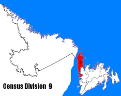
| Census divisions | |
|---|---|
| Cities | |
| Other communities |
|
| |