Division No. 9, Newfoundland and Labrador
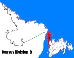
Census Division No. 9 is composed of the area of the province of Newfoundland and Labrador called the Northern Peninsula. It has a land area of 13,527.12 km² (5,222.85 sq mi) and had a population of 15,607 at the 2016 census.[1] The largest community is the town of St. Anthony, near its northern tip, on the Atlantic Ocean coast.
Division No. 9 | |
|---|---|
 | |
| Coordinates: 50°20′00″N 57°31′54″W | |
| Country | Canada |
| Province | Newfoundland and Labrador |
| Area | |
| • Total | 13,527.12 km2 (5,222.85 sq mi) |
| As of 2016 | |
| Population (2016)[1] | |
| • Total | 15,607 |
| • Density | 1.2/km2 (3.0/sq mi) |
It includes most of the Great Northern Peninsula, along with Gros Morne National Park.
| Historical populations Division No. 9, NL | ||
|---|---|---|
| Year | Pop. | ±% |
| 2001 | 20,091 | — |
| 2006 | 18,084 | −10.0% |
| 2011 | 16,786 | −7.2% |
| 2016 | 15,607 | −7.0% |
| [2][1][3] | ||
Towns
| Name | 2016 Census of Population[4] | ||||
|---|---|---|---|---|---|
| Population (2016) | Population (2011) | Change | Land area (km²) | Population density | |
| Anchor Point | 314 | 326 | -3.7% | 2.41 | 130.2/km2 |
| Belburns | 53 | 62 | -14.5% | 7.39 | 7.2/km2 |
| Bird Cove | 179 | 182 | -1.6% | 9.39 | 19.1/km2 |
| Conche | 170 | 181 | -6.1% | 9.25 | 18.4/km2 |
| Cooks Harbour | 123 | 176 | -30.1% | 1.95 | 63.1/km2 |
| Cow's Head | 418 | 475 | -9.9% | 17.84 | 24.0/km2 |
| Daniel's Harbour | 253 | 265 | -4.5% | 8.19 | 30.9/km2 |
| Englee | 527 | 583 | -9.6% | 28.8 | 18.3/km2 |
| Flower's Cove | 270 | 308 | -12.3% | 7.64 | 35.3/km2 |
| Glenburnie-Birchy Head-Shoal Brook | 224 | 258 | -13.2% | 6.57 | 34.1/km2 |
| Goose Cove East | 174 | 211 | -17.5% | 2.69 | 64.7/km2 |
| Hawke's Bay | 315 | 338 | -6.8% | 46.55 | 6.8/km2 |
| Main Brook | 243 | 265 | -8.3% | 28.51 | 8.5/km2 |
| Norris Point | 670 | 685 | -2.2% | 4.91 | 136.5/km2 |
| Parson's Pond | 345 | 383 | -9.9% | 12.63 | 27.3/km2 |
| Port au Choix | 789 | 839 | -6.0% | 35.61 | 22.2/km2 |
| Point Saunders | 647 | 697 | -3.3% | 38.81 | 17.4/km2 |
| Raleigh | 177 | 201 | -11.9% | 11.12 | 15.9/km2 |
| River of Ponds | 215 | 228 | -5.7% | 4.69 | 45.8/km2 |
| Rocky Harbour | 947 | 979 | -3.3% | 12.08 | 78.4/km2 |
| Roddickton-Bide Arm | 999 | 1057 | -5.5% | 47.85 | 20.9/km2 |
| Sally's Cove | 20 | 27 | -25.9% | 4.54 | 4.4/km2 |
| St. Anthony | 2258 | 2418 | -6.6% | 37.02 | 61.0/km2 |
| St. Lunaire-Griquet | 604 | 661 | -8.6% | 16.68 | 36.2/km2 |
| St. Pauls | 238 | 258 | -7.8% | 5.35 | 44.5/km2 |
| Trout River | 552 | 576 | -4.2% | 5.91 | 93.4/km2 |
| Woody Point | 282 | 281 | +0.4% | 2.91 | 96.9/km2 |
Unorganized subdivisions
- Subdivision A (Includes: Wiltondale, Lomond, Green Point)
- Subdivision C (Includes: Plum Point, St. Barbe, Savage Cove)
- Subdivision D (Includes: Ship Cove, Straitsview, Great Brehat)
- Subdivision F (Includes: Croque, Williamsport, Grandois)
- Subdivision G (Includes: Eddies Cove West, Barr'd Harbour)
- Subdivision H (Includes: Three Mile Rock, Portland Creek, Shallow Bay)
References
- "Census Profile, 2016 Census Division No. 9, Census division [Census division], Newfoundland and Labrador". Statistics Canada. Retrieved October 13, 2019.
- "2006 Community Profiles: Division No. 9". Statistics Canada. Retrieved October 13, 2019.
- "Census Profile - Division No. 9, Census division". Statistics Canada. Retrieved 2 March 2012.
- "Census Profile, 2016 Census - Newfoundland and Labrador". Statistics Canada. February 8, 2017. Retrieved 2020/06/03. Check date values in:
|access-date=(help)
Sources
- "(Code 1009) Census Profile". 2011 census. Statistics Canada. 2012.
Places adjacent to Division No. 9, Newfoundland and Labrador | |
|---|---|
| Towns |
| |
|---|---|---|
| Unorganized subdivisions |
| |
| Census divisions | |
|---|---|
| Cities | |
| Other communities |
|
| |
This article is issued from Wikipedia. The text is licensed under Creative Commons - Attribution - Sharealike. Additional terms may apply for the media files.