Virignin
Virignin is a commune in the Ain department in eastern France.
Virignin | |
|---|---|
 Les Bancs fort | |
Location of Virignin 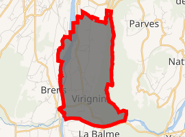
| |
 Virignin  Virignin | |
| Coordinates: 45°42′58″N 5°42′43″E | |
| Country | France |
| Region | Auvergne-Rhône-Alpes |
| Department | Ain |
| Arrondissement | Belley |
| Canton | Belley |
| Intercommunality | Bugey Sud |
| Government | |
| • Mayor (2020-2026) | Stéphanie Bavuz |
| Area 1 | 7.88 km2 (3.04 sq mi) |
| Population (2017-01-01)[1] | 1,097 |
| • Density | 140/km2 (360/sq mi) |
| Time zone | UTC+01:00 (CET) |
| • Summer (DST) | UTC+02:00 (CEST) |
| INSEE/Postal code | 01454 /01300 |
| Elevation | 220–605 m (722–1,985 ft) (avg. 225 m or 738 ft) |
| 1 French Land Register data, which excludes lakes, ponds, glaciers > 1 km2 (0.386 sq mi or 247 acres) and river estuaries. | |
Population
| Historical population | ||
|---|---|---|
| Year | Pop. | ±% |
| 1793 | 428 | — |
| 1800 | 568 | +32.7% |
| 1806 | 630 | +10.9% |
| 1821 | 666 | +5.7% |
| 1831 | 884 | +32.7% |
| 1836 | 776 | −12.2% |
| 1841 | 1,150 | +48.2% |
| 1846 | 882 | −23.3% |
| 1851 | 944 | +7.0% |
| 1856 | 988 | +4.7% |
| 1861 | 1,014 | +2.6% |
| 1866 | 725 | −28.5% |
| 1872 | 633 | −12.7% |
| 1876 | 661 | +4.4% |
| 1881 | 1,151 | +74.1% |
| 1886 | 692 | −39.9% |
| 1891 | 1,141 | +64.9% |
| 1896 | 899 | −21.2% |
| 1901 | 936 | +4.1% |
| 1906 | 1,002 | +7.1% |
| 1911 | 1,013 | +1.1% |
| 1921 | 443 | −56.3% |
| 1926 | 412 | −7.0% |
| 1931 | 393 | −4.6% |
| 1936 | 424 | +7.9% |
| 1946 | 417 | −1.7% |
| 1954 | 338 | −18.9% |
| 1962 | 393 | +16.3% |
| 1968 | 394 | +0.3% |
| 1975 | 417 | +5.8% |
| 1982 | 517 | +24.0% |
| 1990 | 550 | +6.4% |
| 1999 | 643 | +16.9% |
| 2008 | 798 | +24.1% |
| 2014 | 1,054 | +32.1% |
| 2017 | 1,097 | +4.1% |
External links
| Wikimedia Commons has media related to Virignin. |
| Authority control |
|
|---|
- "Populations légales 2017". INSEE. Retrieved 6 January 2020.
This article is issued from Wikipedia. The text is licensed under Creative Commons - Attribution - Sharealike. Additional terms may apply for the media files.