Saint-Sulpice, Ain
Saint-Sulpice is a commune in the Ain department in eastern France.
Saint-Sulpice | |
|---|---|
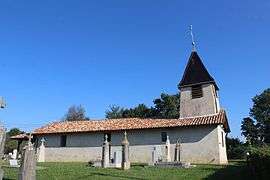 The church in Saint-Sulpice | |
 Coat of arms | |
Location of Saint-Sulpice 
| |
 Saint-Sulpice  Saint-Sulpice | |
| Coordinates: 46°19′16″N 5°02′33″E | |
| Country | France |
| Region | Auvergne-Rhône-Alpes |
| Department | Ain |
| Arrondissement | Bourg-en-Bresse |
| Canton | Attignat |
| Intercommunality | Montrevel-en-Bresse |
| Government | |
| • Mayor (2008–2014) | Philippe Porst |
| Area 1 | 5.26 km2 (2.03 sq mi) |
| Population (2017-01-01)[1] | 257 |
| • Density | 49/km2 (130/sq mi) |
| Time zone | UTC+01:00 (CET) |
| • Summer (DST) | UTC+02:00 (CEST) |
| INSEE/Postal code | 01387 /01340 |
| Elevation | 193–217 m (633–712 ft) |
| 1 French Land Register data, which excludes lakes, ponds, glaciers > 1 km2 (0.386 sq mi or 247 acres) and river estuaries. | |
Population
| Historical population | ||
|---|---|---|
| Year | Pop. | ±% |
| 1793 | 166 | — |
| 1800 | 204 | +22.9% |
| 1806 | 203 | −0.5% |
| 1821 | 191 | −5.9% |
| 1831 | 191 | +0.0% |
| 1836 | 194 | +1.6% |
| 1841 | 217 | +11.9% |
| 1846 | 228 | +5.1% |
| 1851 | 213 | −6.6% |
| 1856 | 199 | −6.6% |
| 1861 | 196 | −1.5% |
| 1866 | 208 | +6.1% |
| 1872 | 214 | +2.9% |
| 1876 | 192 | −10.3% |
| 1881 | 194 | +1.0% |
| 1886 | 201 | +3.6% |
| 1891 | 192 | −4.5% |
| 1896 | 188 | −2.1% |
| 1901 | 175 | −6.9% |
| 1906 | 186 | +6.3% |
| 1911 | 175 | −5.9% |
| 1921 | 180 | +2.9% |
| 1926 | 157 | −12.8% |
| 1931 | 146 | −7.0% |
| 1936 | 134 | −8.2% |
| 1946 | 125 | −6.7% |
| 1954 | 129 | +3.2% |
| 1962 | 135 | +4.7% |
| 1968 | 120 | −11.1% |
| 1975 | 119 | −0.8% |
| 1982 | 107 | −10.1% |
| 1990 | 102 | −4.7% |
| 1999 | 103 | +1.0% |
| 2008 | 135 | +31.1% |
See also
References
- "Populations légales 2017". INSEE. Retrieved 6 January 2020.
| Wikimedia Commons has media related to Saint-Sulpice, Ain. |
This article is issued from Wikipedia. The text is licensed under Creative Commons - Attribution - Sharealike. Additional terms may apply for the media files.