Seyssel, Ain
Seyssel is a commune in the Ain department in eastern France.
Seyssel | |
|---|---|
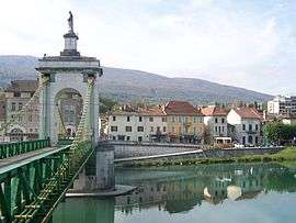 Town center seen from Seyssel, Haute-Savoie | |
.svg.png) Coat of arms | |
Location of Seyssel 
| |
 Seyssel  Seyssel | |
| Coordinates: 45°58′00″N 5°50′00″E | |
| Country | France |
| Region | Auvergne-Rhône-Alpes |
| Department | Ain |
| Arrondissement | Belley |
| Canton | Hauteville-Lompnes |
| Intercommunality | Pays de Seyssel |
| Government | |
| • Mayor (2014–2020) | Jean-Paul Granchamp |
| Area 1 | 2.40 km2 (0.93 sq mi) |
| Population (2017-01-01)[1] | 999 |
| • Density | 420/km2 (1,100/sq mi) |
| Time zone | UTC+01:00 (CET) |
| • Summer (DST) | UTC+02:00 (CEST) |
| INSEE/Postal code | 01407 /01420 |
| Elevation | 250–332 m (820–1,089 ft) (avg. 258 m or 846 ft) |
| 1 French Land Register data, which excludes lakes, ponds, glaciers > 1 km2 (0.386 sq mi or 247 acres) and river estuaries. | |
It lies on the west bank of the Rhône River.
The part of the town across the Rhône is also named Seyssel but located in the Haute-Savoie department, and is locally referred as Seyssel-Savoie. It is a rare case in France of two homonymous communes adjacent to each other, similar to the situation of the village of Saint-Santin, divided between the communes of Saint-Santin (Aveyron) and Saint-Santin-de-Maurs (Cantal).
Population
| Historical population | ||
|---|---|---|
| Year | Pop. | ±% |
| 1793 | 1,057 | — |
| 1800 | 1,058 | +0.1% |
| 1806 | 2,304 | +117.8% |
| 1821 | 1,215 | −47.3% |
| 1831 | 1,336 | +10.0% |
| 1836 | 1,230 | −7.9% |
| 1841 | 1,336 | +8.6% |
| 1846 | 1,418 | +6.1% |
| 1851 | 1,493 | +5.3% |
| 1856 | 1,312 | −12.1% |
| 1861 | 1,235 | −5.9% |
| 1866 | 1,234 | −0.1% |
| 1872 | 1,184 | −4.1% |
| 1876 | 1,150 | −2.9% |
| 1881 | 1,178 | +2.4% |
| 1886 | 1,144 | −2.9% |
| 1891 | 1,028 | −10.1% |
| 1896 | 1,032 | +0.4% |
| 1901 | 1,056 | +2.3% |
| 1906 | 989 | −6.3% |
| 1911 | 1,017 | +2.8% |
| 1921 | 924 | −9.1% |
| 1926 | 902 | −2.4% |
| 1931 | 941 | +4.3% |
| 1936 | 898 | −4.6% |
| 1946 | 1,055 | +17.5% |
| 1954 | 1,003 | −4.9% |
| 1962 | 1,001 | −0.2% |
| 1968 | 1,029 | +2.8% |
| 1975 | 1,043 | +1.4% |
| 1982 | 831 | −20.3% |
| 1990 | 817 | −1.7% |
| 1999 | 801 | −2.0% |
| 2008 | 933 | +16.5% |
| 2014 | 981 | +5.1% |
See also
- Communes of the Ain department
- Pont de la Vierge noire
- Pont de Seyssel
References
- "Populations légales 2017". INSEE. Retrieved 6 January 2020.
| Wikimedia Commons has media related to Seyssel, Ain. |
| Authority control |
|
|---|
This article is issued from Wikipedia. The text is licensed under Creative Commons - Attribution - Sharealike. Additional terms may apply for the media files.