Lent, Ain
Lent is a commune in the Ain department in eastern France.
Lent | |
|---|---|
 The town hall in Lent | |
.svg.png) Coat of arms | |
Location of Lent 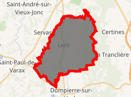
| |
 Lent  Lent | |
| Coordinates: 46°07′13″N 5°11′47″E | |
| Country | France |
| Region | Auvergne-Rhône-Alpes |
| Department | Ain |
| Arrondissement | Bourg-en-Bresse |
| Canton | Ceyzériat |
| Intercommunality | Bourg-en-Bresse |
| Government | |
| • Mayor (2008–2014) | Michel Buellet |
| Area 1 | 31.48 km2 (12.15 sq mi) |
| Population (2017-01-01)[1] | 1,405 |
| • Density | 45/km2 (120/sq mi) |
| Time zone | UTC+01:00 (CET) |
| • Summer (DST) | UTC+02:00 (CEST) |
| INSEE/Postal code | 01211 /01240 |
| Elevation | 240–296 m (787–971 ft) (avg. 250 m or 820 ft) |
| 1 French Land Register data, which excludes lakes, ponds, glaciers > 1 km2 (0.386 sq mi or 247 acres) and river estuaries. | |
It has been part of the intercommunality of Bourg-en-Bresse since 2001, when it was created.
Geography
The Veyle flows northward through the middle of the commune.
Population
| Historical population | ||
|---|---|---|
| Year | Pop. | ±% |
| 1793 | 830 | — |
| 1800 | 941 | +13.4% |
| 1806 | 931 | −1.1% |
| 1821 | 1,039 | +11.6% |
| 1831 | 1,062 | +2.2% |
| 1836 | 1,051 | −1.0% |
| 1841 | 1,039 | −1.1% |
| 1846 | 1,173 | +12.9% |
| 1851 | 1,159 | −1.2% |
| 1856 | 1,087 | −6.2% |
| 1861 | 1,155 | +6.3% |
| 1866 | 1,234 | +6.8% |
| 1872 | 1,181 | −4.3% |
| 1876 | 1,253 | +6.1% |
| 1881 | 1,227 | −2.1% |
| 1886 | 1,186 | −3.3% |
| 1891 | 1,184 | −0.2% |
| 1896 | 1,121 | −5.3% |
| 1901 | 1,107 | −1.2% |
| 1906 | 1,108 | +0.1% |
| 1911 | 1,051 | −5.1% |
| 1921 | 921 | −12.4% |
| 1926 | 851 | −7.6% |
| 1931 | 814 | −4.3% |
| 1936 | 781 | −4.1% |
| 1946 | 750 | −4.0% |
| 1954 | 729 | −2.8% |
| 1962 | 721 | −1.1% |
| 1968 | 778 | +7.9% |
| 1975 | 801 | +3.0% |
| 1982 | 976 | +21.8% |
| 1990 | 1,043 | +6.9% |
| 1999 | 1,145 | +9.8% |
| 2008 | 1,266 | +10.6% |
See also
References
- "Populations légales 2017". INSEE. Retrieved 6 January 2020.
| Wikimedia Commons has media related to Lent, Ain. |
This article is issued from Wikipedia. The text is licensed under Creative Commons - Attribution - Sharealike. Additional terms may apply for the media files.