Van Buren Township, Clay County, Indiana
Van Buren Township is one of eleven townships in Clay County, Indiana. As of the 2010 census, its population was 3,528 and it contained 1,448 housing units.[3]
Van Buren Township | |
|---|---|
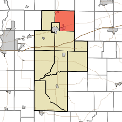 Location of Van Buren Township in Clay County | |
| Coordinates: 39°33′46″N 87°03′38″W | |
| Country | United States |
| State | Indiana |
| County | Clay |
| Government | |
| • Type | Indiana township |
| Area | |
| • Total | 32.32 sq mi (83.7 km2) |
| • Land | 32.18 sq mi (83.3 km2) |
| • Water | 0.14 sq mi (0.4 km2) |
| Elevation | 682 ft (208 m) |
| Population (2010) | |
| • Total | 3,528 |
| • Density | 109.6/sq mi (42.3/km2) |
| FIPS code | 18-78416[2] |
| GNIS feature ID | 453943 |
History
Van Buren Township was established in the late 1830s. It was named for Martin Van Buren, the ninth Vice President of the United States. There is also a Dick Johnson Township in Clay County in honor of Richard Mentor Johnson, Van Buren's vice president.[4]
Eaglefield Place was listed on the National Register of Historic Places in 1998.[5]
Geography
According to the 2010 census, the township has a total area of 32.32 square miles (83.7 km2), of which 32.18 square miles (83.3 km2) (or 99.57%) is land and 0.14 square miles (0.36 km2) (or 0.43%) is water.[3]
Cities and towns
Unincorporated towns
(This list is based on USGS data and may include former settlements.)
Adjacent townships
- Jackson Township, Parke County (north)
- Madison Township, Putnam County (northeast)
- Washington Township, Putnam County (east)
- Jackson Township (south)
- Brazil Township (southwest)
- Dick Johnson Township (west)
- Raccoon Township, Parke County (northwest)
Major highways


Cemeteries
The township contains five cemeteries: Calcutta, Pell, Pell, Poff and Roberts.
References
- "US Board on Geographic Names". United States Geological Survey. 2007-10-25. Retrieved 2008-01-31.
- "U.S. Census website". United States Census Bureau. Retrieved 2008-01-31.
- "Population, Housing Units, Area, and Density: 2010 - County -- County Subdivision and Place -- 2010 Census Summary File 1". United States Census. Archived from the original on 2020-02-12. Retrieved 2013-05-10.
- Blanchard, Charles (1884). Counties of Clay and Owen, Indiana: Historical and Biographical. F.A. Battey & Company. pp. 83.
- "National Register Information System". National Register of Historic Places. National Park Service. July 9, 2010.
External links
Municipalities and communities of Clay County, Indiana, United States | ||
|---|---|---|
| City | Map of Indiana highlighting Clay County | |
| Towns | ||
| Townships | ||
| CDP | ||
| Other unincorporated communities |
| |
| Ghost towns | ||
| Footnotes | ‡This populated place also has portions in an adjacent county or counties | |