Harrison Township, Clay County, Indiana
Harrison Township is one of eleven townships in Clay County, Indiana. As of the 2010 census, its population was 2,172 and it contained 1,040 housing units.[3]
Harrison Township | |
|---|---|
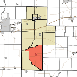 Location of Harrison Township in Clay County | |
| Coordinates: 39°16′10″N 87°06′37″W | |
| Country | United States |
| State | Indiana |
| County | Clay |
| Government | |
| • Type | Indiana township |
| Area | |
| • Total | 62.67 sq mi (162.3 km2) |
| • Land | 62.24 sq mi (161.2 km2) |
| • Water | 0.43 sq mi (1.1 km2) |
| Elevation | 604 ft (184 m) |
| Population (2010) | |
| • Total | 2,172 |
| • Density | 34.9/sq mi (13.5/km2) |
| FIPS code | 18-31684[2] |
| GNIS feature ID | 453381 |
History
The Feeder Dam Bridge and Tide Water Pumping Station are listed on the National Register of Historic Places.[4]
Geography
According to the 2010 census, the township has a total area of 62.67 square miles (162.3 km2), of which 62.24 square miles (161.2 km2) (or 99.31%) is land and 0.43 square miles (1.1 km2) (or 0.69%) is water.[3]
Cities and towns
Unincorporated towns
- Barrick Corner
- Eel River
- New Brunswick
- Old Hill
(This list is based on USGS data and may include former settlements.)
Adjacent townships
- Sugar Ridge Township (north)
- Washington Township (northeast)
- Marion Township, Owen County (east)
- Jefferson Township, Owen County (southeast)
- Smith Township, Greene County (south)
- Lewis Township (southwest)
- Perry Township (northwest)
Major highways
Cemeteries
The township contains nine cemeteries: Cole, Duncan, Goshorn Memorial Park, Greenwell, Liechty, Maple Grove, Maple Grove, Sink and Wilson.
References
- "Harrison Township, Clay County, Indiana". Geographic Names Information System. United States Geological Survey. Retrieved 2009-09-24.
- United States Census Bureau cartographic boundary files
- "US Board on Geographic Names". United States Geological Survey. 2007-10-25. Retrieved 2008-01-31.
- "U.S. Census website". United States Census Bureau. Retrieved 2008-01-31.
- "Population, Housing Units, Area, and Density: 2010 - County -- County Subdivision and Place -- 2010 Census Summary File 1". United States Census. Archived from the original on 2020-02-12. Retrieved 2013-05-10.
- "National Register Information System". National Register of Historic Places. National Park Service. July 9, 2010.
External links
Municipalities and communities of Clay County, Indiana, United States | ||
|---|---|---|
| City | Map of Indiana highlighting Clay County | |
| Towns | ||
| Townships | ||
| CDP | ||
| Other unincorporated communities |
| |
| Ghost towns | ||
| Footnotes | ‡This populated place also has portions in an adjacent county or counties | |
| Authority control |
|
|---|
This article is issued from Wikipedia. The text is licensed under Creative Commons - Attribution - Sharealike. Additional terms may apply for the media files.