Coalmont, Indiana
Coalmont is an unincorporated community and census-designated place in Lewis Township, Clay County, Indiana, United States. It is part of the Terre Haute Metropolitan Statistical Area. As of the 2010 census it had a population of 402.[3]
Coalmont, Indiana | |
|---|---|
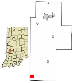 Location of Coalmont in Clay County, Indiana. | |
 Coalmont Location in Clay County | |
| Coordinates: 39°11′36″N 87°13′52″W | |
| Country | United States |
| State | Indiana |
| County | Clay |
| Township | Lewis |
| Area | |
| • Total | 1.5 sq mi (3.9 km2) |
| • Land | 1.5 sq mi (3.9 km2) |
| • Water | 0 sq mi (0 km2) |
| Elevation | 630 ft (190 m) |
| Population (2010) | |
| • Total | 402 |
| • Density | 268/sq mi (103.4/km2) |
| ZIP code | 47438 |
| FIPS code | 18-14032[1] |
| GNIS feature ID | 432712[2] |
History
A post office was established at Coalmont in 1901.[4] Deposits of coal in the area caused the name to be selected.[5]
Geography
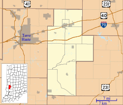
Coalmont is located in southwestern Clay County at 39°11′36″N 87°13′52″W. Its western border is the Sullivan County line. Indiana State Road 159 runs north-south through the center of the community, and IN 48 forms the southern edge of the CDP. Shakamak State Park is directly to the south. Jasonville is 3.4 miles (5.5 km) to the southeast on routes 159 and 48, and Hymera is 4 miles (6 km) to the west on IN 48.
References
- "U.S. Census website". United States Census Bureau. Retrieved 2008-01-31.
- "Coalmont, Indiana". Geographic Names Information System. United States Geological Survey. Retrieved 2009-10-10.
- "Geographic Identifiers: 2010 Demographic Profile Data (G001): Coalmont CDP, Indiana". U.S. Census Bureau, American Factfinder. Archived from the original on February 12, 2020. Retrieved August 4, 2014.
- "Clay County". Jim Forte Postal History. Retrieved 30 August 2014.
- Baker, Ronald L. (October 1995). From Needmore to Prosperity: Hoosier Place Names in Folklore and History. Indiana University Press. p. 99. ISBN 978-0-253-32866-3.
...and named for the coal here...
- "Census of Population and Housing". Census.gov. Retrieved June 4, 2016.
Municipalities and communities of Clay County, Indiana, United States | ||
|---|---|---|
| City | Map of Indiana highlighting Clay County | |
| Towns | ||
| Townships | ||
| CDP | ||
| Other unincorporated communities |
| |
| Ghost towns | ||
| Footnotes | ‡This populated place also has portions in an adjacent county or counties | |