Sugar Ridge Township, Clay County, Indiana
Sugar Ridge Township is one of eleven townships in Clay County, Indiana. As of the 2010 census, its population was 939 and it contained 449 housing units.[3]
Sugar Ridge Township | |
|---|---|
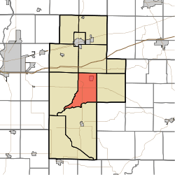 Location of Sugar Ridge Township in Clay County | |
| Coordinates: 39°22′36″N 87°06′05″W | |
| Country | United States |
| State | Indiana |
| County | Clay |
| Government | |
| • Type | Indiana township |
| Area | |
| • Total | 28.21 sq mi (73.1 km2) |
| • Land | 27.72 sq mi (71.8 km2) |
| • Water | 0.5 sq mi (1 km2) |
| Elevation | 581 ft (177 m) |
| Population (2010) | |
| • Total | 939 |
| • Density | 33.9/sq mi (13.1/km2) |
| FIPS code | 18-73988[2] |
| GNIS feature ID | 453887 |
History
Sugar Ridge Township organized in 1854. It was named from a high ridge passing through its central portion.[4]
The Aqueduct Bridge, Feeder Dam Bridge, and Jeffers Bridge are listed on the National Register of Historic Places.[5]
Geography
According to the 2010 census, the township has a total area of 28.21 square miles (73.1 km2), of which 27.72 square miles (71.8 km2) (or 98.26%) is land and 0.5 square miles (1.3 km2) (or 1.77%) is water.[3] Dietz Lake is in this township.
Cities and towns
Unincorporated towns
(This list is based on USGS data and may include former settlements.)
Adjacent townships
- Jackson Township (north)
- Washington Township (east)
- Marion Township, Owen County (southeast)
- Harrison Township (south)
- Perry Township (west)
- Posey Township (northwest)
Major highways
Cemeteries
The township contains three cemeteries: Gremes, Harris and Moss.
References
- "US Board on Geographic Names". United States Geological Survey. 2007-10-25. Retrieved 2008-01-31.
- "U.S. Census website". United States Census Bureau. Retrieved 2008-01-31.
- "Population, Housing Units, Area, and Density: 2010 - County -- County Subdivision and Place -- 2010 Census Summary File 1". United States Census. Archived from the original on 2020-02-12. Retrieved 2013-05-10.
- Blanchard, Charles (1884). Counties of Clay and Owen, Indiana: Historical and Biographical. F.A. Battey & Company. pp. 83–84.
- "National Register Information System". National Register of Historic Places. National Park Service. July 9, 2010.
External links
Municipalities and communities of Clay County, Indiana, United States | ||
|---|---|---|
| City | Map of Indiana highlighting Clay County | |
| Towns | ||
| Townships | ||
| CDP | ||
| Other unincorporated communities |
| |
| Ghost towns | ||
| Footnotes | ‡This populated place also has portions in an adjacent county or counties | |