Tver Oblast
Tver Oblast (Russian: Тверска́я о́бласть, Tverskaya oblast) is a federal subject of Russia (an oblast). Its administrative center is the city of Tver. From 1935 to 1990, it was known as Kalinin Oblast (Кали́нинская о́бласть), named after Mikhail Kalinin. Population: 1,353,392 (2010 Census).[10]
Tver Oblast | |
|---|---|
| Тверская область | |
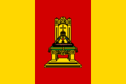 Flag  Coat of arms | |
| Anthem: [1] | |
 | |
| Coordinates: 57°09′N 34°37′E | |
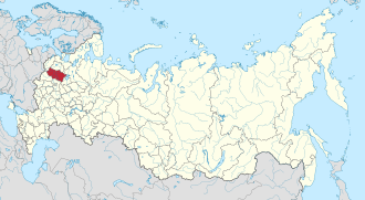
| Country | Russia |
| Federal district | Central[2] |
| Economic region | Central[3] |
| Established | January 29, 1935[4] |
| Administrative center | Tver[5] |
| Government | |
| • Body | Legislative Assembly[6] |
| • Governor[7] | Igor Rudenya[8] |
| Area | |
| • Total | 84,100 km2 (32,500 sq mi) |
| Area rank | 39th |
| Population (2010 Census)[10] | |
| • Total | 1,353,392 |
| • Estimate (2018)[11] | 1,283,873 (-5.1%) |
| • Rank | 33rd |
| • Density | 16/km2 (42/sq mi) |
| • Urban | 74.7% |
| • Rural | 25.3% |
| Time zone | UTC+3 (MSK |
| ISO 3166 code | RU-TVE |
| License plates | 69 |
| OKTMO ID | 28000000 |
| Official languages | Russian[13] |
| Website | http://www.region.tver.ru |
Tver Oblast is a region of lakes, such as Seliger and Brosno. Much of the remaining area is occupied by the Valdai Hills, where the Volga, the Western Dvina, and the Dnieper have their source.
Tver Oblast is one of the tourist regions of Russia with a modern tourist infrastructure. There are also many historic towns: Torzhok, Toropets, Zubtsov, Kashin, Vyshny Volochyok, and Kalyazin. The oldest of these is Rzhev, primarily known for the Battles of Rzhev in World War II. Staritsa was the seat of the last appanage principality in Russia. Ostashkov is a major tourist center.
Geography
Tver Oblast is located in the west of the middle part of the East European Plain. It stretches for 260 km from north to south and 450 km from west to east. The area borders Yaroslavl Oblast in the east, Vologda Oblast in the northeast, Novgorod Oblast in the northwest and north, Moscow in the southeast, Smolensk Oblast in the southwest, and Pskov Oblast in the west.
The area of Tver Oblast is 84201 km², the 38th of 85 subjects. This is 0.49% of the territory of Russia. It is the largest territory (by area) of the Central Federal District.
Relief
Tver Oblast as a whole is characterized by flat terrain with alternating lowlands and highlands. In the western part of the province, occupying about one-third of its area is Valdai Hills, with elevations of 200–300 m above sea level. It is surrounded by depressions, lowlands have a height of 100–150 m highest point of the area has a height of 347 m, is located on a hill Tsninsky (The top of the Valdai). The low point (61 m) - the extreme north-west area of the river's edge Kunya (Russian: Кунья) on the border with the Novgorod Oblast.
Natural resources
Minerals discovered and developed in the Tver Oblast are mainly deposits of ancient seas, lakes and swamps, and partly a consequence of glaciers (clastic rocks).
Minerals of industrial importance are the seams of brown coal Moscow coal basin. The largest deposit is Bolshoy Nelidovskiy, which gave between 1948 and 1996 about 21 million tons.
Widespread powerful peat deposits totaling 15.4 billion m³. The estimated reserves of peat are 2,051 million tonnes, representing approximately 7% of the stock of European Russia. On an industrial scale mastered 43 peat deposits with a total area of about 300 hectares, the main exploited stocks are concentrated in five fields located in the central and southern parts of the oblast. From 1971 to 1999, has developed more than 44 million tons of peat.
Distributed limestones ( near the town of Bayou several centuries developed reserves of white Staritskogo stone). Dolomitic limestones are common along rivers Vazuza, Osugi, Tsna ( marble-like limestone), there are deposits of tile, brick and pottery ( refractory ) of clay and quartz sand, sapropel are numerous underground fresh water and mineral formations, open sources (the best known medicinal table water Kashinskaya).
Rivers
The region is a watershed of the Caspian Sea and Baltic Sea. In the south, Belsky district has several tributaries of the upper reaches of the river Vop, the right tributary of the Dnieper River (basin of the Black Sea). Go to the Caspian Sea basin owns 70% of the region, the Baltic Sea - 29.7%.
In the region of more than 800 rivers longer than 10 km total length of about 17,000 km. The main river - Volga ( 685 km within the region). Its source is in Ostashkov area. The most important tributaries of the Volga: Mologa (280 km), Dipper (269 km), Tvertsa (188 km). Other important rivers: the Western Dvina and its tributary Meza (259 km), Msta and Cna (160 km).
Climate
The climate is humid continental, transitional from continental Russia to the more humid north-western regions. The area lies in a zone of comfort for living and recreation climatic conditions. Average January temperatures range from −8 °C (18 °F) in west to −13 °C (9 °F) in northeast, and July from +17 °C (63 °F) to +19 °C (66 °F) °C. The average annual rainfall ranges from 560 to 720 mm, the greatest amount of precipitation falls on the western slopes of the Valdai Hills . The snow cover starts at the mid-November, the period with snow cover lasts 130–150 days, snow depth is about 40–60 cm, with a maximum of 80 cm.
History
There was already a settlement on the point of land at the confluence of the Tmaka River and Volga rivers in the 9th and 10th centuries. A fortress was built on the site much later, during the fighting between the Rostov-Suzdal princes and Novgorod Republic. On 13 June 1996 Tver Oblast, alongside Leningrad Oblast and Saint Petersburg, signed a power-sharing agreement with the federal government, granting it autonomy.[14] This agreement would be abolished on 19 February 2002.[15]
Politics
During the Soviet period, the high authority in the oblast was shared between three persons: The first secretary of the Tver CPSU Committee (who in reality had the biggest authority), the chairman of the oblast Soviet (legislative power), and the Chairman of the oblast Executive Committee (executive power). Since 1991, CPSU lost all the power, and the head of the Oblast administration, and eventually the governor was appointed/elected alongside elected regional parliament.
The Charter of Tver Oblast is the fundamental law of the region. The Legislative Assembly of Tver Oblast is the province's standing legislative (representative) body. The Legislative Assembly exercises its authority by passing laws, resolutions, and other legal acts and by supervising the implementation and observance of the laws and other legal acts passed by it. The highest executive body is the Oblast Administration, which includes territorial executive bodies such as district administrations, committees, and commissions that facilitate development and run the day to day matters of the province. The Oblast administration supports the activities of the Governor who is the highest official and acts as guarantor of the observance of the oblast Charter in accordance with the Constitution of Russia.
Administrative divisions
Administratively, Tver Oblast is divided into two urban-type settlements under the federal government management (Ozyorny and Solnechny), five cities and towns of oblast significance (Tver, Kimry, Rzhev, Torzhok, and Vyshny Volochyok), and thirty-six districts.
Economy
Tver Oblast has a very strong economy due to its machinery industry in the automobile and aeronautics sectors.
Transportation
The Oblast has a well-developed infrastructure consisting of railway, river, motor vehicle, air, and pipeline transportation systems. Tver Oblast has one of the highest proportions of paved roads in the country. The region's location between Russia's two major cities, Moscow and St. Petersburg, has an obvious influence on traffic flows from Northern Europe and the Baltic countries to central Russia.
Passes through the region connecting the main "two capitals" Railway - October single-track railway with branches in Rzhev and Vyazma, Kuvshinovo and Selizharovo through Torzhok . Equally important are single-track diesel Moscow - Kashin - St. Petersburg and Moscow - Riga, and Yaroslavl - Bologoe - Great Luke and Bologoe - The bottom of the (station ), but very popular .
The area is crossed by two federal highways: M10 "Russia" and M9 "Baltic" . Of internal roads are significant Torzhok A111 - A112 Ostashkov and Tver-Rzhev. The length of paved roads - 16,032 km .
There are three civilian airports close to Tver: Migalovo with a runway for commercial aviation, 2500m in length, airport local lines Zmeevo (now - heliport) and Orlovka Airfield (ICAO: UUTO).
The development of navigation on the Volga river port "Tver" with a cargo jetty for boats "river -sea" with a draft of up to four meters.
The region is crossed four beams railways going from Moscow to the north, northwest and west:
to St. Petersburg via Tver - Bologoye (main course of the Oktyabrskaya Railway), west across the Rzhev - Velikiye Luki (branch of Riga, Vilnius, Warsaw and Kaliningrad - Berlin. to Kimry - Sonkovo - Pestovo - St. Petersburg; to Pskov through Tver - Bologoe. The largest railway junction of Tver Oblast is located in Bologoye. Bologovskiy assembly includes five areas : Moscow, St. Petersburg, Pskov, Yaroslavl, Great Luke.
The narrow gauge railway of KSM-2 factory, Tver serves a factory of building materials №2 in Tver.
Demographics
Population: 1,353,392 (2010 Census);[10] 1,471,459 (2002 Census);[16] 1,670,117 (1989 Census).[17]
- 2012
- Births: 15 476 (11.6 per 1000)
- Deaths: 24 325 (18.2 per 1000) [18]
- Total fertility rate: 1.65
- Total fertility rate:[19]
2009 - 1.55 | 2010 - 1.52 | 2011 - 1.54 | 2012 - 1.65 | 2013 - 1.64 | 2014 - 1.66 | 2015 - 1.70 | 2016 - 1.72(e)
Ethnic composition (2010):[10]
- Russians - 93.4%
- Ukrainians - 1.2%
- Armenians - 0.7%
- Karelians - 0.6%
- Tatars - 0.5%
- Belarusians - 0.4%
- Azeris - 0.4%
- Romani people - 0.4%
- Uzbeks - 0.3%
- Others - 2.1%
- 99,260 people were registered from administrative databases, and could not declare an ethnicity. It is estimated that the proportion of ethnicities in this group is the same as that of the declared group.[20]
Religion
According to a 2012 survey[21] 30% of the population of Tver Oblast adheres to the Russian Orthodox Church, 9% are unaffiliated generic Christians, and 1% are Muslims. In addition, 34% of the population declares to be "spiritual but not religious", 20% is atheist, and 6% follows other religions or did not give an answer to the question.[21]
Tver Karelians
A branch of Karelians, known as Tver Karelians live in the oblast. They numbered 140,567 in 1926. Due to heavy casualties suffered during the World War II, they vanished as a separate ethnic group from most parts of the oblast. The Tver Karelians numbered 14,633 according to the 2002 Census.[23]
Culture

Bolshoe Zavidovo in Tver Oblast hosts Nashestvie, the largest festival of Russian rock, since 2009. Previously, in 2004-2008, it was hosted in Emmaus, also Tver Oblast.
References
Notes
- Article 42 of the Charter of Tver Oblast states that the oblast may have an anthem, providing a law is adopted to that effect. As of 2015, no such law is in place.
- Президент Российской Федерации. Указ №849 от 13 мая 2000 г. «О полномочном представителе Президента Российской Федерации в федеральном округе». Вступил в силу 13 мая 2000 г. Опубликован: "Собрание законодательства РФ", No. 20, ст. 2112, 15 мая 2000 г. (President of the Russian Federation. Decree #849 of May 13, 2000 On the Plenipotentiary Representative of the President of the Russian Federation in a Federal District. Effective as of May 13, 2000.).
- Госстандарт Российской Федерации. №ОК 024-95 27 декабря 1995 г. «Общероссийский классификатор экономических регионов. 2. Экономические районы», в ред. Изменения №5/2001 ОКЭР. (Gosstandart of the Russian Federation. #OK 024-95 December 27, 1995 Russian Classification of Economic Regions. 2. Economic Regions, as amended by the Amendment #5/2001 OKER. ).
- Resolution of January 29, 1935
- Charter of Tver Oblast, Article 8
- Charter of Tver Oblast, Article 82
- Charter of Tver Oblast, Article 105
- Official website of Tver Oblast. Andrei Vladimirovich Shevelyov, Governor of Tver Oblast (in Russian)
- Федеральная служба государственной статистики (Federal State Statistics Service) (May 21, 2004). "Территория, число районов, населённых пунктов и сельских администраций по субъектам Российской Федерации (Territory, Number of Districts, Inhabited Localities, and Rural Administration by Federal Subjects of the Russian Federation)". Всероссийская перепись населения 2002 года (All-Russia Population Census of 2002) (in Russian). Federal State Statistics Service. Retrieved November 1, 2011.
- Russian Federal State Statistics Service (2011). "Всероссийская перепись населения 2010 года. Том 1" [2010 All-Russian Population Census, vol. 1]. Всероссийская перепись населения 2010 года [2010 All-Russia Population Census] (in Russian). Federal State Statistics Service.
- "26. Численность постоянного населения Российской Федерации по муниципальным образованиям на 1 января 2018 года". Federal State Statistics Service. Retrieved January 23, 2019.
- "Об исчислении времени". Официальный интернет-портал правовой информации (in Russian). June 3, 2011. Retrieved January 19, 2019.
- Official throughout the Russian Federation according to Article 68.1 of the Constitution of Russia.
- "Newsline - June 14, 1996 Yeltsin Signs More Power-Sharing Agreements". Radio Free Europe/Radio Liberty. June 14, 1996. Retrieved May 2, 2019.
- Chuman, Mizuki. "The Rise and Fall of Power-Sharing Treaties Between Center and Regions in Post-Soviet Russia" (PDF). Demokratizatsiya: 146.
- Russian Federal State Statistics Service (May 21, 2004). "Численность населения России, субъектов Российской Федерации в составе федеральных округов, районов, городских поселений, сельских населённых пунктов – районных центров и сельских населённых пунктов с населением 3 тысячи и более человек" [Population of Russia, Its Federal Districts, Federal Subjects, Districts, Urban Localities, Rural Localities—Administrative Centers, and Rural Localities with Population of Over 3,000] (XLS). Всероссийская перепись населения 2002 года [All-Russia Population Census of 2002] (in Russian).
- "Всесоюзная перепись населения 1989 г. Численность наличного населения союзных и автономных республик, автономных областей и округов, краёв, областей, районов, городских поселений и сёл-райцентров" [All Union Population Census of 1989: Present Population of Union and Autonomous Republics, Autonomous Oblasts and Okrugs, Krais, Oblasts, Districts, Urban Settlements, and Villages Serving as District Administrative Centers]. Всесоюзная перепись населения 1989 года [All-Union Population Census of 1989] (in Russian). Институт демографии Национального исследовательского университета: Высшая школа экономики [Institute of Demography at the National Research University: Higher School of Economics]. 1989 – via Demoscope Weekly.
- "Естественное движение населения в разрезе субъектов Российской Федерации" [The natural movement of the population by regions of the Russian Federation]. www.gks.ru (in Russian). Retrieved March 19, 2018.
- "Каталог публикаций::Федеральная служба государственной статистики" [Publication Catalog Federal State Statistics Service]. www.gks.ru (in Russian). Archived from the original on March 24, 2013. Retrieved March 19, 2018.
- "ВПН-2010". www.perepis-2010.ru. Retrieved March 19, 2018.
- "Arena: Atlas of Religions and Nationalities in Russia". Sreda, 2012.
- 2012 Arena Atlas Religion Maps. "Ogonek", № 34 (5243), 27/08/2012. Retrieved 21/04/2017. Archived.
- Демоскоп Weekly — Приложение. - Weekly Demoscope - Application.
Sources
- Законодательное Собрание Тверской области. Постановление №436 от 5 ноября 1996 г. «Об Уставе Тверской области», в ред. №19-ПУ от 15 июля 2015 г. «Поправки к Уставу Тверской области». Опубликован: "Тверские ведомости", №98, 4–10 декабря 1998 г. (Legislative Assembly of Tver Oblast. Resolution #436 of November 5, 1996 On the Charter of Tver Oblast, as amended by the #19-PU of July 15, 2015 Amendments to the Charter of Tver Oblast. ).
- Всероссийский центральный исполнительный комитет. Постановление от 29 января 1935 г. «Об образовании Калининской области». (All-Russian Central Executive Committee. Resolution of January 29, 1935 On the Formation of Kalinin Oblast. ).
External links

- (in Russian) Official website of Tver Oblast
Administrative center: Tver • Rural localities | |||
| Districts |
| ||
| Closed administrative-territorial formations | |||
| Cities and towns (all levels) | |||
| Urban-type settlements | |||
| Authority control |
|---|